Heritage Register
Discover. Explore. Celebrate.
The Saskatoon area has been inhabited for at least 8,000 years. Remnants of the past, such as teepee rings and medicine wheels, can still be seen today and form an important link with our history and the indigenous peoples of this Province.
Our community has changed dramatically since it was founded by the temperance colonists in the spring of 1883. From a small collection of sod shacks on the east bank of the South Saskatchewan River, Saskatoon has grown to be the largest city in Saskatchewan.
What is the Register?
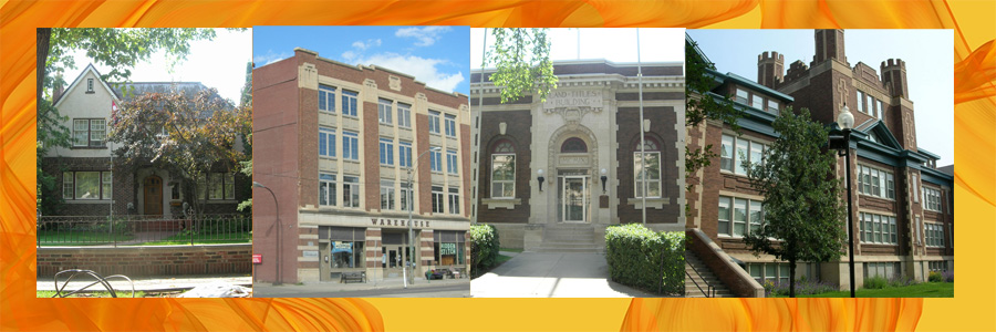
Saskatoon is rich in heritage. The Saskatoon Register of Historic Places (Register) is an official listing of heritage resources identified by the City of Saskatoon as having significant heritage value or interest. It includes buildings, structures, monuments, memorials and natural and cultural landscapes that have helped shape our community and tell the story of Saskatoon.
Heritage resources included on the Register have been identified as having heritage significance for one (or a combination) of the following reasons:
- The resource is representative of a distinct or unique architectural style;
- The resource is associated with a significant person(s);
- The resource is attributed to a particular historical event or theme;
- The resource exhibits cultural, environmental, archeological or paleontological significance; and/or
- The resource adds value in the context of its surrounding area or landscape.
Please see the Heritage Register Publication or Register FAQ Sheet for more information on the Register.
Are Heritage Resources listed on the Register Protected?
Many of the heritage resources included in the Register have no legal protection. Those that have been protected and/or commemorated fall under one (or more) of the following categories:
- Holding Bylaw Property - provides short-term protection of a heritage resource from demolition by providing for a 60 day holding period in the event a demolition permit is received. Within that 60 day period heritage designation is considered by City Council.
- Municipal Heritage Property – designation by the City of Saskatoon to legally protect a heritage resource from demolition or unsympathetic alteration under The Heritage Property Act.
- Provincial Heritage Property – designation by the Province of Saskatchewan to legally protect a heritage resource from demolition or unsympathetic alteration under The Heritage Property Act.
- National Historic Site – commemoration by the Federal Government to recognize places of profound importance to Canada.
- Federal Heritage Railway Station Designation – designation by the Federal Government to protect railway stations from demolition and unsympathetic alteration under the Heritage Railway Stations Protection Act.
How Do I Use the Register?
The Register is categorized according to the original use or function of the heritage resource. Heritage resources are listed by their key name (which often correlates with either the original name or heritage value of the resource). Properties that are officially protected and/or recognized by the Municipal, Provincial or Federal Government are listed as designated. You may also view these properties on the Heritage Property Map.
Each Register listing is written in the form of a Statement of Significance (or SOS). A Statement of Significance consists of the following three components:
- A Description of the Historic Place – outlines what the historic place is;
- The Heritage Value of the Historic Place – explains why the historic resource is important, and;
- The Character Defining Elements of the Historic Place - describes what elements need to be conserved in order for the resource to retain its heritage value.
How Can I Submit a Request for a Heritage Resource to be Included on the Register?
Please contact us to make a request. All requests will be evaluated and approved at the discretion of the City and the Municipal Heritage Advisory Committee.
Getting Started
To get started simply click on one of the Heritage Register Categories listed below, or click on the button below to view the Heritage Register Interactive Map.
Heritage Register Interactive Map
Disclaimer: The Saskatoon Register of Historic Places has no legal status and is for information purposes only. Although every effort is made to ensure the accuracy of information contained in the Register, information may be revised or updated without notice.
Heritage Register Categories
Bridges and Infrastructure
19th Street Subway
Description of the Historic Place
The 19th Street Subway is a roadway that was constructed in the 1930s as a means to pass underneath the rail lines. The remnant subway now stands in the shadow of two freeway approaches. This historic resource, located at the 100 Block of 19th Street East, was built in 1931 in the City’s downtown.
Heritage Value
As early as 1906, Saskatoon citizens have had difficulty connecting between the west side of the city and its downtown. The multitude of railway tracks made crossing not only difficult but exceedingly dangerous. Construction of the first 19th Street Subway started in 1911. It was located 60 metres southeast of the 19th Street Subway's present location. Concerns about the new subway began almost as soon as it was built - it was dangerous, the approaches made it difficult to enter and exit, and it was narrow. Construction of the new 19th Street Subway was undertaken as an unemployment relief measure in December, 1930. Much of the work was done by hand and it took six and a-half months to complete. Today, the 19th Street Subway no longer has a centre pier, roof or retaining walls. However, the site continues to stand as a reminder of early Saskatoon underpasses.
Source: City of Saskatoon Built Heritage Database
Character Defining Elements
Key elements which contribute to the heritage value of this historic resource include:
- Those features that relate to its historic value such as its original site.
A.L. Cole Pumphouse
Description of the Historic Place
The A.L. Cole Pumphouse is a brick building, with an octagonal tower, located at River Landing along the South Saskatchewan River. Built in 1911 in the Riversdale neighbourhood, the pumphouse supplied water from the river to cool the power plant generators. The A.L. Cole Pumphouse is the last surviving remnant of the Saskatoon Power Plant.
Heritage Value
Once the Queen Elizabeth Power Station was built, the A.L. Cole Power Plant provided back-up electricity for the city until 1983. After that time the plant was decommissioned and subsequently demolished. The A.L. Cole Pumphouse however, was spared. Inside the Pumphouse, a spiral staircase leads to the pump floor, where two large pumps once operated from the ground level gallery. A large opening in the gallery floor allowed for ventilation and the installation of the pumps.
Recently, the A.L. Cole Pumphouse was renovated to highlight its unique industrial history and provide for future commercial opportunities. Work completed included the removal of some of the equipment, repairs to the exterior brickwork, replacement of windows, and heat and electrical servicing. The renovation work was undertaken to celebrate the heritage aspects and interpretive opportunities of this building and site, while providing usable tenant space for future commercial activity on the riverfront. The building received an honorable mention for restoration of its exterior under the City's Heritage Awards Program in 2014.
Source: City of Saskatoon Built Heritage Database
Character Defining Elements
Key elements which contribute to the heritage value of this historic resource include:
- Those features that reflect the building’s industrial history such as the building’s brick façade, octagonal brick tower with crenellations and original windows;
- The form, massing and scale of the building, and its original location along the South Saskatchewan River; and
- The inscription ‘City of Saskatoon 1911’ on the building’s front facade.
Broadway Bridge (Holding Bylaw)
Description of the Historic Place
The Broadway Bridge crosses the South Saskatchewan River from Broadway Avenue to 19th Street and 4th Avenue. Constructed in 1932, the Broadway Bridge provides an important link between the neighbourhood of Nutana and the downtown.
This historic place is listed under Bylaw No. 6770 (Holding Bylaw). This Bylaw provides short-term protection of the structure from demolition by providing for a 60 day holding period in the event a demolition permit is received. Within that 60 day period heritage designation is considered by City Council.
Heritage Value
The Broadway Bridge is a significant historic landmark in Saskatoon. The plan for the city's third bridge was initiated in 1926 by the Town Planning Board and J. E. Underwood, an alderman who became Saskatoon's mayor by the time the bridge was completed. The bridge was designed by engineers from the University of Saskatchewan and was built by the City in partnership with the federal and provincial governments as a ‘make work project’ during the Depression. It was finished in just 11 months, opening on November 11, 1932. A total of 1,593 men worked around the clock to build it. The total cost at the time of construction was $850,000.
With the east bank of the South Saskatchewan River being more than 60 feet higher than the west, the Broadway Bridge was designed with a four percent grade. The five arches of the bridge get gradually wider and higher toward the east side. Because the ratio of width to height in each arch remains constant, the bridge maintains an attractive symmetry. The Broadway Bridge’s simple, yet bold design, at the end of one of Saskatoon’s most prominent streets (Broadway Avenue) makes it an important landmark within the city of Saskatoon.
Through the City’s Heritage Awards Program, the Broadway Bridge received an award for the renovation of a public site in 1989.
Source: City of Saskatoon Built Heritage Database
Key elements which contribute to the heritage value of this historic resource include:
- Those features that relate to its historic value such as its original location, materials, form, massing and scale.
Canadian National (CN) Railway Bridge (Grand Trunk Bridge)
Description of the Historic Place
The Canadian National Railway Bridge (also referred to as the Grand Trunk Bridge) is a steel trestle rail bridge that was constructed in 1908. The bridge spans the South Saskatchewan River and is situated at the south end of Diefenbaker Park.
Heritage Value
The Canadian National Railway Bridge was built as part of the Grand Trunk Pacific Railway that connected Winnipeg and Edmonton. It was the third major railway line to run through Saskatoon and helped assure the city’s position as the primary wholesale-distribution centre for central Saskatchewan. In 1923 the bridge became part of the Canadian National Railway.
Source: City of Saskatoon Built Heritage Database
Character Defining Elements
Key elements which contribute to the heritage value of this historic resource include:
- Those features that relate to the bridge's historic value including its original location, materials, form, massing and scale.
Canadian Pacific Railway (CPR) Bridge
Description of the Historic Place
The Canadian Pacific Railway Bridge is a high steel trestle rail bridge that was constructed in 1908. The bridge spans the South Saskatchewan River and is 341 metres (1120 feet) long. The bridge is located within the City Park neighbourhood.
Heritage Value
The Canadian Pacific Railway Bridge is part of the CPR trunk line between Winnipeg and Edmonton. This was the second major rail line routed through Saskatoon. Located on what was then the north edge of the city, the bridge linked the CPR’s divisional yards at Sutherland with its station in downtown Saskatoon. It replaced a temporary wooden trestle bridge that had been constructed at the same location one year earlier.
The pedestrian walkway was added in 1909. The City of Saskatoon's original design for the bridge included a single lane of traffic to be added on each side of the bridge at a later date. These traffic lanes would have cost $50,000 more. Eventually the City opted to build the University Bridge as an alternative.
Source: City of Saskatoon Built Heritage Database
Character Defining Elements
Key elements which contribute to the heritage value of this historic resource include:
- Those features that relate to the bridge's historic value including its original location, materials, form, massing and scale.
Canadian Pacific Railway (CPR) Station (Designated)
Description of the Historic Place
The Canadian Pacific Railway (CPR) Station is located on a one-half hectare lot in the Caswell Hill neighbourhood. The property features a grand two-storey, brick and stone railway station that was constructed between 1907 and 1908.
This historic place, located at 305 Idylwyld Drive North, was designated as a Municipal Heritage Property in 1994. The designation is limited to the building’s exterior. The property received designation as a National Historic Site in 1976, and the building was designated under the Federal Heritage Railway Stations Protection Act in 1990.
Heritage Value
The heritage value of the CPR Station resides in its association with Saskatoon's emerging status as an important prairie city. By constructing a station of this size and stature, the Canadian Pacific Railway Company helped confirm Saskatoon's status in the West. Unlike the wooden structures in smaller centres and rural areas, Saskatoon's CPR station was significantly larger and built of brick - an indication of the permanent nature of the depot. Similarly, the station's chateau-style of architecture, which emulated Edmonton's grand Strathcona Station, speaks to the level of importance that the company placed on the flourishing town. Unlike other railway stations, Saskatoon's CPR depot was not built according to a typical CPR plan; rather, since it coincided with the city's building boom, the station was designed specifically to reflect the optimism of a booming prairie town.
The downtown site chosen for the CPR station was only a few blocks from the rival Canadian Northern Depot that was built in 1890. The new CPR station attested to the fact that Saskatoon was now served by the three main railway lines—the Canadian Pacific, the Canadian Northern, and the Grand Trunk—and this solidified Saskatoon's identity as a "hub city," a distribution centre to the North and the halfway point between Winnipeg and Edmonton. In its day, the CPR Station included separate waiting rooms for men and women, a telegraph office, a baggage area and a conductor’s office.
By 1960 other modes of transport threatened rail use. The station was closed and used as an administrative centre before being privately developed in 1993. The only remaining original railway depot in Saskatoon, the CPR station continues to stand as a symbol of a city's optimism. Through the City’s Heritage Awards Program, the CPR Station received an award for the renovation of a commercial building in 1996.
Source: City of Saskatoon Bylaw No.7444 / City of Saskatoon Built Heritage Database / Canadian Register of Historic Places
Character Defining Elements
Key elements which contribute to the heritage value of this historic resource include:
- Its Chateau-style railway architecture, evident in: its steeply-pitched bell-cast roof with bay dormers, the 15 metre polygonal turret, and the large overhanging eaves supported by heavy, arched brackets;
- Its brick construction, Tyndall stone and lintels; and
- The building's massing and angular siting on its original lot.
Five Corners
Description of the Historic Place
Five Corners is an intersection at Broadway Avenue and 12th Street East. Located in the neighbourhood of Nutana, Five Corners has been an important intersection throughout the history of Saskatoon.
Heritage Value
Five Corners was laid out in 1883 as the intersection of 12th Street East, Broadway Avenue, and North Broadway Avenue (University Drive). North Broadway Avenue was surveyed roughly parallel to the river following the Batoche Trail. The Traffic Bridge was built in 1907 and Five Corners was connected to it by improvements to the Long Hill on Saskatchewan Crescent. This connection created a five-point intersection, and it became an access point to downtown with the completion of the Broadway Bridge in 1932.
Five Corners was marked for many years by a service station up until the 1970s when it was demolished and replaced with an apartment block. Entry from the western part of 12th Street was later blocked off, and access from University Drive was restricted in 2000, thus reducing the number of corners to three. The Five Corners name remains, however, and an interpretive sculpture was erected in 2009 on the site.
Source: City of Saskatoon Built Heritage Database; Saskatoon’s History in Street Names
Character Defining Elements
Key elements which contribute to the heritage value of this historic resource include:
- Those features that relate to its historic value such as its location and interpretive sculpture.
Long Hill
Description of the Historic Place
Long Hill is a historic roadway located on the east bank of the South Saskatchewan River. This historic place is located in the neighbourhood of Nutana between the 400 and 500 Blocks of Saskatchewan Crescent East.
Heritage Value
Long Hill was cut across the hillside around the turn of the century. It was an alternate route for loaded wagons and street cars, as the steep slope of the Short Hill was often too difficult to manage. The Long Hill became the main approach to the City’s ferry, and after 1907, the Traffic Bridge. From 1913 to 1932, when the Broadway Bridge was completed, streetcars climbed the hill from the end of the Traffic Bridge up to Five Corners. Washouts on the hill, especially one in 1913 at what became the foot of Eastlake Avenue, resulted in further reconstruction of the Long Hill and building of retaining walls.
Today, the Long Hill continues to convey Saskatoon’s early history and transportation network.
Source: City of Saskatoon Built Heritage Database; Saskatoon’s History in Street Names
Character Defining Elements
Key elements which contribute to the heritage value of this historic resource include:
- Those features that relate to its historic value such as its location and context within the neighbourhood of Nutana.
Short Hill
Description of the Historic Place
Short Hill is a historic roadway located on the east bank of the South Saskatchewan River. This historic place is located in the neighbourhood of Nutana between the 500 and 600 Blocks of Victoria Avenue.
Heritage Value
Short Hill was dug out of an existing indentation in the riverbank around 1910. Too steep for wagons or streetcars, it was used very little until automobiles became more prevalent. Today, Short Hill continues to convey Saskatoon’s early history and transportation network.
Source: City of Saskatoon Built Heritage Database; Saskatoon’s History in Street Names
Character Defining Elements
Key elements which contribute to the heritage value of this historic resource include:
- Those features that relate to its historic value such as its location and context within the neighbourhood of Nutana.
Spadina Crescent Bridge
Description of the Historic Place
The Spadina Crescent Bridge is a concrete arch bridge that spans a ravine in the neighbourhood of City Park along Spadina Crescent East. Constructed in 1930, the Spadina Crescent Bridge was built to replace an earlier wooden structure.
Heritage Value
The Spadina Crescent Bridge features a single span concrete arch bridge with simple geometric lines reminiscent of the nearby University Bridge. With the Depression beginning to take hold of Saskatoon in 1930, the City of Saskatoon did not have the money to pay for replacement of the existing wooden bridge. In the end, the money to construct the new concrete bridge had to be raised by debenture in the sum of $6,000.
In 1933, a series of small ponds were dug in the ravine as part of a relief work project aimed at beautifying ‘Central Park’ (called Mendel Park today). The system of ponds was extended in the 1950s, and along with the charming little bridge, created an “oasis of calm and beauty” in the heart of the city. The pond system has since been filled in.
Today, the Spadina Crescent Bridge, being one of the smaller bridges in the City, remains unknown to most people yet thousands of cars pass over it daily. The bridge adds both character and visual appeal to the neighbourhood of City Park.
Source: City of Saskatoon Built Heritage Database
Character Defining Elements
Key elements which contribute to the heritage value of this historic resource include:
- Those features that relate to the bridge's historic value including its original location, materials, and simple geometric arch.
University Bridge (Holding Bylaw)
Description of the Historic Place
The University Bridge spans the South Saskatchewan River from the corner of 25th Street and Spadina Crescent to College Drive and Clarence Avenue. Built in 1916, the University Bridge was the first reinforced concrete bridge in Saskatoon.
This historic place is listed under Bylaw No. 6770 (Holding Bylaw). This Bylaw provides short-term protection of the structure from demolition by providing for a 60 day holding period in the event a demolition permit is received. Within that 60 day period heritage designation is considered by City Council.
Heritage Value
The University Bridge was built to link the neighbourhood of Sutherland and the University of Saskatchewan with the central part of the city. The bridge was designed by Adam P. Lindner, who was hired in the spring of 1912 as the assistant chief engineer to the Board of Highway Commissioners. Lindner was responsible for bridge construction in the Province. He changed the proposed steel bridge, like the city's railroad bridges, to a relatively new bridge design, a steel-reinforced concrete arch bridge. A notable feature of its original design was the descending size of its arches, which were described as "like a stone skipping across water". When the University Bridge was built it was the longest such bridge in Canada at 378 metres (1240 feet) long.
Construction of the bridge initially began in 1913, but was delayed when the original contractor went bankrupt. The bridge was eventually completed in 1916 by the provincial government, with the City of Saskatoon paying one-third of the $520,000 cost. Although a double line of streetcar track was laid over the University Bridge when it was built, it was never used and the rails were removed in 1947.
Between 1998 and 1999 a major reconstruction of the bridge was completed. The characteristic interior arches were rebuilt, antique lighting was installed and decorative outer handrails that echo the curves of the arches were created. Despite being a part of Saskatoon for most of the city’s history, the University Bridge was not formally named until January 1, 2006. Today, the University Bridge adds visual appeal and character to the city, and solidifies Saskatoon’s identity as the ‘City of Bridges.’
Source: City of Saskatoon Built Heritage Database
Character Defining Elements
Key elements which contribute to the heritage value of this historic resource include:
- Those features that relate to the bridge's historic value including its original location, its materials, form, arches, lighting and decorative handrails.
VIA Rail (Union) Station (Designated)
Description of the Historic Place
The Via Rail (Union) Station is a one-storey railway station built by Canadian National Railway (CN) in 1964. It is located within the C.N. Yards Management Area on the southwest side of the City.
This historic place, located at 1701 Chappell Drive, was designated under the Federal Heritage Railway Stations Protection Act in 1996. The formal recognition is confined to the railway station building itself.
Heritage Value
Heritage value of the Via Rail (Union) Station lies in its ability to reflect the profound changes in rail transportation brought about by the introduction of diesel engines and container freighting during the mid-20th century. The creation of an up-to-date rail yard and a new passenger station on the outskirts of the city reflected both the need for reorganization and restructuring of rail service and facilities, and the continuing importance of Saskatoon within the Prairie railway system.
The heritage value of the Via Rail (Union) Station also lies in its significance as one of western Canada’s best examples of a station constructed in the International Style. This particular style is often characterized by large geometric forms, large un-textured (and often white) surfaces, large areas of glass and general use of steel or reinforced concrete construction. The Via Rail (Union) Station’s sleek, straight lines, its balanced, symmetrical facades, its simple finishes and its open, sunlit plan exemplify modern station design.
Today, the Via Rail (Union) Station continues to serve as a prominent feature of the busy Chappell rail yards. The flat, simple, ground plan, and the open spaces surrounding the station complement the visual impact of its design.
Source: City of Saskatoon Built Heritage Database / Canadian Register of Historic Places
Character Defining Elements
Key elements which contribute to the heritage value of this historic resource include:
- The simple massing and streamlined horizontal lines;
- Its rectangular and balanced symmetrical plan;
- The low, one-storey height, with a raised central section accentuating the interior concourse and the main entrances on the north and south facades;
- The contrast between solid and void, and sense of monumentality created by the two; the lower rectangular wings connected by a raised, glazed link; and
- Its International architectural style, evident in: the raised central roof, the entrance canopy that overhangs the vertical wall elements, the numerous windows on the upper portion of the raised central section, and the bands of windows on the one-storey side elevations.
The Weir
Description of the Historic Place
The Weir, which was initially a water reservoir and regulator of water flow through the city, is a landmark in Saskatoon. Located along the South Saskatchewan River, between the University Bridge and the CPR Bridge, it was initially constructed in 1939.
Heritage Value
In 1938, federal agriculture minister J.G. Gardiner approved the construction of the Weir, as a relief project during the Depression. The Weir was designed to raise the water level in and adjacent to the city by 6 feet or more. This would make the river safer for boating and other aquatic activities, and would create a water reservoir through the city to ensure the city's potable and power house water intakes would be under water year round. The Weir was designed by the Prairie Farm Rehabilitation Administration (PFRA) and paid for by the City of Saskatoon. The location of the Weir along Spadina Crescent East was chosen due to its proximity to the CPR Bridge.
Construction on the Weir was completed in early 1940 and on March 15, 1940, the coffer dams were removed and the first river water flowed over the Weir. With the construction of the Gardiner Dam at Lake Diefenbaker in 1967, the Weir was no longer functional as the Gardiner Dam controlled river levels. Today, the Weir largely functions as a landscape feature. A gravelled parking lot adjacent to the Weir was built in 1961, and the Meewasin Trail was built near the site in 1981. About 350,000 people visit the Weir each year, and it has become an educational and recreational focal point for the Meewasin Trail. The area around the Weir was upgraded between 2001 and 2002 through a $1.3 million redevelopment project. The Weir has become a prominent landmark and attraction along the South Saskatchewan River in Saskatoon with many opportunities for sight-seeing and bird watching.
Source: City of Saskatoon
Character Defining Elements
Key elements which contribute to the heritage value of this historic resource include:
- Those features that relate to its cultural value, including its location and proximity to the Meewasin Trail and the CPR Bridge.
Cemeteries
Pioneer (Nutana) Cemetery (Designated)
Description of the Historic Place
The Pioneer (Nutana) Cemetery is located on the scenic eastern bank of the South Saskatchewan River in the Exhibition neighbourhood of Saskatoon. The cemetery covers 5.6 hectares, consisting of grass-covered interment areas marked by a cairn, tombstones, natural vegetation, footpaths and a scattered planting of trees.
This historic place, located at Ruth Street West and St. Henry Avenue, was designated as a Municipal Heritage Property in 1982.
Heritage Value
The heritage value of the Pioneer (Nutana) Cemetery lies in its association with the early settlers of Saskatoon. A central cairn honours this resting spot of persons who succumbed to prairie hazards such as prairie fire and snowstorms, as well as casualties of the Riel Resistance. The Clark, Trounce, Fletcher and Caswell surnames are among the notable pioneer Saskatoon families represented on inscribed tombstones. With the first interment occurring in the spring of 1884, the cemetery was the community’s first and for two decades, only cemetery. While the exact number of interments is unknown, 162 interments in total have been documented.
Impassable roads, the loss of early cemetery records and the instability of the riverbank were factors leading to the creation of a new cemetery. In 1910 the City of Saskatoon took over management of the Cemetery from the Pioneer (Nutana) Cemetery Company, and only those who already owned plots or had family buried there could use it. The last burial occurred in the Pioneer (Nutana) Cemetery in 1948.
The heritage value of the Pioneer (Nutana) Cemetery also resides in its landscape design. Located far beyond the original Temperance Colony settlement, its location was chosen for its dramatic and placid river view. Except for changes caused by river erosion, the cemetery is one of the last remnants of natural prairie landscape within the boundaries of the city.
Source: City of Saskatoon Bylaw No.6210 / City of Saskatoon Built Heritage Database / Canadian Register of Historic Places
Character Defining Elements
Key elements which contribute to the heritage value of this historic resource include:
- Its built features, particularly the cairn and the tombstones marking interments;
- Its natural grass cover, footpaths, and planting of trees; and
- The open view of the river valley on its west.
Next of Kin Memorial Avenue NHS at Woodlawn Cemetery (Designated)
Description of the Historic Place
The Next of Kin Memorial Avenue National Historic Site of Canada is a picturesque 0.7 kilometre-long “Road of Remembrance” located in Woodlawn Cemetery in Saskatoon. The Avenue begins at a pair of stone pedestals, flanked by a wrought-iron fence, and runs northwards following the western boundary of the cemetery. It ends in a paved circle surrounding a stone memorial cairn. The asphalt-paved roadway is flanked on either side by a single row of 112 stately, mature elm trees, accompanied by bronze plaques on wrought-iron stands that dedicate each tree to a deceased soldier.
This historic place, located at 1502 2nd Avenue North, was designated as a National Historic Site in 1992. Official recognition refers to Memorial Avenue and a boundary extending 14.2 metres from its centre, including the stone cairn.
Heritage Value
The heritage value of the Next of Kin Memorial Avenue National Historic Site of Canada lies in its significance as an excellent example of the “Roads of Remembrance” phenomenon which was developed to honour those who died in WWI; and it is the only such boulevard in Canada to have retained its integrity.
Following the First World War, the Imperial Order Daughters of the Empire (IODE) sponsored and initiated the tradition of planting memorial trees to honour Saskatoon residents killed in the war. Memorial avenues were based on two symbol-laden images. The first was the long, straight, tree-lined roads of France; the second was, as a living memorial, trees symbolizing the victory of life over death. Initially, 265 trees were planted in single rows on either side of the avenue. Each tree was planted in individual memory of a deceased First World War soldier and was accompanied by a standardized bronze plaque bearing his name, rank and dates of birth and death. The tradition was later expanded to include tree memorials to casualties of both the Second World War and the Korean War. The cemetery now contains more than 1200 memorial trees, 112 of which are on the Next of Kin Memorial Avenue.
Source: City of Saskatoon Built Heritage Database / Canadian Register of Historic Places
Character Defining Elements
Key elements which contribute to the heritage value of this historic resource include:
- Its siting in Saskatoon’s north end, bounded by a residential neighbourhood on one side and Woodlawn Cemetery on the other;
- The 0.7 kilometre long, 10 metre wide roadway, extending through much of Woodlawn Cemetery;
- The existing characteristics of a Road of Remembrance, including a linear, evenly-spaced, tree-lined roadway, semi-rural setting, and a single species of tree;
- The pair of stone pedestals and wrought-iron fence that define the beginning of the avenue at the southern end of the cemetery;
- The mature trees on either side of the avenue with their bronze plaques on wrought-iron stands that dedicate them to individual soldiers; and
- The memorial cairn situated at the opposite end of the avenue.
Education Facilities and Schools
Albert School (Albert Community Centre) (Designated)
Description of the Historic Place
Albert School is a former Saskatoon school that features an elaborate and imposing three storey brick and granite building with a central tower. It reflects a British style which emphasized simple, bold lines. Constructed in 1911, the Albert School (now called the Albert Community Centre) is located in the neighbourhood of Varsity View.
This historic place, located at 610 Clarence Avenue South, was designated as a Municipal Heritage Property in 1983. Designation is limited to the building’s exterior.
Heritage Value
As the city expanded in size, the demand for more and better educational facilities grew and the Saskatoon Public School Board met the challenge by planning the construction of ten major schools. David Webster, who emigrated from Scotland in 1908, was the official Public School Board architect from 1910 to 1914. Albert School was one of four great school plans developed by the Saskatoon architect. These buildings were designed in true British tradition - solid brick with a classic turret-top. The school reflects the Collegiate Gothic style of architecture. The highest storey of the building, with its wide view of the city, was home to the school’s caretaker who kept the huge school heated with coal. King Edward School, demolished in 1979, was considered to be the twin of Albert School.
In addition to serving as an educational centre, Albert School played a big role in city sports, especially lacrosse and hockey. A drop in enrollments brought the closing of the school in 1978, after which it served as the centre for L’Ecole Francaise de Saskatoon. Through the efforts of the Saskatoon Heritage Society and various community groups, the school became the Albert Community Centre after being purchased by the City of Saskatoon. Today the building is used for a variety of community programs, writers’ groups and the arts. The school continues to stand as a witness to the educational ideals of the early Saskatoon community, and through the City’s Heritage Awards Program Albert School received an award for restoration of a public building in 1986.
Source: City of Saskatoon Bylaw No.6408; City of Saskatoon Built Heritage Database / Canadian Register of Historic Places
Character Defining Elements
Key elements which contribute to the heritage value of this historic resource include:
- Those features that relate the buildings Historical and Cultural Value including its continued function as a community orientated use and its imposing and elaborate appearance representative in its form, scale and massing; and
- Its Collegiate Gothic (castle school) style of architecture, evident in: its brick and granite façade, central tower, and imposing pediments and crenellations.
Bedford Road Collegiate
Description of the Historic Place
Bedford Road Collegiate is a large two storey brick building located in the neighbourhood of Caswell Hill. Constructed in 1922 at 722 Bedford Road, the school is Saskatoon’s second oldest high school, and the first high school built on the west side of the South Saskatchewan River.
Heritage Value
Saskatoon's first-born generation was reaching high school age in 1915, but World War I delayed addressing the issue of educational space needs. The issue was temporarily solved by operating two Nutana schools in two different shifts at different times of the day with separate teaching staff. The location of an additional high school site was determined in a plebiscite during the 1919 municipal election, which saw the vote going to the west side of the city. It would take an additional few years until the financing for the school could be secured before its official construction and opening in 1923. By the end of that same year, Bedford Road Collegiate had over 700 students enrolled making it one of the largest amongst the Prairie Provinces.
During World War II the school provided facilities for the training of air crew as part of the Initial Training School No. 7 under the British Commonwealth Air Training Plan. Famous graduates of Bedford Road Collegiate include Roy Romanow (Premier of Saskatchewan), Ethel Catherwood (Olympian), Cyprian Enweani (Olympian), Carey Nelson (Olympian), and Jerry Friesen (CFL).
Designed by John N. Semmens, Bedford Road Collegiate has had numerous additions and renovations to modernize and address the growth of the student population in the area over the years. The school continues to be an important symbol of the expansion of the population on the west side of the city, and represents the importance of education in Saskatoon. Through the City's Heritage Awards Program, Bedford Road Collegiate received an award for restoration of a public building in 2004.
Source: City of Saskatoon Built Heritage Database
Character Defining Elements
Key elements which contribute to the heritage value of this historic resource include:
- Those features that relate to its historical value including its imposing and elaborate appearance, and its location on the west side of the city; and
- Its architecture, evident in: its brick façade, parapet roofline and castellations.
Buena Vista School (Holding Bylaw)
Description of the Historic Place
Buena Vista School is a large imposing solid brick building with a central tower and castle like turrets. Constructed in 1912, Buena Vista School is located in the neighbourhood of Buena Vista.
This historic place, located at 1306 Lorne Avenue, is listed under Bylaw No. 6770 (Holding Bylaw). This Bylaw provides short-term protection of the building from demolition by providing for a 60 day holding period in the event a demolition permit is received. Within that 60 day period heritage designation is considered by City Council.
Heritage Value
Designed by architect David Webster, Buena Vista School reflects the Collegiate Gothic style of architecture. Webster designed the school in the true British tradition: solid brick with a classic turret-top. Construction of Buena Vista School began in October 1912, but the school was not completed until the spring of 1914, when it opened to relieve congestion at Victoria School. Many students at Buena Vista School entered their new school during World War I and readily took part in aiding the war effort. W.H. Holliston, principal at Buena Vista for many years, organized a Cadet Corps of 52 boys in 1916, an endeavor which continued throughout the war. Senator Sid Buckwold is one well-known individual who attended Buena Vista School in his childhood.
For many years the school provided accommodation for visitors during Fair Week because of its close proximity to the Exhibition Grounds. From housing boys attending camp at the Exhibition to St. John's Ambulance lectures, Buena Vista School has long served, and continues to serve, its neighborhood and community. Through the City’s Heritage Awards Program, Buena Vista School received an award for interior/exterior renovation in 2006.
Source: City of Saskatoon Built Heritage Database
Character Defining Elements
Key elements which contribute to the heritage value of this historic resource include:
- Those features and functions that relate to the building’s historical and cultural value such as its imposing and elaborate appearance representative in its form, massing and scale, and its continued use as an educational facility; and
- Its Collegiate Gothic (castle school) style of architecture, evident in: its brick façade, central tower, and castle like turrets.
Caswell School
Description of the Historic Place
Caswell School is a large, elaborate three storey brick building built with a central tower. Constructed in 1911, the school is located in the neighbourhood of Caswell Hill at 204 30th Street West. The school reflects a Collegiate Gothic style of architecture that was common in schools built in the Pre-World War I era.
Heritage Value
Designed by David Webster, Caswell School was named for R. W. Caswell, an honoured pioneer of the Saskatoon community. It was built on the same piece of property that he had farmed when he arrived in the area in 1883, and it was R.W. Caswell that provided the 1,350 pound bell for the school. Caswell School featured modern elements including slate blackboards, a fire alarm and a programmed clock system. By 1916, enrollment pressures resulted in the construction of an additional room to increase capacity. Activities in the school were varied. During World War I for example, St. John Ambulance lectures were held for the public and the school was used as a polling station on many election days. During World War II, students worked through their Red Cross Societies to assist in the war effort.
Caswell School, along with others built in the same extravagant style and period, represents an important chapter in Saskatoon's history and remains as an elaborate memorial to Saskatoon's educational heritage. Extensive interior renovations to Caswell School were completed in 1983. The building’s exterior however, has remained largely unaltered with the exception of the removal of the bell tower and the dormer windows.
Source: City of Saskatoon Built Heritage Database
Character Defining Elements
Key elements which contribute to the heritage value of this historic resource include:
- Those features that relate to its historic value including its imposing and elaborate appearance, its ‘Caswell’ inscription and date insignia and its location on the former lot of pioneer R.W. Caswell; and
- Its Collegiate Gothic (castle school) style of architecture, evident in: its brick façade, central tower, and pediments.
City Park School
Description of the Historic Place
City Park School is a large three-storey brick building reminiscent of the ‘castle schools’. Constructed in 1928, City Park School is located in the neighbourhood of City Park at 820 9th Avenue North.
Heritage Value
The heritage value of City Park School lies in its architecture and its role as an educational institution and community focal point in its surrounding community. The building features a solid design by architect Frank P. Martin with traditional brick work. Its construction reflects the British tradition which emphasized simple, bold lines. Although the school was built later than the other 'castle schools' in Saskatoon, it still retains the traditional, collegiate look. At the time of its opening in 1928, it was Saskatoon's third high school.
The school was originally designed to accommodate 200 students but by the 1970s the student population was up to 900 and the school had to run split shift classes. The first addition to the building occurred in 1957 with the addition of a gymnasium and auditorium. To accommodate the larger student population in the 1970s, an addition was put on the school in 1974. This new section added 22,300 square feet and housed three new classrooms along with an expanded gymnasium and locker rooms. With the opening of Marion Graham Collegiate in 1984, there were no longer enough students to keep the school viable, and City Park School was subsequently closed. The building was leased to the Saskatoon Region Community College for two years until it was reopened as a Saskatoon Public School in the fall of 1986. Since then City Park School has been an alternative secondary school. The school provides education to students planning to directly enter the work force and now includes an auto mechanics shop, welding and woodworking facilities, a daycare and a preschool.
Today, in addition to its educational role in the community, City Park School provides a focal point for events and programming.
Source: City of Saskatoon Built Heritage Database
Character Defining Elements
Key elements which contribute to the heritage value of this historic resource include:
- Those features and functions that relate to the building’s historical and cultural value such as its imposing and elaborate appearance representative in its form and its continued use as an educational/community facility; and
- Its British (castle school) style of architecture, evident in: its brick façade and central tower.
Joe Duquette / Oskayak High School
Description of the Historic Place
Joe Duquette / Oskayak High School is a large two storey brick building (with two steel frame additions) located in the neighbourhood of Nutana at 919 Broadway Avenue. Constructed in 1926, the school is an important educational institution for First Nations students.
Heritage Value
Joe Duquette / Oskayak High School originally opened as St. Joseph's Elementary Catholic School on December 17, 1928. Just over fifty years later, the school closed due to declining enrollment in 1980. The building was repurposed as the Joe Duquette High School, which was later named Oskayak High School. Joe Duquette High School was a special division of the Catholic School System which sought to preserve the cultural heritage of the First Nations community. With increasing numbers of Aboriginal youth enrolled in urban schools, it became very apparent from high dropout rates and from rising statistics in age-grade discrepancies of Aboriginal youth that present educational structures were not aware of or able to address the language and cultural differences inherent in Aboriginal students. Joe Duquette / Oskayak High School is one of a series of urban Aboriginal schools in Canada
The school was named in honour of Joe Duquette, an elder from the Mistawasis First Nation who had worked with students and teachers at the school in the early 1980s. Oskayak High School was eventually selected as the new name for Joe Duquette High School. Oskayak means "young people" in Cree. It was felt this name captured the community belief that the school is for all young people. Since the opening of the Joe Duquette / Oskayak High School, student enrollments have continued to rise. The student-centered programs have attracted many urban Aboriginal youth to return to school to complete their high school education.
Source: City of Saskatoon Built Heritage Database
Character Defining Elements
Key elements which contribute to the heritage value of this historic resource include:
- Those features that relate to its historical and cultural value including its imposing and elaborate appearance, its location along Broadway Avenue, and its continued use as a facility geared towards Aboriginal youth; and
- Its architectural features, including the original building’s brick façade, parapet roofline, arched doorways and window sills.
King George School (Holding Bylaw)
Description of the Historic Place
King George School is a large imposing brick building with a central tower. Designed in the Collegiate Gothic architectural style, and constructed between 1912 and 1913, King George School is located in the neighbourhood of King George.
This historic place, located at 721 Avenue K South, is listed under Bylaw No. 6770 (Holding Bylaw). This Bylaw provides short-term protection of the building from demolition by providing for a 60 day holding period in the event a demolition permit is received. Within that 60 day period heritage designation is considered by City Council.
Heritage Value
King George School represents the importance of education and the British tradition. Between 1910 and 1914, money was abundant, enterprises thrived and construction of all kinds flourished. During this time the Saskatoon Public School Board planned the construction of ten major schools, including King George School. In November 1909, property on Avenue K south was purchased by the Saskatoon Public School District No. 13 for the future construction of a school. In 1911 a two-room frame school, formerly known as the Prince of Wales School, was moved to the site where it was renamed the King George School in recognition of the coronation of the monarch. By 1912 the Board decided to construct a new 14-room school.
Designed by David Webster, official Public School Board architect from 1911 to 1914, King George School exhibits a solid brick structure with a classic turret-top. The Masonic symbols on the façade of the school is common in Webster’s designs.
Former professional hockey player, Gordie Howe, is one of the best-known graduates of King George School. The school continues to be an important landmark in the community.
Source: City of Saskatoon Built Heritage Database
Character Defining Elements
Key elements which contribute to the heritage value of this historic resource include:
- Those features that relate to its historical and cultural value including its imposing and elaborate appearance representative in its form and its continued use as an educational facility;
- Its Collegiate Gothic (castle school) style of architecture, evident in: its brick façade, central tower, and castle like turrets; and
- The masonic symbols located on its façade.
Little Stone School House (Designated)
Description of the Historic Place
The Little Stone School House is located directly east of St. Andrew’s College on the grounds of the University of Saskatchewan. The property features a one-storey stone school constructed in 1887 that was moved to the University of Saskatchewan in 1911.
This historic place was designated as a Municipal Heritage Property in 1982.
Heritage Value
The heritage value of the Little Stone School House lies in its association with the foundation of public education in Saskatoon. In 1885, Saskatoon Public School District No. 13 was formed with classes held in various temporary locations. This granite one-room school, originally known as Victoria School, was built by Alexander Marr in 1887. Community members assisted in the gathering of suitable building stones from the surrounding prairie. Stone being a readily-available alternative to wood-frame construction at a time when lumber was rare and expensive to transport. The school accommodated approximately 40 pupils, and having a central location at the corner of Broadway Avenue and 11th Street, immediately became a gathering place for religious, social and cultural events. It was replaced in 1910 when the growing community required a larger educational facility.
The heritage value of the Little Stone School House also resides in its stonemasonry. Stonemason Alexander Marr constructed this building in 1887. A school of Prairie Vernacular design, its hip roof, robust mass, sequence of its stonework and strong form speak to the importance of education in the community, as well as optimism for the future.
The Little Stone School House was one of the first heritage conservation projects in western Canada. Undertaken as a tribute to pioneer education, the school was dismantled stone by stone and each stone was numbered. It was then reconstructed on the grounds of the newly-established University of Saskatchewan in 1911, under the direction of stonemason, Lorne Thompson. It was restored in 1967 and established as a school museum.
Source: City of Saskatoon Bylaw No.6267 / City of Saskatoon Built Heritage Database / Canadian Register of Historic Places
Character Defining Elements
Key elements which contribute to the heritage value of this historic resource include:
- Its use as a school, its shape, the placement of its windows and central door;
- Its form, walls, and steep hip roof; and
- Its orientation on its lot, and the materials used in the construction of its front door, windows, floor, walls and ceiling dating to the school’s reconstruction at the University location.
Mayfair School
Description of the Historic Place
Mayfair School is a large two storey brick building located in the neighbourhood of Mayfair. Constructed in 1919 at 510 34th Street West, the school is a local neighbourhood landmark.
Heritage Value
The heritage value of Mayfair School resides in its representation of Saskatoon’s early educational system. The spring of 1912 was a prosperous one for Saskatoon; as economic and population growth boomed, officials prepared to accommodate rapidly-expanding educational needs. But 1913 was a year of sudden change. The "boom" had passed, and a pre-war economy proved restricting. Originally, Mayfair School was to be opened no later than September, 1914. Plans for the school required changes in detail and cost of materials. Though the foundations were complete in 1914, construction of the building was postponed by the onset of World War I. All construction "not immediately necessary" was put on hold, and all efforts turned to war.
Only a few months after the return of peace, plans for Mayfair School resumed. A slowly recovering economy demanded extreme care in all financial decisions. In 1919 a call for tenders was announced and A. W. Cassidy became the successful contractor with R. Blackwood as the architect. Mayfair School was occupied in September 1920, while further construction continued. In January, 1921, nearly ten years after the original plans had begun; the school was in full operation. Mayfair School would be one of the last large and elaborate schools built in Saskatoon. Significant individuals connected to Mayfair School include George Cairns (relative of honoured Sgt. Hugh Cairns) and J. M. Cowie, vice principal at Mayfair School, who served in the Second World War and died in action in September, 1944.
Architecturally, Mayfair School’s flat-top construction, offset with parapet walls, differs from the characteristic turret-top style of earlier schools. In 1950 Mayfair School completed an addition to the school to accommodate growing numbers. There were also portable classrooms added in 1968. Mayfair School continues to be a busy functioning facility. It is a symbol of the struggles encountered and the persevering nature of the Saskatoon Public School System.
Source: City of Saskatoon Built Heritage Database
Character Defining Elements
Key elements which contribute to the heritage value of this historic resource include:
- Those features that relate to its historical value including its imposing and elaborate appearance, its location on Saskatoon’s west side, and the inscription ‘Mayfair’ above the main entrance.
- Its architecture, evident in: its brick façade, flat roof with offset parapet walls, double front entrances and cornice.
Normal School (E. A. Davies Building) (Holding Bylaw)
Description of the Historic Place
The Normal School (now called the E.A. Davies Building) features a massive three storey brick and stone building built in the Collegiate Gothic architectural style. The Normal School was built in 1920 in the Central Industrial neighbourhood.
This historic place, located at 1030 Idylwyld Drive North, is listed under Bylaw No. 6770 (Holding Bylaw). This Bylaw provides short-term protection of the building from demolition by providing for a 60 day holding period in the event a demolition permit is received. Within that 60 day period heritage designation is considered by City Council.
Heritage Value
Normal School was designed for training primary and secondary school teachers, and initially opened in 1912. At the time, the school rented space and did not occupy a specific building. By 1918 enrollment in the Saskatoon Normal School had reached several hundred students and it became clear that a ‘normal school’ building was needed. Initial construction on the Normal School began in 1920, and in 1922 the facility opened for its first classes. At the time of the construction it was one of the most modern and best equipped institutions in Canada. For over four decades, it served as a teacher-training centre from which thousands of teachers entered classrooms across the province. From September, 1941 to June, 1944, the Normal School was leased to the federal government for use as a residence for trainees at the Initial Training School Number 7 of the Royal Canadian Air Force, which was located to the north of the property.
As University programs for teacher-training developed, the Normal School was absorbed by the College of Education in 1964. Since the early 1970s, a number of provincial government offices have been located in the Normal school Building, including Saskatchewan Treasury, the Highway Traffic Board, and the Departments of Labour, Agriculture and Social Services. In 1971 a drill hall, which had been constructed during the war, was demolished to make way for the Harry Bailey Aquatic Centre, and from 1979 to the mid-1980s it was the home of the Saskatchewan Indian Cultural College. In 1986, the building was renamed the E. A. Davies Centre in honour of Edmund A. (Fred) Davies, the first principal of the Canadian Vocational Training School. The Centre now houses a variety of programs for the Saskatchewan Polytechnic Saskatoon Campus.
Designed by Maurice W. Sharon, the Normal School is built in the Collegiate Gothic style - a style popular in the 19th and 20th centuries for school structures with characteristic arches and parapets. The building features a brick and stone exterior, tall bay windows and a dramatic arched entrance of embossed stone beneath decorated parapets. The interplay of texture and colour of building materials, lancet windows and stained glass suggest endurance and strength. The Normal School’s imposing Collegiate Gothic style offers visual interest to the surrounding area.
Source: City of Saskatoon Built Heritage Database
Character Defining Elements
Key elements which contribute to the heritage value of this historic place include:
- Those features that relate the historical and cultural value of the building, such as its continued use as an educational facility and its imposing and elaborate appearance representative in its form and scale;
- Its Collegiate Gothic style, evident in: its brick and stone exterior, tall bay windows, dramatic arched entrance embossed with stone and decorated parapet; and
- Its additional aesthetic elements including its lancet windows, stained glass and granite steps.
Nutana Collegiate (Holding Bylaw)
Description of the Historic Place
Nutana Collegiate is a large three storey brick building built in the French Renaissance architectural style. Constructed in 1909, this school is located in the neighbourhood of Nutana. The building is situated on a site that offers sweeping views of the South Saskatchewan River and the downtown. To the east of the school is Chief Darcy Bear Park.
This historic place, located at 411 11th Street East, is listed under Bylaw No. 6770 (Holding Bylaw). This Bylaw provides short-term protection of the building from demolition by providing for a 60 day holding period in the event a demolition permit is received. Within that 60 day period heritage designation is considered by City Council.
Heritage Value
The heritage value of Nutana Collegiate lies in its significance as the first collegiate in Saskatoon. The use of "collegiate" in the school's name reflects the school's original curriculum and intended role as a preparatory school for students expecting to attend university and enter professional careers. The building was built in 1909 on a site that was used as an exhibition ground by Saskatoon's first settlers.
Nutana Collegiate faced overcrowding during the Boom years, although the completion of Bedford Road Collegiate in 1923 helped to alleviate the problem. At times, the University of Saskatchewan and the Normal School also used the building. After Bedford Road Collegiate was constructed, Saskatoon Collegiate was renamed Nutana Collegiate Institute because the School Board felt no one school should be named after the city. Well-known graduates of Nutana Collegiate include: J.G. Diefenbaker, Chief Justice Emmett Hall, Sid Buckwold, Farley Mowat, Ray Hnatyshyn, Cliff Wright and Max Braithwaite.
The heritage value of Nutana Collegiate also lies in its contribution to Saskatoon’s art community. Established in 1919, the Memorial Art Gallery located in the school housed the first important collection of art in Saskatoon. The gallery was a student initiative. The Nutana Collegiate students raised funds to purchase paintings to commemorate the 29 fallen soldiers of World War I who had attended the school. In 1921, loans from the National Gallery of Canada and from collectors in Saskatoon enabled the gallery to hold its first exhibition, which was also the first art exhibition in Saskatoon. The collection includes works from many early Saskatchewan artists, including Ernest Lindner, Augustus Kenderdine, Fred Loveroff, Inglis Sheldon-Williams, James Henderson, and Emile Walters. More recently, works by Wynona Mulcaster, Paul Constable, and Allan Sapp have been acquired.
Designed by Storey and Van Egmond, Nutana Collegiate is designed in the French Renaissance architectural style, and includes elements characteristic of the style, such as pilasters, quoins, and dentils. The school features a pressed brick symmetrical façade with large two-storey white stone classical columns and heavy squared piers flanking the main entrance.
Additions were made to the building in 1930, 1953, 1958, 1964, and 1965. Despite these numerous alterations and additions, the original façade and parts of the building’s exterior have been retained. In 2013, the Lieutenant Governor of Saskatchewan Heritage Architecture Excellence Awards was awarded to Nutana Collegiate for Adaptive Re-Use & Rehabilitation of the building. In 2014, through the City’s Heritage Awards Program, the school was awarded for its exterior restoration.
Source: City of Saskatoon Built Heritage Database
Character Defining Elements
Key elements which contribute to the heritage value of this historic resource include:
- Those features that relate to its historical value including its imposing and elaborate appearance representative in its form and location along the banks of the South Saskatchewan River;
- Those features that relate to its cultural significance, including its continued use as an education facility and art gallery, and its symbols and lettering located on its front façade; and
- Its French Renaissance style of architecture, evident in: its brick façade, stone composite columns, heavy squared piers, full height entry porch, gabled central, right and left projection, dormers, dentils, and pediment.
Peter MacKinnon Building (College Building) (Designated)
Description of the Historic Place
The Peter MacKinnon Building (formerly the College Building) is situated prominently at the head of a landscaped, oval space known as "The Bowl" on the University of Saskatchewan campus. Located on sixteen hectares of the campus grounds, the property features an impressive, 2 ½-storey, stone-clad, Collegiate Gothic-style building that was constructed between 1910 and 1912.
This historic place, located at 105 Administration Place, was designated as a Provincial Heritage Property in 1982, and a National Historic Site in 2001.
Heritage Value
The heritage value of the Peter MacKinnon Building resides in its status as the first College of Agriculture at a Canadian university. While formal agricultural education had been introduced in eastern Canada in the late nineteenth century, these institutions had only nominal connections to universities. The University of Saskatchewan was the first in Canada to establish an agricultural college on its main campus and give it a status equal to the more traditional colleges, such as the Liberal Arts and Sciences, Medicine, and Law. Knowing the vital role that agriculture was to play in the development of the province, the university founders considered the College of Agriculture a priority over all other colleges and commissioned the Peter MacKinnon Building as the first academic building constructed on the campus. Constructed to house lecture halls, classrooms, and offices for the College of Agriculture, the building's importance was further emphasized in the 1909 master plan, which placed it in its prominent location at the head of what was designed to be an agricultural precinct.
The heritage value of the Peter MacKinnon Building also lies in its Collegiate Gothic architecture, a style symbolic of older, well-established universities. This style was specifically chosen by the university's Board of Governors because of its use on prominent campuses such as McGill and Princeton. As such, they commissioned the Montreal architectural firm of Brown and Vallance because of their expertise in the Collegiate Gothic style. Brown and Vallance were the university architects until 1930, and designed the layout of the campus and its original buildings, including five of its most prominent. This set of five buildings has been called "the finest grouping of Collegiate Gothic university buildings in Canada" and the Peter MacKinnon Building stands as its centrepiece. Its architectural style is evident in its vertical lines and strong symmetrical massing, Gothic fenestration, and decorative motifs. The three oriel windows fronted the library and, later, the President's office, as the building took on a university governance role. Though the original design called for rough-cut Tyndall Stone, local "greystone" was substituted when a plentiful supply was found nearby.
The Heritage value of the Peter MacKinnon Building also lies in the building's association with academic, cultural, and student life at the University of Saskatchewan. The only building on campus in the early years, the Peter MacKinnon Building housed offices for the College of Agriculture and the College of Arts and Science, as well as classrooms, lecture halls, and laboratories for physics, chemistry, animal husbandry, and home economics courses. As the university expanded, the colleges and classes moved to other locations and the building adopted an administrative role, housing student registration, business offices, and the office of the university secretary. A key feature of the building is the Convocation Hall, which is a large assembly hall with a stage and wrap-around balcony that forms the central wing of the E-shaped building. Added at the request of Dean of Agriculture W.J. Rutherford during the design phase, the room was designed to seat 500-600 people as a meeting place for farmers and as a facility for use in extension work. Convocation Hall became the cultural centre of the university campus, hosting convocation ceremonies, dances, concerts, drama productions, societies' meetings and conventions, and class reunions.
Through the City’s Heritage Awards Program, the Peter MacKinnon Building received an award for interior restoration in 2006.
Source: City of Saskatoon Built Heritage Database / Canadian Register of Historic Places
Character Defining Elements
Key elements which contribute to the heritage value of this historic resource include:
- Those features that speak to its setting, such its location at the head of the "Bowl," its relationship to the core group of Collegiate Gothic buildings, and the unimpeded view of the front façade; the metal casements, the notched parapet, and the gargoyles which reflect the prairie fauna in the shapes of owls and prairie dogs;
- Those features that illustrate the spatial design of the building, including the E-shaped massing and the main interior corridors and staircases;
- Those features that reflect its role as the academic, ceremonial, and cultural centre of the campus, such as Convocation Hall and its decorative elements, including the chandeliers and wrap-around balcony, the Honor Roll frieze, and the commemorative plaques;
- Its continued function as a community orientated use;
- Its imposing and elaborate appearance representative in its form; and,
- Its Collegiate Gothic style of architecture, evident in: its vertical lines and strong symmetrical massing, Gothic fenestration and decorative motifs, three oriel windows, textured fieldstone walls and contrasting sandstone trim, windows with crossed stone mullions.
Pleasant Hill School
Description of the Historic Place
Pleasant Hill School is a large three storey brick building located in the neighbourhood of Pleasant Hill. Constructed in 1928, the school is located adjacent to Pleasant Hill Park at 215 Avenue S South.
Heritage Value
The heritage value of Pleasant Hill School resides in its representation of Saskatoon’s early educational system. The original Pleasant Hill School, a two-room frame structure, was built on this site in 1913. In the mid-1920s most schools in Saskatoon were overly congested with students. Pleasant Hill however was not affected, nor was Wilson School in City Park. In 1928 a new school was built on the site to relieve some of the pressure from other schools. Designed by Frank P. Martin, Pleasant Hill School opened in February of 1929 to accept over 350 public school students.
Pleasant Hill School was considered to be very progressive at the time of its construction. Not only did it have the largest school grounds in the city, but it had offices for medical staff and dentists to care for the students. The new school also contained twelve classrooms, a household science room, manual training rooms, and a large auditorium that could be converted into four additional classrooms.
Pleasant Hill School is a local neighbourhood landmark and it continues to symbolize the importance of education in Saskatoon.
Source: City of Saskatoon Built Heritage Database
Character Defining Elements
Key elements which contribute to the heritage value of this historic resource include:
- Those features that relate to its historical value including its imposing and elaborate appearance, central tower, and original location.
- Its architecture, evident in: its symmetrical brick façade and parapet roofline
R.J.D. Williams Building (Holding Bylaw)
Description of the Historic Place
The R.J.D. Williams Building is a three-storey brick boom time building located within the University of Saskatchewan Management Area. Originally a School for the Deaf, the building’s name, R.J.D. Williams, honours the school's dean of residence, Rupert Williams who lost his hearing as a child.
This historic place, located at 221 Cumberland Avenue, is listed under Bylaw No. 6770 (Holding Bylaw). This Bylaw provides short-term protection of the building from demolition by providing for a 60 day holding period in the event a demolition permit is received. Within that 60 day period heritage designation is considered by City Council.
Heritage Value
The R.J.D. Williams Building is an important educational landmark in Saskatoon and the province of Saskatchewan. In the 1920s, Saskatchewan's deaf children had to travel to Manitoba or Montreal for their education which meant that many deaf children received no formal education. The Western Canadian Association for the Deaf appointed Rupert Williams to investigate education for the deaf in Saskatchewan.
R.J.D Williams, who had lost his hearing at the age of five after contracting spinal meningitis, moved to Saskatoon in February 1927. A graduate of the Manitoba School for the Deaf, Williams was determined to establish a Saskatchewan School and in 1929 it was announced that a new school for the deaf would be built in Saskatoon. The university agreed to provide land, with the location being chosen on Cumberland Avenue, several hundred yards south of what was then the university street car terminal. Construction began in 1930 at the start of the Depression. This meant that plans for the school were revamped to conform to the new economic reality. Although sacrifice in the design and size of the building were made, it allowed for the use of Saskatchewan materials and generated sorely-needed economic activity in the province.
R. J. D. Williams took the position of Chief Supervisor of resident students in the new school. He remained there for thirty-two years. 1982 marked the 50th anniversary of the School for the Deaf, and the building was renamed the R.J.D. Williams Provincial School for the Deaf. In June of 1991 the students at the school were moved into mainstream education. The school was subsequently closed and the building became part of the University of Saskatchewan.
The R.J.D Williams Building was designed by H. Dawson and Frank P. Martin in the Gothic architectural style; a style of architecture characterized by great cathedrals, pointed arches and richly decorated fenestrations. The building’s exterior features brick from Claybank, Saskatchewan, and is ornamented with Tyndall Stone from Manitoba. Inside, the main floor housed the administrative offices and classrooms. The second and third floors consisted of dormitories, rooms for domestic science and home nursing, recreation rooms and two suites for supervisors. The basement was devoted primarily to vocational training, with manual training facilities for the boys and sewing, millinery and laundry demonstration rooms for the girls.
Today the R.J.D. Williams Building is home to the University of Saskatchewan Language Centre (USLC).
Source: City of Saskatoon Built Heritage Database
Character Defining Elements
Key elements which contribute to the heritage value of this historic resource include:
- Those features that represent its historical significance including the building's continued use as an educational facility, and the use of local materials in its construction.
- Its architecture, evident in its form, scale and massing, pointed arches and fenestrations.
St. Andrew's College
Description of the Historic Place
St. Andrew’s College is located on the University of Saskatchewan campus in Saskatoon at 1121 College Drive. The building was constructed in 1922 in the Collegiate Gothic style.
Heritage Value
The heritage value of St. Andrews College resides in its association with theological education in Saskatoon. Originally founded in 1912, St. Andrews College (previously named the Presbyterian Theological College in Saskatoon) was proclaimed by an Act of the Saskatchewan Legislature in 1913. The College was originally located in a large family home on Albert Avenue before the University of Saskatchewan agreed to lease 4.5 acres of land to the College for a period of 21 years beginning in 1914. The lease was subject to renewal, but was conditional: the land could only be used “for the purpose of erecting buildings and structures for the advancement of learning and for teaching and instruction in Theology and Divinity.” Foundations were laid and material accumulated, but all plans were cancelled with the outbreak of the First World War.
Designed by architect David Brown, construction did not begin again on the College until 1922 on land at the southwest corner of the campus, adjacent to the main campus entrance. The building held its first classes in the fall of 1923. As with many communities and congregations across the Prairies, St. Andrew's College struggled to support students and maintain the educational program throughout the years of market collapse, depression and drought of the 1930s. The 1930s closed with Canada at war again and with many St. Andrew College students serving with the Canadian Armed Forces in Europe. Notable graduates of St. Andrews College include Lydia Gruchy, the first woman to be ordained in the United Church of Canada; and Lorne Calvert, former Premier of Saskatchewan.
During the 1950s plans were drafted for the completion of the East Wing of St. Andrew's College. The expansion was a signal to the wider church about the permanence and future of the college at a time when the need for a theological presence on the Prairies was being debated. The addition was completed in 1961 by the architectural firm of Webster, Forrester, and Scott.
The heritage value of St. Andrews College also lies in the building's Collegiate Gothic architecture, a style symbolic of older, well-established universities. Its architectural style is evident in its vertical lines and strong symmetrical massing, Gothic fenestration, and decorative motifs. St. Andrew’s College remains as an important architectural feature on the University of Saskatchewan Campus and along College Drive.
Source: City of Saskatoon Built Heritage Database
Character Defining Elements
Key elements which contribute to the heritage value of this historic resource include:
- Those features that speak to its setting, such its location within the University of Saskatchewan and along College Drive;
- Its imposing and elaborate appearance representative in its form, massing and scale; and
- Its Collegiate Gothic style of architecture, evident in: its vertical lines and strong symmetrical massing, Gothic fenestration and decorative motifs, and fieldstone walls.
Stone Barn
Description of the Historic Place
The Stone Barn is a barn located on the University of Saskatchewan Campus, and is one of the largest of its type in Western Canada. Built in 1912, the Stone Barn has been a highly visible landmark of the Farm Site of the College of Agriculture throughout its history.
Heritage Value
The Stone Barn is one of the oldest buildings on the University of Saskatchewan campus, and is one of the few French Canada/Eastern Township structures in existence on the Prairies. Its size and location makes the main barn one of the most recognizable buildings at the University of Saskatchewan. Designed by Brown and Vallance of Montreal, the large L-shaped barn with attached silos was intended to provide accommodation for about thirty horses and fifty cattle. Construction took two years (1910 -1912) with a total cost of $150,000. The west wing was finished in the first year and was used for the university's horses until the 1950s. The east wing was used to house the dairy herd. The loft, which is approximately the same area of the ground floor, was used to store feed.
The Barn rests on a concrete foundation with the first eight feet of the exterior walls composed of rough granite stone. The upper part of the exterior walls and roof are clad in cedar shingles. The building has a Gambrel-type roof that became popular in the United States in the 1850s and is reminiscent of barns in Quebec’s Eastern Townships. Two 120 ton concrete silos flank the north ramp and are considered to be one of the oldest in Saskatchewan. A low stone wall of rough granite encircles much of the building and defines the Barn’s external pens.
Today, the Stone Barn remains as a rare example of French Canada/Eastern Township structures on the Prairies, and continues to symbolize the study of Agriculture in Saskatchewan.
Source: City of Saskatoon Built Heritage Database
Character Defining Elements
Key elements which contribute to the heritage value of this historic resource include:
- Those features that represent its French Canada/Eastern Township structure and agricultural use including: its L-shaped form; silos; granite walls; cedar shingles, cupolas; gambrel roof; and stone wall.
Victoria School (Ecole Victoria School)
Description of the Historic Place
Victoria School is a large elaborate brick building that was built in 1909 at 639 Broadway Avenue. The school is located in the neighbourhood of Nutana and reflects an eclectic architectural style with Classic Revival and Second Empire influences.
Heritage Value
The heritage value of Victoria School resides in its representation of Saskatoon’s early educational system. Victoria School, named in honour of Queen Victoria, was constructed in 1909 to meet the needs of Saskatoon's growing population. Designed by W.W. LaChance, the school was built on the original site of the Little Stone School House which was constructed in 1887.
Victoria School has been used for a number of purposes over the years. In 1910 for example, the University of Saskatchewan used Victoria School’s assembly hall for convocation and in 1912 for adult education evening classes. Classes connected with McGill Conservatory of Music, Westminster and Lutheran Churches, Boy Scout troops, Fair Week visitors, University lectures, Boys' League ball teams, and Rotarian Rugby players at one time or another, all used Victoria School. In the summer following WWII, Victoria School’s office space was utilized as a demobilization centre for army troops. The school also became a meeting place for the Women Teachers Association, who lobbied for "equal pay for equal work."
Victoria School exhibits an eclectic architectural style. The variation in the design of the roof and the remainder of the building lends itself to no singular style. Rather, the school is part Classic Revival, part Second Empire, with the design containing some of the features of each. The brick veneer building is ornamented with green wood mouldings and cornices. The main portion of the school features a steeply-pitched central gable with an arched window dominating the pediment and cornice below. The front entrance is arched by wedge-shaped brick and concrete voussoirs which compliment the school's ornamentation.
Over the years, numerous additions have been made to Victoria School, with one of the larger ones being in 1976. That year the Saskatoon Public School Board laid plans to create a modern inner-city school that could house a number of special programs and services, including French immersion instruction, industrial arts and special education classes. After two years of work, the revitalization of Victoria School was hailed with an official reopening in November, 1980. The changes included a brighter, more spacious open-plan entrance, the creation of a large learning resource area, and an industrial arts shop which could offer woodworking, drafting and photography courses. Exterior renovations included the repair of the roof, construction of a new outside entrance, and repointing of the brick work.
Victoria School continues to serve as a multipurpose, modern educational facility within one of Saskatoon’s core neighbourhoods. The ‘castle-like’ school continues to be a community focal point and an important architectural feature in the Broadway area. In commemoration of the 100th anniversary of Victoria School in 1988, a life-size statue of a girl and her dog was cast in bronze-alloy and located on the right front portion of the school grounds.
Source: City of Saskatoon Built Heritage Database
Character Defining Elements
Key elements which contribute to the heritage value of this historic resource include:
- Those features that relate to its historical value including its location on the site of Saskatoon’s earliest school, and its imposing and elaborate appearance;
- Its eclectic style of architecture, evident in: its brick façade; green wood mouldings and cornice; steeply-pitched central gable; arched windows; pediment; and arched front entrance.
Westmount Community School
Description of the Historic Place
Westmount Community School is a large brick building located in the Westmount neighbourhood at 411 Avenue J North. Constructed in 1912, Westmount School reflects the Collegiate Gothic style of architecture which emphasized simple, bold lines.
Heritage Value
The heritage value of Westmount Community School resides in its association with education in Saskatoon’s early beginnings. Saskatoon School District had foreseen future demands for educational facilities in the Westmount area and purchased a block of land for the purposes of constructing a ten room school. The school was built on land which was homesteaded by Archie Brown, one of the first settlers west of the South Saskatchewan River. Westmount Community School opened in April of 1913 with five rooms, accommodating Grades 1 through 5. Student numbers steadily increased over the next few years and new rooms were subsequently opened between 1913 and 1916. During the years of World War II, students from Bedford Road Collegiate attended classes at Westmount because the collegiate was being used as the Initial Training Centre for the R.C.A.F.
Westmount Community School is also valued for its association with George Cairns and his wife Viola, who lived with their family at the school while Cairns served as a caretaker in the late 1940s. "Eagle-eye Cairns," as he was fondly referred to, became very involved as a coach, referee, mentor and friend of many of the Westmount Community School students. He went on to become Assistant Buildings Superintendent and then Superintendent of Caretakers for the Public School System. Several notable students attended Westmount Community School including Roy Romanow, former Premier of Saskatchewan and Chief Justice Ernest Boychuk.
The heritage value of Westmount Community School also lies in its Collegiate Gothic architectural style. Built to the same design as its neighbor - King George School, the school was designed by David Webster. Webster was the official Public School Board architect from 1911 to 1914, and designed all but two of the ten large schools in Saskatoon. In 1974, a major addition to the building was constructed, and in 1976 the old school gymnasium was demolished. In 2013, the school commissioned a centennial mural with support from the Saskatoon Public School Foundation. Local artist and former Westmount Community School graduate, Jeff Bluesky Crowe, completed a 25-foot mural that hangs in the gym entitled My Grandmother’s Teachings.
Today, the ‘castle-like’ design of Westmount Community School adds character and visual appeal to the surrounding area, and continues to stand as an important landmark in the Westmount neighbourhood.
Source: City of Saskatoon Built Heritage Database
Character Defining Elements
Key elements which contribute to the heritage value of this historic resource include:
- Those features that relate to its historical and cultural value including its imposing and elaborate appearance representative in its form and its continued use as an educational facility; and
- Its Collegiate Gothic (castle school) style of architecture, evident in: its brick façade, central tower, and castle like turrets.
Wilson School (Affinity Credit Union)
Description of the Historic Place
Wilson School is a large, four storey brick and glass building located in the neighbourhood of City Park at 902 7th Avenue North. Constructed in 1927, the former school underwent a recent two-year renovation and expansion project. Wilson School was the last remaining elementary school in the neighbourhood up until its closure.
Heritage Value
The heritage value of Wilson School resides in its association with education in Saskatoon’s early beginnings. Designed by local architect John M. Morrison, the school opened in 1928. It was built of reinforced concrete with brick trim, contained 16 classrooms, a domestic science room, a large assembly hall, recreation rooms, lavatories, a principal’s room, nurses’ room, teachers’ room and a kitchen. The school was named in honour of James R. Wilson, a Saskatoon Public School Board member.
Prior to the 1980s, the neighbourhood of City Park had two elementary schools King Edward School (located at 25th Street and 6th Avenue North) was demolished in 1980 following a fire; and, Wilson School (located at Duke Street and 7th Avenue North) eventually closed in 1993. Wilson School was purchased by the First Nations University of Canada (FNUC) in 1994 for use for their Saskatoon campus. After operating from 1994 to 2010, FNUC made the decision to close its Saskatoon campus.
In February 2011, Affinity Credit Union acquired the former First Nations University for redevelopment into their new head office. Extensive renovations were conducted between 2012 and 2013 including a 4th level addition as well as a glass front entry on the north side of the building. The renovations were sympathetic to the existing character of the building, and in 2014 the building received the Lieutenant Governor of Saskatchewan Heritage Excellence Award for Adaptive Reuse. Affinity Credit Union was also honoured under the City's Heritage Awards Program. To help foster a sense of community 1,000 native plants, trees and shrubs were planted on the site and the fruit trees which line the perimeter are freely accessible to local residents. The property owners also provide access to the on-site ice rink complete with a newly-constructed rink shack.
Wilson School continues to be an important historical feature in City Park neighbourhood.
Source: City of Saskatoon Built Heritage Database
Character Defining Elements
Key elements which contribute to the heritage value of this historic resource include:
- Its unique architectural elements, evident in: its brick façade, parapet roofline, heavy sills and modillions;
- Those features that relate to its historical value including the Wilson School plaque and Tyndall stone benches (repurposed from the original school’s steps); and
- Those features that relate to its cultural importance including the community ice rink and rink shack.
Financial Institutions
Bank of Montreal
Description of the Historic Place
The Bank of Montreal is a three-storey stone building that was built in 1955. Located in the city’s downtown at 101 2nd Avenue North, the Bank of Montreal building is an excellent example of the International style of architecture.
Heritage Value
The heritage value of the Bank of Montreal lies in its architectural style. Designed by Webster & Gilbert, the Bank of Montreal building exhibits rectangular modules, hard angular edges, plain surfaces, large expanses of glass and a flat roof – all features characteristic of the International style which was popularized during the mid-20th century. The stone building is trimmed with marble and granite.
The heritage value of the Bank of Montreal also lies in its association with Canada’s first permanent bank which dates back to 1817. The Bank of Montreal opened its first Saskatoon branch in 1906 in an old frame building on 2nd Avenue. The Bank of Montreal bought land to build a new bank in 1907 at the bank's current location. At the time, the location at the corner of 2nd Avenue North and 22nd Street was virtually outside of the town's limits, but within a couple of years, as growth of the city continued, the site was right in the middle of the now busy city centre. In 1909 a new bank was built on the corner lot. This building required alterations in 1918 and 1922 to cope with increased business when the Bank of Montreal took over clients from the Bank of British North America and the Merchants Bank of Canada.
In 1955 it was decided that a new, ultra-modern bank would be built. The Bank of Montreal office was temporarily transferred to 21st Street at the Great Western Furniture Co. building. The Greek-style 1909 bank was demolished and a new bank was built. Today, the grand design of the Bank of Montreal continues to be a prominent feature in the city’s downtown. The building received an award for sympathetic restoration under the City's Heritage Awards Program in 1998.
Source: City of Saskatoon Built Heritage Database
Character Defining Elements
Key elements which contribute to the heritage value of this historic resource include:
- Its International style of architecture, evident in: its form; rectangular modules; hard angular edges; plain surfaces; large expanses of glass and flat roof;
- Its stone façade with marble and bronze trim; and
- Its central location on the corner of 22nd Street East and 2nd Avenue North
Hollywood Studios Building (Hanson Building)
Description of the Historic Place
The Hollywood Studios Building (once referred to as the Hanson Building) is a small two-storey commercial building that was constructed in 1907. Originally used as a branch for the Bank of Nova Scotia, the Hollywood Studios Building is located at 238 2nd Avenue South in Saskatoon's downtown.
Heritage Value
The Hollywood Studios Building features many unique architectural features. The building's two-bay facade is composed of painted brick with a flat parapet roofline. The north side-wall extends to form a narrow pilaster on the left side of the facade and there is a wide brick pilaster on the right side of the facade. The upper facade shows an elaborate entablature set between the pilasters, comprised of a cornice with dentil molding, modillions, flat rectangular panels, and rope-twist molding. The windows on the second level are large with arched voussoirs of textured, cast-concrete blocks with key stones. The facade was attractively remodelled by a former occupant who was sympathetic to the building’s design and tradition.
The heritage value of the Hollywood Studios Building also lies in its association with the Bank of Nova Scotia. The building originally housed the Bank of Nova Scotia when its first branch opened in Saskatoon in 1906. Albert Hanson, an early realtor, was the original owner of the building. He was also the manager of the Saskatchewan Valley Land Co. and was president of the Saskatoon Real Estate Board. Hanson's firm occupied the 2nd floor almost until his death in 1946.
The Hollywood Studios Building housed a variety of businesses over the years including chartered accountants and doctors. One of the longer running tenants of the building was a photographer's gallery named Hollywood Studios. It opened in 1932 and continued operating until 1967. Other occupants of the building have included Holliday-Scott Interiors, Piccadilly Ltd. Women's Wear, Hickory Farms of Canada and The Sony Store. The building continues to be of architectural interest in the City’s downtown.
Source: City of Saskatoon Built Heritage Database
Character Defining Elements
Key elements which contribute to the heritage value of this historic resource include:
- Its unique architectural features, including: its painted brick façade and flat parapet roofline; pilasters; entablature with a cornice and dentil moldings; modillions; flat rectangular panels; and rope-twist moldings; and its second level windows with arched voussoirs and keystones.
Laurentian / Union Bank
Description of the Historic Place
The Laurentian / Union Bank (also known as the Pinder Block) is a two-storey stone and brick building that was constructed in 1909. Located on the corner of 2nd Avenue South and 21st Street East at 283 2nd Avenue South, the Laurentian / Union Bank features Classical Revival architectural influences, and is a prominent architectural and historical feature of Saskatoon’s downtown.
Heritage Value
The Laurentian / Union Bank was the second chartered bank in Saskatoon. Designed by architects Brown and Vallance, whose work also includes some of the early University of Saskatchewan buildings, the Laurentian / Union Bank Building exhibits Classical Revival architectural influences. The building is characterized by a low profile, rounded corners, and Grecian-style dentil moulds under the cornice. At the time of its construction, the main entrance was ornamented with fluted columns with carved Ionic capitals. Inside the building, the main banking room and vestibule were floored with Italian marble and all office fittings were in mahogany and oxidized copper.
Many changes have been made to the Laurentian / Union Bank Building since its construction, including the windows and lower floors. Alterations in the 1920s, when the ceiling on the main floor was lowered, resulted in an extra level without raising the roof. The bank premises were also subdivided in the 1920s resulting in a number of different businesses including Tip Top Tailors, Pinder's Drugstore, United Cigar Stores, The Nut House, Cinderella Style Shop, Fur Town and Fran's Gifts & Souvenirs.
Although the interior of the building has been updated, the exterior has retained much of its original character. In 1993, the Laurentian / Union Bank Building received a City of Saskatoon Heritage Award for the sympathetic renovation of a commercial building.
Source: City of Saskatoon Built Heritage Database
Character Defining Elements
Key elements which contribute to the heritage value of this historic resource include:
- Its architectural style with Classical Revival influences, evident in: its brick and stone low profile façade, rounded corners, cornice and Grecian-style dentil moulds.
Royal Bank (Holding Bylaw)
Description of the Historic Place
The Royal Bank building is a three storey commercial building that features a unique blend of Classical and Renaissance architectural styles. Located in the city’s downtown, the Royal Bank building was built between 1911 and 1913.
This historic place, located at 243 2nd Avenue South, is listed under Bylaw No. 6770 (Holding Bylaw). This Bylaw provides short-term protection of the building from demolition by providing for a 60 day holding period in the event a demolition permit is received. Within that 60 day period heritage designation is considered by City Council.
Heritage Value
The heritage value of the Royal Bank building lies in its architecture, with influences of the Classical and Renaissance architectural styles. Designed by architect Kenneth Guscotte Rea, the building features a stone cut façade with Ionic columns. The building is the only remaining example of the Classical/Renaissance style bank building built during and after Saskatoon's first boom time.
The Royal Bank of Canada purchased the site in April 1910 with construction beginning in 1911. Construction continued through 1912 and the building was finally occupied by the Royal Bank in October of 1913. The Royal Bank continued to occupy the main floor of the building until 1975. Extensive renovations to the building were undertaken in the 1970s, which included water-blasting the front of the building, restoring an old fireplace, extending the mezzanine floor, and converting two vaults into office space. The building has been home to various tenants, including The Saskatchewan Economic Development Corporation, which was housed on the main floor from 1979 to 1983.
Source: City of Saskatoon Built Heritage Database
Character Defining Elements
Key elements which contribute to the heritage value of this historic place include:
- Its architectural style, with classical and renaissance influences, evident in: its symmetrical stone cut façade; full-height Ionic columns; heavy cornice with dentils; and its roofline balustrade; and
- Its Royal Bank of Canada signage etched in stone above the main entrance.
Government Facilities and Institutions
City Greenhouses
Description of the Historic Place
The City Greenhouses consist of one long rectangular greenhouse, called "the head-house" (Greenhouse 1 and Greenhouse 1A), along with four separate small greenhouses. The northern portion of the site has been remodelled to accommodate a general office, a supervisor’s office, a storage and potting area, a garage, and a shop. A root cellar, with a sod roof and stone walls, is also located on site for the storage of bulbs and trees. The site spans approximately 35 acres of land at 1101 Avenue P North.
Heritage Value
The heritage value of the City Greenhouses is its place in the social and aesthetic history of the city. The site has been the home of the City Nursery since 1929 and the location of the City Greenhouses since 1959. Early citizens of Saskatoon recognized the need for the provision of its own beautification infrastructure, and thus the operation of its own greenhouse and nursery. In October 1926, the Saskatoon Parks Board recommended that a number of properties acquired through the Arrears of Taxes Act be set aside, including land lying between 31st and 33rd Streets and Avenues P and S. These lands, which offered both sufficient space and a suitable location, were to be utilized for the City Nursery. Plans for new greenhouses to be built at the Avenue P and 33rd Street Nursery were developed in 1955 by Lord and Burnham Co. Ltd. Actual construction began in 1958, with the official opening in 1959.
Today, the City of Saskatoon Greenhouses continue to provide horticultural displays for public viewing and/or landscape enhancement at the Civic Conservatory, City Hall and other civic facilities as well as major public roadways, parks and public open spaces.
Source: City of Saskatoon Built Heritage Database
Character Defining Elements
Key elements which contribute to the heritage value of this historic resource include:
- Those features that relate to its cultural and historical significance including the greenhouse buildings and root cellar; the large expanse of land; and its continued use for the purposes of public horticulture displays and beautification.
Federal Building (Government of Canada Building)
Description of the Historic Place
The Federal Building is a five-storey raised office building that was constructed in 1929. Located in downtown Saskatoon at 101 22nd Street East, the Federal Building features a ‘Scraped’ Beaux Arts style of architecture. This style is known for the balance and symmetry characteristic of the Beaux Arts style, but with a more subdued approach in terms of ornamentation.
Heritage Value
The Federal Building was designed by the Federal Department of Public Works under the supervision of Chief Architect T.W. Fuller. Its heritage value lies in its ‘Scraped’ Beaux Arts style of architecture, which was a response to the hard economic conditions that prevailed at the time of construction. Extensive and elaborate ornamentation represented significant costs which could not be justified during periods of economic hardship.
The Federal Building features three major bays on the front (22nd Street) facade with the centre bay projecting slightly. The east side wall is of buff brick, and the windows have flat voissours with limestone sills. The front façade of the Federal Building is Tyndall stone and at the centre is a parapet with a slightly-arched name panel and metal coping. The interior of the Federal Building was extensively renovated in 1961 under architect Frank P. Martin.
The building has housed many different government offices like Weights & Measures, the Department of Agriculture, Immigration Offices, and the Post Office. With its massive and simple style of architecture, the Federal Building continues to represent the finest in material finish and workmanship today.
Source: City of Saskatoon Built Heritage Database
Character Defining Elements
Key elements which contribute to the heritage value of this historic resource include:
- Its ‘Scraped’ Beaux Arts style of architecture, evident in: its brick and Tyndall stone facade; parapet; sign facia and framed pilasters on the main entry door; and its cornices and frieze; and
- Those features that relate to its historical context including its original exterior iron lights with frosted glass globes; and the "CANADA" and "SASKATOON" lettering.
Former Fire Hall No. 3 (Designated)
Description of the Historic Place
The Former Fire Hall No. 3 is a two-storey, yellow brick building that was constructed in 1911. The building, located at 612 11th Street East in the neighbourhood of Nutana, features a simplistic and utilitarian style of architecture which reflects its original use as a fire hall, and later as a communications centre during the Cold War.
This historic place was designated as a Municipal Heritage Property in 1991. The designation is limited to the exterior of the building.
Heritage Value
The heritage value of Fire Hall No. 3 resides in its association with Saskatoon's boom years when the city's rapidly growing population created an increased demand for civic services. Though a fire hall already existed in Saskatoon's downtown, the population boom, combined with the decision to locate the University of Saskatchewan on the east side of the city, increased the need for a new fire hall on the east side of the South Saskatchewan River. Equipped with every modern device for its time, such as automatic overhead doors, a fireman's pole, overhead harness storage, loading pulleys, and both horse-drawn and gasoline-powered machines, this building also symbolized the progress and optimism of a growing prairie city. By 1926, the fire hall was completely motorized; it continued to serve the community until 1956 when a new fire hall was built further east.
The heritage value of Fire Hall No. 3 also resides in the building's association with the Cold War period. In 1959, at the height of the Cold War, the building became a headquarters for the Department of Civil Defence, the result of which led to alterations in the interior of the building. The basement, for example, became a radiation-proof communications centre in the event of nuclear war, an emergency food kitchen was built, and radiation-proof bricks were installed at the base of the stairs, all of which reflect the mentality of the Cold War era.
The heritage value of Fire Hall No. 3 also resides in the building's architecture, which balances a simple, functional, and utilitarian design with more elaborate elements, such as an exterior cornice and an interior molded tin ceiling. Its presence helped establish a sense of permanence in a burgeoning community and contributed to the character of the area. It is the last remaining example of Saskatoon's original fire halls and serves as a reminder of the changes that the city has undergone over the course of its history.
The building is now privately owned, and is currently used as a bar and restaurant featuring mementos from the now-demolished Capitol Theatre. Through the City’s Heritage Awards Program, the Former Fire Hall No. 3 received an award for renovation of a commercial building in 1993.
Source: City of Saskatoon Bylaw No. 7184 / City of Saskatoon Built Heritage Database / Canadian Register of Historic Places
Character Defining Elements
Key elements which contribute to the heritage value of this historic resource include:
- Those elements related to the building's original use as a fire hall, such as the fireman's pole and the original overhead doors;
- Those elements that speak to the building's use as a communications centre during the Cold War, such as the radiation-proof bricks; and
- Its basic, utilitarian design with its exterior cornice and yellow brick.
H.M.C.S. Unicorn
Description of the Historic Place
The H.M.C.S. Unicorn building is a two-storey brick building used for the Canadian Naval Reserve Division in Saskatoon. Located in the Central Business District, the H.M.C.S. Unicorn is situated across from City Hall on a corner lot at 405 24th Street East.
Heritage Value
The Canadian Naval Reserve Division in Saskatoon was first established in April of 1923 as the Saskatoon Half Company, Royal Canadian Naval Volunteer Reserve. In 1942 the Saskatoon Half Company commissioned a land based ship, more commonly referred to as a "stone frigate", called the H.M.C.S. Unicorn in honour of one of the first ships to sail into Hudson Bay in the journey to find the Northwest Passage.
During World War II, the H.M.C.S. Unicorn operated as a recruiting centre, enlisting over 3,500 men and women into the Royal Canadian Navy. It also developed a University Naval Training program. Today, HMCS Unicorn remains a vital part of navy operations.
An anchor mounted in front of the H.M.C.S. Unicorn is dedicated to the "Saskatchewan Sailor" which is the naval equivalent of the Unknown Soldier.
Source: City of Saskatoon Built Heritage Database
Character Defining Elements
Key elements which contribute to the heritage value of this historic resource include:
- Those features that contribute to its historical value, evident in: its form; massing, brick façade with H.M.C.S lettering, and mounted anchor.
Land Titles Building (Designated)
Description of the Historic Place
The Land Titles Building is a one-storey, brick and stone office building constructed between 1909 and 1910. The building, with its blend of Neo-Classical and Romanesque Revival design, was used as Saskatoon’s Land Titles office up until 1987.
This historic place, located at 311 21st Street East, was designated as a Provincial Heritage Property in 1985.
Heritage Value
The heritage value of the Land Titles Building resides in its architecture, which reflects a blending of Neo-Classical and Romanesque Revival elements that aimed to project the image of strength, permanency, and modernity desired by the Province of Saskatchewan. Designed by the prominent Regina architectural firm of Storey and Van Egmond, this was their first of four such buildings and the most elaborate. While the simple, symmetrical features and the decorative iron cornice reflect the Classical style of the building, the Romanesque Revival style is reflected in the building's quoins, its stone detailing at the arched entry, round-arched windows, and sharp contrasts between its brick and stone finishing materials. Its interior elements, such as the marble finish and vaulted ceilings, also gave the building a sense of opulence and modernity at the time of its construction.
The heritage value of the Land Titles Building also lies in its association with the growth and prosperity of the province. The early twentieth-century immigration boom resulted in a massive influx of settlers to the prairies and led to high levels of land registration. This heightened the demand for services and required permanent, modern, and fireproof facilities for the storage and administration of land ownership records. In order to handle the increased demands being placed on the three pre-existing land titles offices, the provincial government created seven new land registration districts, each with its own land titles office. Almost immediately, the busy Saskatoon office was deemed too small and in 1910, plans were underway for its enlargement. An addition was completed in 1911, which was identically styled to the original and virtually doubled the building's capacity. Today, the building is used for office purposes.
Through the City’s Heritage Awards Program, the Land Titles Building received an award for the renovation and restoration of a commercial building in 1996.
Source: City of Saskatoon Built Heritage Database / Canadian Register of Historic Places
Character Defining Elements
Key elements which contribute to the heritage value of this historic resource include:
- Its Romanesque Revival style of architecture, evident in: the quoins, the brick and Tyndall Stone façade, the stone detailing, the round-arched windows, and the decorative, arched entry;
- Its Neo-Classical style of architecture, evident in: its symmetry and its decorative galvanized iron cornice; and
- Those features that speak to its role as a provincial land titles office, such as the vaulted ceilings, marble finish in vestibule, the Saskatchewan provincial crest and signage over the main entrance, and original vaults.
Saskatoon Electrical System Substation Building (Designated)
Description of the Historic Place
The Saskatoon Electrical System Substation Building is a one-storey masonry building in the neighborhood of Nutana. Originally used for the purposes of public works, the building was designed to accomodate transformers for the municipal electrical system.
This historic place, located at at 619 Main Street, was designated as a Municipal Heritage Property in 2000. Heritage designation is limited to the exterior of the building.
Heritage Value
The heritage value of the Saskatoon Electrical System Substation resides in its architecture and historical integrity. Constructed in the late 1920s, this is one of the last surviving examples of the flat-roofed, brick style buildings that were commonly constructed to house public works in Saskatoon during the mid-twentieth century. The building exudes permanence and strength. Strong, clean geometrics typical of the Modern Classical style are maintained in the façade through the use of contrasting brick pilasters, belt courses, decorative brick panels trimmed with granite and a stepped entablature capped by a parapet wall. While the building has been refurbished, the alterations have been designed for minimal visual intrusion to the façade.
The building has had a longstanding association with public works in Saskatoon and has contributed to the surrounding streetscape. The building was used to house the transformers for the municipal electrical system up until 1973, and for city storage thereafter. Although located off Broadway Avenue itself, it is one of several masonry buildings that characterize this commercial district.
Through the City’s Heritage Awards Program, the building received an award for adaptive reuse in 2002.
Source: City of Saskatoon Bylaw No.7986 / City of Saskatoon Built Heritage Database / Canadian Register of Historic Places
Character Defining Elements
Key elements which contribute to the heritage value of this historic resource include:
- Its Modern Classical architectural elements, evident in: its stepped entablature and parapet wall, limited cornice, and piers; and
- Its historical integrity, evident in: the use of brick throughout the exterior and its number of windows and their metal-grid treatment.
Sgt. Hugh Cairns V.C. Armoury
Description of the Historic Place
The Sgt. Hugh Cairns V.C. Armoury building is a large two-storey brick building that was named in honour of Saskatoon’s Victoria Cross recipient Hugh Cairns. Located in the Central Industrial area of the city at 930 Idylwyld Drive North, the building sits on a large lot with a compound at the rear of the property. A well preserved World War I German model L/40 artillery gun sits on permanent display in front of the Sgt. Hugh Cairns V.C. Armoury building.
Heritage Value
The heritage value of the Sgt. Hugh Cairns V.C. Armoury building lies in its association with Hugh Cairns, and the sacrifice made by Canadian soldiers in World War I. Cairns was born in 1896 in England but was raised in Saskatoon. Cairns was an apprentice plumber, and a member of the Christ Church football team and choir. He began his military service at age 19 in 1915 when he joined the 65th Battalion. He later transferred to The 46th Battalion, Saskatchewan Regiment, where he attained the rank of Sergeant.
In the summer of 1917, Cairns was awarded the Distinguished Conduct Medal for his bravery during the Battle of Vimy Ridge. He had led his machine gun crew against a German position, captured enemy gun emplacements and then stayed behind to cover the retreat of his men. He incurred thirteen pieces of shrapnel in the encounter but recovered. Sergeant Hugh Cairns led three skirmishes during the advance at Valenciennes in Northern France; he was wounded on a fourth skirmish and died the next day, November 2, 1918. He was awarded the Victoria Cross posthumously in 1919 for his extraordinary efforts, an honour which has only been bestowed on six Saskatchewan Soldiers.
The Sgt. Hugh Cairns V.C. Armoury was named in Cairns’ honour. Built in 1958, it was the headquarters for local military training, replacing a previous building that was located at Spadina Crescent and Third Avenue. Its opening in 1960 was officiated by Prime Minister Diefenbaker. Today the building is home of the North Saskatchewan Regiment, the successor of the Saskatoon Light Infantry that served during the Second World War.
The WWI German model L/40 artillery gun located in the building’s front yard was presented to the City of Saskatoon by the Government of Canada in 1919. The weapon’s history traces back to 1917 when the German Army was desperately short of artillery of all types. The German Navy on the other hand was not short of surface vessels and a number of large calibre barrels were deemed surplus to requirements by the Navy. The army took these barrels and mounted them on wheels. It is unclear whether this weapon system was confiscated or seized by the Allies when Germany surrendered.
Source: City of Saskatoon Built Heritage Database
Character Defining Elements
Key elements which contribute to the heritage value of this historic resource include:
- Those features that contribute to its historical value, evident in: its form; massing and brick facade;
- The artillery gun located at the front of the property; and
- The ‘Sgt. Hugh Cairns V.C. Armoury’ signage located on the front façade.
Wing (Lynx) Building (Royal Canadian Air Force)
Description of the Historic Place
The Wing (Lynx) Building is a small one-storey building located at 2407 Avenue C North in Saskatoon’s Airport Industrial neighbourhood. Built in 1941 for the purposes of a Royal Canadian Air Force (RCAF) training school, the building is situated adjacent to R.C.A.F. Memorial Park.
Heritage Value
The heritage value of the Wing (Lynx) Building resides in its association with the Royal Canadian Air Force and the efforts and sacrifices made by RCAF members in World War II. The British Commonwealth Air Training Plan (BCATP) agreement between Canada, the United Kingdom, New Zealand, and Australia was signed in Ottawa on December 17, 1939. Canadian BCATP bases were spread out across Canada but with higher concentrations in Alberta, Saskatchewan, Manitoba, and Ontario. In 1940, the Federal Government took over the Saskatoon Municipal Airport for use as a RCAF training facility as part of the BCATP. The Wing (Lynx) Building was constructed in 1941, along with all other buildings and hangars that made up No. 4 Service Flying Training School (STFS) at the Airport in Saskatoon. The building served the RCAF until 1953 when a small RCAF contingent took over the building for their operational headquarters - the 406 (Lynx) Squadron - a tactical bomber squadron that had been adopted by the City of Saskatoon during WWII.
A T. 33 "Red Knight" aircraft is mounted on the site of the Wing (Lynx) Building, and a former RCAF member donated a Cairn, dedicated May 31, 1987, that established a reminder to future generations that the RCAF and the city of Saskatoon played an important role in World War II.
Source: City of Saskatoon Built Heritage Database
Character Defining Elements
Key elements which contribute to the heritage value of this historic resource include:
- Those features that relate to its historic value such as its original location, A.T. 33 “Red Knight” aircraft and Cairn.
Health Care and Related Facilities
Arnold's Private Hospital
Description of Historic Place
Arnold’s Private Hospital is a small two storey dwelling located in the Buena Vista neighbourhood at 203 8th Street West. Constructed in 1908, the building was originally used as a hospital and has long been associated with Elizabeth Arnold, a Saskatoon nurse in the early 20th century.
Heritage Value
Arnold’s Private Hospital is representative of Saskatoon’s healthcare institutions and early nursing practices. Elizabeth Arnold, was an integral part of the first practices of nursing in the village of Nutana, and subsequently Saskatoon. Arnold eventually opened a private hospital at 203 8th Street West to aid the typhoid victims of the early 1900s. She worked alongside Dr. Peter Stewart, Saskatoon’s first full time doctor and health officer, and Dr. Harry A. Stewart. In 1911 the hospital was renamed Arnold's Maternity Hospital, and shortly after the death of Arnold’s husband in 1913 the hospital closed its doors. At that time, Saskatoon had constructed two new hospitals - City Hospital and St. Paul's Hospital.
In 1928, a concrete basement, stucco and plumbing were added to the building which was now being used as a residence. After her death in 1946, Arnold’s daughter moved into the house and resided there until 1964.
Source: City of Saskatoon Built Heritage Database
Character Defining Elements
Key elements which contribute to the heritage value of this historic place include:
- Those elements that reflect its historical importance and arts and crafts influences including its stucco façade, side gabled roof and shed dormer.
City Hospital's Nurses Residence
Description of the Historic Place
The City Hospital's Nurses Residence is a large five storey brick building located adjacent to Saskatoon City Hospital. The building is situated in the City Park neighbourhood at 701 Queen Street.
Heritage Value
The Nurses Residence is representative of health care education in the first half of the 20th century. Designed by architect John M. Morrison, the building was constructed in 1930 to be used as a residence for Saskatoon City Hospital nurses enrolled in the school of nursing. In 1949, City Hospital expanded and the nurses' residence was renovated with the addition of three stories. Saskatoon City Hospital's school of nursing was closed in 1969 with the introduction of centralized Saskatchewan Institute of Applied Sciences and Technology (SIAST) nurses training. With this change the nurses residence was no longer needed at the hospital, and as a result was converted for patient accommodation and renamed the Nurses Alumnae Wing.
During City Hospital's 75th anniversary in 1984, all original brass name plates, room numbers, and light switch covers were given to former nurses who came for the celebrations as a memento of the residence. Between 1984 and 1985, the hospital spent $1.9 million renovating the building to better house mental health services for Saskatoon. Today, the Nurses Residence continues to be symbolic of early nursing care in the city.
Source: City of Saskatoon Built Heritage Database
Character Defining Elements
Key elements which contribute to the heritage value of this historic resource include:
- Those elements that reflect its historical importance as an institution including its brick façade, castellated roofline, main arched entrance, the inscription ‘NURSES RESIDENCE’ on the facade, and the buildings’ original location and close proximity to Saskatoon City Hospital.
Royal University Hospital
Description of the Historic Place
The Royal University Hospital (RUH) is a large seven storey, seven wing structure that was completed in 1955. The building is situated at 103 Hospital Drive on the University of Saskatchewan Campus. The hospital is one of three hospitals located in the City of Saskatoon.
Heritage Value
In 1944, a survey of the health needs of Saskatchewan residents recommended that a University Hospital of 500 beds be constructed for scientific teaching, clinical instruction, and research. The opening of RUH fulfilled a huge need in the province. It provided a first-class hospital facility with diagnostic equipment and laboratories that were now linked with the University of Saskatchewan College of Medicine to deliver a comprehensive health program. A partnership between training and healthcare was also established to raise the standard of medical treatment throughout Saskatchewan.
By 1958 the hospital was fully occupied, and it became necessary to plan for an expansion. The addition was opened by Queen Elizabeth II on July 31, 1978, with 333,000 square feet dedicated to outpatient facilities, emergency services, and operating suites. A second expansion project added three new floors on top of the addition in May of 1990.
In 1992 the hospital became part of the Saskatoon District Health Board, but it continued as the principal teaching hospital of the College of Medicine. Today, the Royal University Hospital provides special services (cardiovascular medicine/surgery, neurosciences, obstetrics, and pediatrics) to the Saskatoon Health Region and the entire province.
Source: Saskatoon Health Region; Encyclopedia of Saskatchewan, Canadian Plains Research Center, University of Regina
Character Defining Elements
Key elements which contribute to the heritage value of this historic resource include:
- Those elements that reflect its historical importance as an institution including its Tyndall stone façade, castellated roofline, main arched entrance, and the buildings’ location within the University of Saskatchewan's campus; and
- Those features that relate to its scientific value, including its commitment to scientific research and health education.
St. Paul's Hospital Nurses Residence
Description of the Historic Place
The St. Paul's Hospital Nurses Residence is a large five storey brick building located adjacent to St. Paul’s Hospital at 1702 20th Street West. It is situated in the Pleasant Hill neighbourhood and was constructed between 1929 and1931.
Heritage Value
The St. Paul's Hospital Nurses Residence is representative of health care education in the first half of the 20th century. St. Paul's Hospital was established on March 19, 1907. The Nurses Residence was built in close proximity to the hospital, and was originally used to house the school of nursing. The facility could accommodate approximately 100 nurses-in-training. The nursing students shared living quarters, classes and jobs. The building was last used as a residence in 1969, and has been repurposed in later years as offices for St. Paul’s Hospital administration, Saskatoon Health Region, and community based service groups.
Designed by architect Gentil J. Verbeke, the building has a brick and stone exterior, and originally included interior features such as oak and hardwood finishings, modern lecture rooms, and an automatic elevator service.
Source: City of Saskatoon Built Heritage Database
Character Defining Elements
Key elements which contribute to the heritage value of this historic resource include:
- Those elements that reflect its historical importance as an institution including its brick façade, parapet roofline with decorative moldings, bay windows, and archways; and the buildings original location and close proximity to St. Paul’s Hospital.
Hotels
Albany Hotel
Description of the Historic Place
The Albany Hotel is a three-storey brick building located at 265 Avenue B South in the Riversdale neighbourhood. The hotel has long been a historical feature along 20th Street West.
Heritage Value
The Albany Hotel (initially referred to as the Iroquois Hotel) was built by the Graham brothers in 1906. It was one of the first large buildings to be constructed west of the Canadian National Railway (CNR) lines. The brick building, with its stone basement, once had a distinctive double-tiered balcony across the front of the hotel that overlooked 20th Street. In 1912, through the assistance of the Regina architectural firm, Storey and Van Egmond, the balconies were removed and the building was enlarged, extensively altered, and renamed the Albany Hotel. By 1914, the Albany Hotel had 42 rooms. The hotel was outfitted with modern luxuries for its time, including hot and cold water, steam heat, electric lights, bathtubs, and telephones.
The Albany Hotel has been identified as one of the buildings in the Riversdale area that has shaped the community, in addition to others such as the A.L. Cole Generating Station, the Roxy Theatre, and the former Barry Hotel. In December of 2000 the hotel was converted into housing services.
Source: City of Saskatoon Built Heritage Database
Character Defining Elements
Key elements which contribute to the heritage value of this historic resource include:
- Those elements that reflect its historical importance including its brick façade, symmetrical design, flat roof and prominent location along 20th Street West.
Bessborough Hotel (Holding Bylaw)
Description of the Historic Place
The Bessborough Hotel is a winged ten-storey building located along the riverbank of the South Saskatchewan River. Located in the city’s downtown, the Bessborough Hotel is situated on a five acre lot that also contains a private garden. The Hotel is regarded as one of the most significant projects in shaping Saskatoon's visual profile. Many photographers have captured images of it, from the silhouette of its steel framework during construction to the current depictions of the building seen through the arch of the Broadway Bridge.
This historic place, located at 601 Spadina Crescent East, is listed under Bylaw No. 6770 (Holding Bylaw). This Bylaw provides short-term protection of the building from demolition by providing for a 60 day holding period in the event a demolition permit is received. Within that 60 day period heritage designation is considered by City Council.
Heritage Value
The Bessborough Hotel is considered to be a historic and cultural landmark in Saskatoon. Originally owned and built by the Canadian National Railway (CNR) Company, the hotel was designed by the architectural firm of J.S. Archibald and John Schofield who were known for their designs of other Canadian National Hotels. Preparation for its construction began in February, 1930 with the local firm of Smith Brothers and Wilson as the general contractors. The hotel was named the Bessborough Hotel after the Earl of Bessborough, Governor General of Canada. Construction proceeded through 1931 before the hotel stood empty for four years - a testament to the effects of the Depression. The official opening of the Bessborough Hotel did not take place until December 10, 1935, and at that time the hotel was regarded as the new social and business centre of Saskatoon.
Inside the original Bessborough Hotel contained luxurious features, including travertine marble stairs, a lobby with a terrazzo floor, a beamed and gold-leaf ceiling, antique bronze fixtures, a main dining room decorated in Italian Renaissance style in copper and turquoise with walnut wainscoting and arched windows, and a ballroom with ornate ceiling work, arched windows, oak floors, stately chandeliers, candle fixtures along the walls, and several large mirrors with decorative gold frieze-work. The hotel contained two hundred and fifty-seven guest rooms.
Locally, the hotel was the largest project of a Depression building wave that included the Federal Building, a new Police Station, and the Roxy Theatre. Whenever possible, Canadian building products were used: the bricks originated from Dominion Firebrick Co. Ltd. in Claybank, Saskatchewan; tiles were supplied by International Clay Products of Estevan, Saskatchewan; bronze came from Montreal, Quebec; stone from Tyndall, Manitoba; and steel was supplied by Dominion Bridge Ltd. in Hamilton, Ontario.
The Bessborough Hotel is a classic example of the Chateau style - a uniquely Canadian architectural type – and a style often seen in Canada’s railway hotels. The hotel features walls made of heavy granite and brick decorated with stone. The roof is supported by a central tower and is ornamented with turrets, dormers and tall chimneys. Bay windows maximize the view of the surrounding area, and stone-carved medallions representing bees, swans, unicorns and dragons adorn the building. The castle-like structure has come to define the downtown skyline and become an architectural centrepiece in Saskatoon.
The Bessborough Hotel continues to occupy a central place in Saskatoon's profile. As a commercial hotel, it has provided an elegant setting for visits by royalty and numerous prominent figures in politics, business and the arts. It also holds a unique place in Saskatoon's social memory, including various functions held in the Bessborough Gardens.
Through the City’s Heritage Awards Program, the Bessborough Hotel received an award for restoration of a commercial building in 1986.
Source: City of Saskatoon Built Heritage Database
Character Defining Elements
Key elements which contribute to the heritage value of this historic resource include:
- Its Chateau style of architecture, evident in: its steep Norman copper roof with a central tower, ornamented turrets, dormers topped with finials, and tall chimneys; symmetrical bay windows; stone carved medallions; decorative frieze separating the sixth and seventh storeys; and stone quoins decorating the exterior walls;
- Its fortified appearance, evident in: its granite walls; inset, arched windows and wrought iron gating;
- Those features that represent its historical value including its large scale appearance, its prominent location in Saskatoon’s downtown, and proximity to the South Saskatchewan River;
- The Canadian materials and products used in the exterior features, such as the granite, brick and Tyndall stone walls; and
- Its large lot and private garden, and its continued use for various social and cultural functions.
King George Hotel
Description of the Historic Place
The King George Hotel is a five-storey building located at 157 2nd Avenue North. Constructed in 1911 the building now functions as a mixed use commercial building. The building has been a historic feature in Saskatoon’s downtown for over 100 years.
Heritage Value
In 1910 there was a notable lack of sufficient hotel accommodations in the city. A group of investors in London, England committed to fund the development and construction of a first class luxury hotel in Saskatoon. Designed by Brown and Vallance, the King George Hotel officially opened in January of 1912 by owner and general manager C.W. Underhill. The original five storey brick hotel was designed in an early gothic style of architecture; featuring statuettes of terra cotta medieval knights and quaint stone figures throughout the brickwork to give the structure a unique appearance. The hotel’s interior contained a marble staircase and an oak finished interior.
Over the years, the hotel had a series of financial ups and downs, with the first hit occurring during the First World War when prohibition came to Saskatchewan. The hotel successfully recovered, only to suffer again with the onset of the Depression in the 1930s. With the opening of the Bessborough Hotel in the mid-1930s, the King George Hotel was also no longer considered a first class luxury hotel. The hotel did however manage to survive and build a successful business reputation with travellers, farmers, and country merchants.
The King George Hotel has experienced a number of physical alterations over the years. In 1914, architects Daniel & Colthurst made an addition to the hotel. In the 1960s renovations and expansion allowed for additional dining room space, a cocktail lounge, a cafeteria and a mixed beverage room. The exterior facade was renovated with green and white ceramic mosaic tile (which included the removal of some of the unique statuettes and gargoyles of the original hotel). Interior and exterior renovations were also made in 1975 and again in 1990. The building suffered fire damage in 1979 and again in early 2004.
In 2007, an extensive restoration and redevelopment of the historic King George Hotel was undertaken. The conservation project was awarded the Sensitive Infill Municipal Heritage Award under the City’s Heritage Awards Program in 2010. Although the original brick exterior was still present underneath the green and white ceramic tiles that were cemented to the building in the 1960s, it was impossible to restore the façade to its original condition during the renovation.
Today the King George Hotel consists of retail on the main floor, office tenants on the second, and luxury residential condominiums above. The building is representative of the booming hotel industry when Saskatoon was first becoming established, and it is one of the few original hotels left from that time period.
Source: City of Saskatoon Built Heritage Database
Character Defining Elements
Key elements which contribute to the heritage value of this historic resource include:
- Those elements that reflect its historical importance including its symmetrical form; corner towers; parapet roofline; and original location in the City’s downtown.
Senator Hotel (Holding Bylaw)
Description of the Historic Place
The Senator Hotel (originally called the Flanagan Hotel) is a three-story brick building in the city's Central Business District. Built in 1907, the Senator Hotel is considered to be a landmark building in Saskatoon.
This historic place, located at 243 21st St East, is listed under Bylaw No. 6770 (Holding Bylaw). This Bylaw provides short-term protection of the building from demolition by providing for a 60 day holding period in the event a demolition permit is received. Within that 60 day period heritage designation is considered by City Council.
Heritage Value
James Flanagan came to Saskatoon from Ontario in 1902, and although he was best known as an hotelier, Flanagan, like many of his contemporaries, speculated in local real estate. Shortly after his arrival, Flanagan began building the Western Hotel (located on 2nd Avenue) which opened in 1903. By 1907 - 1908 the focus of the downtown was edging northwards to 21st Street. Recognizing this trend, Flanagan sold the Western Hotel and began the construction of the Flanagan Hotel, with the assistance of the Shannon Brothers. This was the first building constructed in Canada by the Shannon Brothers, and they would go on to become prominent builders in Saskatoon after completing this hotel.
Designed by Walter W. LaChance, the Hotel’s opening in 1908 was attended by hundreds of people who saw the Flanagan as a symbol of Saskatoon's modernity and future prosperity. The hotel was considered to be upscale at the time, and catered mostly to commercial men or travelers, with several prominent businessmen making it their headquarters. The original three-storey L-shaped building was made of solid brick and had two wings; one on 21st Street and one on 3rd Avenue. On the northeast corner there was a turret surmounted by a cupola. The building had a flat parapet roofline with galvanized metal coping. Inside, the Flanagan was outfitted with what was considered modern conveniences at the time, including electricity, steam heating, hot and cold running water, and telephones. The hotel was also elaborately furnished and decorated. There was lavish use of marble, ornamental scrolls, crystal chandeliers, ornate mouldings and friezes and intricate wrought-iron work.
The onset of the Depression caused some major changes to the hotel. The dining room on the 3rd Avenue side was closed and the area was converted to suites. The large lobby was rebuilt to accommodate retail stores, and the corner office was taken over by Dr. Fred Salisbury who remained at this location for 30 years. The 1950s left marks of modernization on the hotel - drop ceilings were installed, main floor windows were filled in with glass blocks, the lobby was altered and even the façade was changed. In 1964 the exterior of the hotel was aggressively modernized; the top frieze was removed, the angle niche in the corner of the building from which the tower had projected was filled in, the lower part of the building was covered in ceramic tile, and the bricks on the second and third floors were painted.
Attempts to restore the original exterior characteristics of the hotel have been made in recent years. The building cornice and the canopy over the main entrance were restored in 1990 and the façade had a major restoration which included the removal of the brick which had hidden the outlines of the original corner turret, in 1995. In commemoration of this work, the Senator Hotel received an award for the sympathetic restoration of a commercial building in 1998 through the City’s Heritage Awards Program, and in 2004 the hotel was awarded for its interior restoration.
Source: City of Saskatoon Built Heritage Database
Character Defining Elements
Key elements which contribute to the heritage value of this historic place include:
- Its vernacular and eclectic architecture, evident in: the outline of the original corner turret, main floor brick façade, building cornice, columns and canopy over the main entrance; its third floor arched windows; and its flat parapet roofline; and
- Those features that represent the building’s historical and cultural significance such as its prominent location in Saskatoon’s downtown and its form, scale and massing.
Monuments, Memorials and Public Art Installations
Cenotaph
Description of the Historic Place
The Cenotaph is a four sided granite plinth war memorial that was built in 1929. The monument is located at 222 3rd Avenue North at City Hall Square in downtown Saskatoon.
Heritage Value
The Cenotaph was built as a symbol of sacrifice, and its purpose was two-fold: to memorialize those from Saskatoon and the surrounding area who fought but did not return from War, and to remind Saskatoon citizens of the sacrifice these individuals made for their country. The four-sided monument was constructed of Vancouver grey granite obtained by the Western Granite and Marble Co. The shaft is affixed to a base of reinforced concrete and was built as a seven foot square, tapering to six square feet at the top and finished with a pyramidal cap. The step base holds the words “In Memoriam.” The main upper feature of the Cenotaph is its clock. Surrounding each dial of the clock are fretted panels which form an outline of a Union Jack. Above the clock dial, a crown represents the war effort of the British Empire.
The lower portion of the Cenotaph features a bronze panel with the inscription:
“In glorious memory of those of this City and District, who, at the call of King and Country, adventured forth and gave their all for the cause of Right and Freedom, 1914 – 1918.”
A granite Coat of Arms of the city was placed above the bronze plaque. The plaque is bordered with draped flags carved in granite.
Built at a total cost of $18,769, and designed by F.H. Portnall, the Cenotaph was unveiled at a dedication ceremony on November 11, 1929 at its original location on 21st Street near 2nd Avenue. The importance of the monument was underlined by the magnificent turnout: nearly 3,000 individuals, among them, many ex-servicemen and those representing all branches of active military service. The Cenotaph would remain a focal point of downtown Saskatoon, and a prominent feature along 21st Street. By the late 1950s, considerable changes had occurred in downtown Saskatoon, particularly in terms of its traffic, and the Cenotaph became a concern for proper vehicle movement. When the new City Hall was built the monument was located to its current location at City Hall Square.
The Cenotaph has served as point of ceremony for many war-related memorial events and as a rallying point for civic events, including civil protest. Today, the Cenotaph continues to be a familiar and beloved landmark of the city. It has been a focal point of civic commemoration and official gathering for over 85 years.
Source: City of Saskatoon Built Heritage Database
Character Defining Elements
Key elements which contribute to the heritage value of this historic resource include:
- Those features that relate to the monument's historical significance including its granite plinth, clock, plaques, inscriptions and ornamentations, along with its location in City Hall Square.
Gabriel Dumont Statue
Description of the Historic Place
The Gabriel Dumont Statue is a monument that honours Métis Leader Gabriel Dumont. The monument is located in Friendship Park in Saskatoon's Central Business District.
Heritage Value
Gabriel Dumont is best known as the man who led the Métis military forces during the Northwest Resistance of 1885. He was born in the Red River area in 1837, the son of Isidore Dumont, a Métis hunter, and Louise Laframboise.
Although unable to read or write, Dumont could speak six languages and was highly adept at the essential skills of the plains: horseback riding and marksmanship. These abilities made Dumont a natural leader in the large annual Buffalo hunts that were an important part of Métis culture. At the age of fourteen Dumont received his initiation in plains warfare when he took part in a Métis skirmish with a large group of Sioux at the Grand Coteau of the Missouri River.
By the 1860s, Dumont was the leader of a group of hunters living in the Fort Carlton area. In 1872, he took advantage of the growing traffic on the Carlton trail and opened a ferry across the South Saskatchewan River and a small store upstream from Batoche. In 1873, his position as a leader was formalized when he was elected as president of the short-lived local government created by the Métis living on the south branch of the Saskatchewan River. His leadership role in the South Branch community continued. In 1877 and 1878, Dumont chaired meetings which drew up petitions to the federal government asking for representation on the Territorial Council, farming assistance, schools, land grants, and title to already occupied lands. Dumont was also a member of the delegation which convinced Louis Riel to return to Canada and plead the Métis case to the federal government.
When a provisional government was declared in 1885, Dumont was named "adjutant general of the Métis people." He proved himself an able commander and his tiny army experienced some success against government forces at Duck Lake and Fish Creek. The Canadian militia, however, proved too large and too well equipped for Dumont's army, which collapsed on May 12, 1885 after a four day battle near Batoche.
Dumont avoided capture by escaping to the United States where, in 1886, he accepted an offer to demonstrate his marksmanship by performing in Buffalo Bill Cody's Wild West Show. After visits to Quebec (where he dictated his memoires in 1889) Dumont returned to his old homestead near Batoche. He lived there quietly until his death in 1906.
The Gabriel Dumont statue was constructed by Bill Epp in 1985, the 100th Anniversary of the Northwest Resistance.
Source: University of Saskatchewan
Character Defining Elements
Key elements which contribute to the heritage value of this historic resource include:
- Those features that relate to the monument's historical significance including its bronze sculpture and original location along the South Saskatchewan River.
Hugh Cairns Memorial (Holding Bylaw)
Description of the Historic Place
The Hugh Cairns Memorial, also known as the Footballer’s Memorial, features an 18 foot high marble statue of a footballer. Underneath the statue, Hugh Cairns' name is engraved, and on the statue’s base is the inscription of seventy-five Saskatoon football players’ names that lost their lives in World War I. The monument is located in Kinsmen Park near the South Saskatchewan River and the University Bridge.
This historic place is listed under Bylaw No. 6770 (Holding Bylaw). This Bylaw provides short-term protection of the structure from demolition by providing for a 60 day holding period in the event a demolition permit is received. Within that 60 day period heritage designation is considered by City Council.
Heritage Value
The Hugh Cairns Memorial is a symbol of the lives that were lost during World War I, including that of Hugh Cairns who was born in 1896 in England but was raised in Saskatoon. Cairns was an apprentice plumber, and a member of the Christ Church football team and choir. He began his military service at the age of 19 in 1915 when he joined the 65th Battalion. He later transferred to The 46th Battalion, Saskatchewan Regiment, where he attained the rank of sergeant.
In the summer of 1917, Cairns was awarded the Distinguished Conduct Medal for his bravery, during the Battle of Vimy Ridge. He had led his machine gun crew against a German position, captured enemy gun emplacements and then stayed behind to cover the retreat of his men. He incurred thirteen pieces of shrapnel in the encounter but recovered. Sergeant Hugh Cairns led three skirmishes during the advance at Valenciennes in Northern France; he was wounded on a fourth skirmish and died the next day, November 2, 1918. He was awarded the Victoria Cross posthumously in 1919 for his extraordinary efforts, an honour which has only been bestowed on six Saskatchewan Soldiers. The official statement which accompanied the award stated: "Throughout the operations he showed the highest degree of valour. His leadership greatly contributed to the success of the attack."
To commemorate the sacrifice of Cairns and other fallen soldiers of World War I, the Hugh Cairns Memorial was unveiled on June 8, 1921. The monument has a polished granite base, and a marble statue resembling a footballer - Hugh Cairns. On the front of the granite base the following inscription is found "Erected by the Saskatoon Football Association and citizens In memory of Our Fallen Comrades 1914 – 1918." On the statue’s base is the inscription of seventy-five Saskatoon football players’ names that lost their lives in World War I (including the names of Hugh Cairns and his brother Albert).
Source: City of Saskatoon Built Heritage Database
Character Defining Elements
Key elements which contribute to the heritage value of this historic resource include:
- Those features that relate to the monument's historical significance including its marble statue and granite base with inscriptions.
International Peace Plaza
Description of the Historic Place
The International Peace Plaza features a stone and metal structure that honours recipients of the Nobel Peace Prize. Constructed in 1998, the monument is located in Rotary Park in the neighbourhood of Nutana.
Heritage Value
Since its dedication in 1967, Rotary Park has been a popular riverbank site along the Meewasin Trail in Saskatoon. Collaborating with the Rotary Clubs of Saskatoon, Nutana Community Association and SaskEnergy, Meewasin officially opened the International Peace Plaza on May 27, 1998, at the base of the Eastlake Hill. On August 11, 1999, a riverbank slump threatened the stability of the plaza and it was rebuilt at its present location. It was rededicated on June 22, 2002 by the Rotary Clubs, and in September of that same year it was the site of the “SaskEnergy Hear the Children Peace Day”.
The Peace Plaza has the names of the recipients of the Nobel Peace Prize engraved in its paving bricks. Since 1901, the Nobel Peace Prize has been awarded annually to individuals and organizations. Each year more Peace Laureate bricks are added to the Saskatoon plaza, the only place in the world that the Peace Laureates are recognized in such a manner. Sponsored privately by organizations and individuals, Peace Laureates already recognized in Rotary Park include: Nelson Mandela, Mother Teresa, Lester B. Pearson, Desmond Tutu, and the Red Cross of 1917.
Source: Meewasin Valley Authority
Character Defining Elements
Key elements which contribute to the heritage value of this historic resource include:
- Those features that relate to the monument's cultural significance including its engraved bricks and its stone and metal structure with the inscription 'May Peace Prevail on Earth'.
Memorial Gates
Description of the Historic Place
The Memorial Gates are two sets of stone columns with bronze gates installed at the entrance and exit roads of the University of Saskatchewan campus. Built in 1927, the Gates were built across from what was once the main entrance to the University.
Heritage Value
The Memorial Gates were constructed to honour sixty seven students and faculty from the University of Saskatchewan who lost their lives in the First World War. The University’s Graduates Association raised $10,000 for the purpose of building the memorial, with the help of various undergraduate groups who sold everything from pictures to poppies to assist in the funding.
In May of 1928 the Memorial Gates were publically unveiled. The monument plans had been prepared by architect David Brown of Montreal. The gate's stonework pedestals are inscribed with "University of Saskatchewan" on one arch and "Memorial Gates, Erected 1927 A.D." on the other. In the centre between the arches, is a large stone tablet on which is the Roll of Honour listing those individuals who had perished in the war. The tablet bears the inscription: "These are they who went forth from this University to the Great War and gave their lives that we might live in freedom."
The Memorial Gates continue to be a neighbourhood landmark in its commemoration of the sacrifice made by those who fought in World War I.
Source: City of Saskatoon Built Heritage Database
Character Defining Elements
Key elements which contribute to the heritage value of this historic resource include:
- Those features that relate to the monument's historical significance including its two stone columns with inscriptions, bronze gates and stone tablet.
Montgomery Place Memorial Cairn
Description of the Historic Place
The Montgomery Place Memorial Cairn is a stone structure that features a plaque dedicated to the war veterans who settled in the area. Built in 1989, the monument is located in Montgomery Park in the neighbourhood of Montgomery Place.
Heritage Value
In 1945, 230 acres of land were purchased from the RM of Cory west of Saskatoon under the Veterans Land Act. The land was subdivided into half acre lots to provide housing sites for the returning World War II veterans. This remained a rural area until 1955 when it became part of the City of Saskatoon.
The neighbourhood was named for Bernard Montgomery, Commander in Chief of the 21st Army Group from 1944 to 1945. War Veterans settled in Montgomery until 1977 when the Land Titles Act officially ended. To commemorate the veterans of World War II, and the history of the Montgomery Place community, a Memorial Cairn was erected. The plaque on the Montgomery Place Cairn reads:
“This Monument Commemorates the Canadian Forces Veterans Who Built Their Homes Here During the Years 1946-77. Montgomery Place Was Established With Small Land Holdings Under the Federal Governments ‘Veterans Land Act’ For Men and Women Returning From World War II and the Korean War. Dedicated Sept. 16th, 1989”
The dedication ceremony was attended by a number of notable municipal, provincial and national dignitaries and officials, including William McKnight, Minister of National Defence. The Montgomery Place Memorial Cairn continues to be a neighbourhood touchstone for paying tribute to war veterans and remembering the history and formation of Montgomery Place.
Source: City of Saskatoon Built Heritage Database
Character Defining Elements
Key elements which contribute to the heritage value of this historic resource include:
- Those features that relate to the monument's historical significance including its stone structure, plaque, and its location within the Montgomery Place neighbourhood.
Pioneer Memorial Cairn
Description of the Historic Place
The Pioneer Memorial Cairn is a stone structure that features a plaque dedicated to commemorate the early Saskatoon pioneers. Built in 1952, the monument is located in Cosmopolitan Park in the neighbourhood of Nutana.
Heritage Value
The Pioneer Memorial Cairn was built to honour the men and women who were the original founders of Saskatoon. Early settlement in the area had not been easy, with the initial long harsh winters that the early pioneers had to face, as well as the Great Depression which had arose after the quick Boom Period. The cairn was dedicated to the memory of all early pioneers by the Saskatoon Old Timer's Association in 1952 on the 70th anniversary of the city's founding.
Source: City of Saskatoon Built Heritage Database
Character Defining Elements
Key elements which contribute to the heritage value of this historic resource include:
- Those features that relate to the monuments historical significance including its stone structure, plaque, and its location within Cosmopolitan Park.
Star Phoenix Clock (Holding Bylaw)
Description of the Historic Place
The Star Phoenix Clock features a large double faced clock that was constructed in 1920. The monument is located on the corner of 5th Avenue and 24th Street in the city’s downtown.
This historic place is listed under Bylaw No. 6770 (Holding Bylaw). This Bylaw provides short-term protection of the structure from demolition by providing for a 60 day holding period in the event a demolition permit is received. Within that 60 day period heritage designation is considered by City Council.
Heritage Value
The heritage value of the Star Phoenix Clock is its symbolic tribute to those Canadians who sacrificed their lives during World War I.
In 1912, Talmage Lawson and W. F. Bill Herman purchased the Capital, one of Saskatoon's daily newspapers (originally formed in 1902). Its name was changed to the Star, and in 1928 the Star and the Phoenix newspapers amalgamated to form the Star-Phoenix. Lawson went overseas during World War I leaving Herman to run the paper. Lawson was killed in action on October 8, 1915, along with twenty other Saskatoon men, when German mines blew up a trench near the village of Kemmel, Belgium. The Star Phoenix clock was erected in 1920 by Herman in memory of Lawson.
The clock was originally placed on 20th Street. However, when the Star Phoenix moved offices in 1967 the clock moved with them to the corner of 5th Avenue and 24th Street. Originally a black/brown colour, the clock was sandblasted at the time of the move to remove the numerous layers of paint that had built up over the years. It was repainted a greenish-blue colour. The clock faces were also replaced and an electric motor was installed. The clock was originally powered by a heavy counterweight that had to be laboriously cranked up every Monday morning and took seven days to run down.
The ornate street clock has two large faces positioned east and west, on a cast iron stand that now contains the clock motor. Above the face is: "1920 The Star-Phoenix Clock" in gothic script. A brass plaque on the west side of the base reads: "Erected by W. F. Herman to the Memory of Talmage Lawson Killed in Action October 8th, 1915."
Source: City of Saskatoon Built Heritage Database
Character Defining Elements
Key elements which contribute to the heritage value of this historic resource include:
- Those features that relate to the monument's historical significance including its double-sided clock face, cast iron stand, and inscriptions.
The Vimy Memorial (Holding Bylaw)
Description of the Historic Place
The Vimy Memorial, also referred as the Vimy Memorial Bandshell, is an open structure/monument supported by pillars that was built in honour of Canada's participation in the First World War at the 1917 Battle of Vimy Ridge. The monument was built in 1937, and is located in Kiwanis Park on the bank of the South Saskatchewan River facing the junction of 20th Street and Spadina Crescent.
This historic place is listed under Bylaw No. 6770 (Holding Bylaw). This Bylaw provides short-term protection of the building from demolition by providing for a 60 day holding period in the event a demolition permit is received. Within that 60 day period heritage designation is considered by City Council.
Heritage Value
The Vimy Memorial is a symbol of the lives that were lost during World War I, and the Battle of Vimy Ridge. The Battle of Vimy Ridge, which occurred in April of 1917, involved four Canadian divisions, 120,000 men, and resulted in 10,602 Canadian casualties - 3,598 of them being fatal. Vimy Ridge was the first great Canadian victory of World War I. The battle and its success was one of the rites of passage for Canada as it moved from colony to nation.
Inspiration for the erection of the Vimy Memorial came from the 1936 pilgrimage to Vimy, France made by 6,000 veterans and their families and all those who had lost loved ones in the Battle of Vimy Ridge. The Kiwanis Club designed the Vimy Memorial to pay tribute to those who sacrificed their lives in World War I, and to also serve as a centre where citizens could gather as a community to enjoy and participate in music. A special memorial committee was established and included many prominent Saskatoon citizens, including A.N. Boyd (chairman), J.M. Stevenson (secretary), Frank P. Martin (architect), R.J. Arrand (contractor), and A.H. Browne (superintendent of Parks for the City of Saskatoon).
The Vimy Memorial was built of concrete and painted white. The semi-domed roof, crowned with a lantern (a turret crowning a dome) is supported by eight pillars. Steps lead to the band area which is enclosed by an iron balustrade. Above the entrance, carved in a band of grey corrugated concrete below the dome are the words: "VIMY MEMORIAL". A brass plaque to the left of the steps reads: "ERECTED 1936 - 1937 BY THE KIWANIS CLUB TO COMMEMORATE THE BATTLE OF VIMY RIDGE 1915". The dedication ceremony for the Vimy Memorial was attended by approximately 2,000 citizens. Throughout the years the monument came to be a centre for community concerts and events. During the 1940s, patriotic war-related activities were organized and community sing-alongs were held on Sunday evenings.
In 1987, the City of Saskatoon began restoration of the Vimy Memorial. The past 50 years had weathered the memorial, and an effort was made to return the monument to a more original condition. Five layers of old paint were removed and a new paint, close to the original colour and texture, was applied. Cracks in the upper floor were routed out and filled with a special sealant. Through the City’s Heritage Awards Program, the Vimy Memorial received an award for the renovation of a public site in 1988.
The Vimy Memorial is a prominent and symbolic landmark in Saskatoon, and even today the memorial continues to be used for organized public meetings, public concerts and weddings.
Source: City of Saskatoon Built Heritage Database
Character Defining Elements
Key elements which contribute to the heritage value of this historic resource include:
- Those features that relate to the monument's historical significance including its concrete structure, roof with crowned lantern, pillars, iron balustrade, inscriptions and brass plaque.
Museums and Galleries
The Diefenbaker Canada Center
Description of the Historic Place
The Diefenbaker Canada Centre is a single storey brick structure located on the University of Saskatchewan Campus and adjacent to the east bank of the South Saskatchewan River. The building was constructed in 1979 to honour Canada’s 13th Prime Minister and house his extensive collection of papers and memorabilia.
Heritage Value
John G. Diefenbaker was born in 1895 in southwestern Ontario, and moved to Saskatchewan with his family in 1903. The family settled in Saskatoon in 1910, with Diefenbaker eventually attending the University of Saskatchewan to complete his Bachelor and Masters of Arts in 1915 and 1916, respectively. After a brief stint in World War I in 1916, Diefenbaker returned to Saskatchewan and to school, where he received his law degree in 1919. He first practiced in Wakaw, Saskatchewan, a small town northeast of Saskatoon.
Throughout the years, Diefenbaker aspired to become a Canadian Politician, an interest that he had even as a young child. A member of the Progressive Conservative Party, Diefenbaker, became the Leader of the Official Opposition in January of 1957, before becoming the Prime Minister of Canada later that year. He remained as Prime Minister until 1963. In 1969 former Prime Minister John Diefenbaker announced that he would donate his papers and memorabilia to the University of Saskatchewan. The Diefenbaker Canada Centre was built with both private and public funding, including contributions from the federal government and five provincial governments.
Designed by Moore and Taylor, the building was originally conceived as an archival repository for the Diefenbaker Collection and a public museum. The building includes replicas of the Prime Minister's Office and the Cabinet Chamber as they appeared in 1957, when Diefenbaker came to power. The office contains the original fireplace, furniture, light fixtures and window frames. The Cabinet chamber is dominated by a reproduction of the chandelier that hangs from the ceiling of the Ottawa chamber, and contains hand-carved reproductions of the original furniture.
Over the years, the mandate of the Diefenbaker Canada Centre has broadened to include national programs in history and government, sponsorship of national and international cultural exhibitions, and the creation of in-house travelling exhibitions. It has also become a major tourist attraction for people from across Canada and abroad. Diefenbaker died in 1979, and in accordance with Diefenbaker’s wishes, he and his wife Olive were buried beside the Centre, which was completed and officially opened on June 12, 1980.
Source: City of Saskatoon Built Heritage Database
Character Defining Elements
Key elements which contribute to the heritage value of this historic resource include:
- Those elements that relate to its importance as a historical and cultural landmark, including its location on the University of Saskatchewan grounds, and its continued use as a public museum and repository for the work of former Prime Minister John Diefenbaker.
Mendel Building and Civic Conservatory
Description of the Historic Place
The Mendel Building and Civic Conservatory is a large concrete, masonry and glass building located at 950 Spadina Crescent East along the banks of the South Saskatchewan River. Built in 1964, the Mendel Building and Civic Conservatory is an excellent example of the Modernist architectural style.
Heritage Value
The design for the Mendel Building and Civic Conservatory was the result of a nation-wide design competition. The building was to include an art exhibit and instruction areas, areas for outdoor display, gallery areas, and the conservatory. The winning design was submitted by Blankstein, Coop, Gilmour, and Hanna of Winnipeg, Manitoba. The building’s architecture exhibits the classic modernist attributes of light, order, and open space planning. The building features no ornamentation, large pure spatial volumes, and exhibits transparency with the exterior landscape and framed views of the river. The building has a unique ‘saw tooth’ roof structure which challenged the roofing technology available at the time.
The main level of the building contains the lobby, conservatory, and museum space. The lobby and museum section of the building features brick walls, skylights, and a reinforced concrete roof, while the conservatory portion of the building is made entirely of glass with a roof that has six pyramid-shaped glass domes. The lower level has a 250 seat auditorium, art workshop studio, and a work area for the conservatory. An addition was completed on the north side of the building in 1975; however the Mendel building continues to retain much of its original character.
The heritage value of the Mendel building also lies in its association with Fred S. Mendel, a local industrialist who was instrumental in establishing the building. Mendel and his family emigrated from Germany to Saskatoon in 1939 as a result of Nazi persecution. Mendel’s family had been in the meatpacking business for generations, and when he came to Saskatoon he purchased an abandoned co-operative packing plant and established a company called the Intercontinental Packers in 1940. In the following years, Mendel opened further meat-packing plants in Regina, Red Deer, and Vancouver. By the end of World War II, Intercontinental Packers had plants across Western Canada and Australia, and by 1975, Intercontinental Packers was the fourth largest meat-packing operation in Canada.
Mendel was not only an industrialist, but also an art collector and art enthusiast. In the early 1960s, Fred Mendel donated $175,000 for the construction of a civic art gallery and conservatory. His contribution was matched by the province, with a suitable site provided by the City of Saskatoon. After much discussion about the location of the art gallery and conservatory, the location along Spadina Crescent, adjacent to the South Saskatchewan River, was chosen. The Mendel Art Gallery and Civic Conservatory officially opened on October 16, 1964. The first curator-director of the gallery was John E. Climer, and in its first year the gallery saw approximately 300,000 visitors.
The Mendel Building and Civic Conservatory became one of the major collecting art galleries in Saskatchewan. In 1965, Fred Mendel donated thirteen paintings to the Gallery, including paintings by the Group of Seven which became the nucleus of the Gallery’s collection. Over the years, by donation and acquisition, the collection had grown to include many works by Saskatchewan, Canadian and international artists in a variety of media and styles.
To accommodate its ever increasing need for space, the Mendel Art Gallery vacated its existing space in 2015, and will move to a new location in 2017 as the Remai Modern Art Gallery of Saskatchewan. The Mendel Building will continue to be used for the Civic Conservatory, and will eventually be the new location of the Children’s Discovery Museum.
Source: City of Saskatoon Built Heritage Database
Character Defining Elements
Key elements which contribute to the heritage value of this historic resource include:
- Its Modernist style of architecture, evident in; its exterior brick façade (including the 1975 addition), its free standing masonry walls; its saw-tooth portion of the roof; its interior lobby design with open site lines; its staircase; and the louvered ceiling in the former gallery space.
- The elements of the Conservatory’s exterior, including its glass façade, pyramid-shaped glass domes, concrete columns, and signage on the south façade.
- Those elements that relate to the building’s cultural significance, including its outdoor garden at the conservatory, the donor wall and the siting of the building in relation to the Riverbank.
Ukrainian Museum of Canada
Description of the Historic Place
The Ukrainian Museum of Canada is a single building with a Tyndall stone exterior that is located in the City’s downtown at 910 Spadina Crescent East. The building was constructed in 1979 to celebrate Ukrainian heritage and depict its contribution to Canada.
Heritage Value
The Ukrainian Museum of Canada was founded in 1936 in Saskatoon. It was Canada's first Ukrainian museum and served as a center dedicated to the advancement of the knowledge of and the preservation of Ukrainian heritage in Canada. From its humble beginnings, and with much community support, the museum has developed into one of Canada's major Ukrainian Collections.
The first museum space was at the Petro Mohyla Institute located on 401 Main Street in 1941. The Ukrainian Museum of Canada moved to 1250 Temperance Street when the Institute relocated in 1965. Rapid growth in the late 1960s and early 1970s resulted in the need for expanded space to house the museum's growing collection. A new museum building, at 910 Spadina Crescent East, was built in the summer of 1979. The official public opening took place in May of 1980.
The architectural design of the building simulates a Ukrainian cottage at the turn of the century. Designed by architect Matthew Stankiewicz, the museum has a main gallery containing the permanent exhibit of Ukrainian culture and history and two galleries for temporary shows. The Ukrainian Museum of Canada is an attractive, unique building on Spadina Crescent that has special cultural significance to the Ukrainian community of Saskatoon.
Source: City of Saskatoon Built Heritage Database
Character Defining Elements
Key elements which contribute to the heritage value of this historic resource include:
- Those elements that relate to its unique architectural style, evident in: its Tyndall stone exterior and thatched roof.
- Those elements that relate to its importance as a historical and cultural landmark, including its continued use as a public museum.
Office Buildings
Board of Trade Office (Holding Bylaw)
Description of the Historic Place
The Board of Trade Office is a small white bungalow that was constructed in 1907 and was originally designed for office use. The building, now located in the neighbourhood of Varsity View, is situated on a long lot with a shed at the rear. The Board of Trade Office was originally located in the city's downtown.
This historic place, located at 1022 Temperance Street, is listed under Bylaw No. 6770 (Holding Bylaw). This Bylaw provides short-term protection of the building from demolition by providing for a 60 day holding period in the event a demolition permit is received. Within that 60 day period heritage designation is considered by City Council.
Heritage Value
The Board of Trade was established by leading businessmen to publicize Saskatoon and encourage businesses to establish themselves within the city. Early active members of the Saskatoon Board of Trade included James Clinkskill and J.F. Cairns. The Board of Trade Office was originally constructed on 1st Avenue, south of the CNR depot. Designed by architect Stewart Neil, the building was moved to various locations a number of times prior to arriving at its present location on Temperance Street in 1920.
The Board of Trade Office exhibits many characteristics of pre-World War I bungalows in the city. It is small, rectangular in shape with a cottage roof and a white clapboard exterior. Unlike other bungalows however, the building exhibits Classical influences that was a mark of prestige in early Saskatoon, and was typically reserved for larger homes and buildings. The Board of Trade Office closely resembles pre-fabricated sectional bank buildings which can still be seen in smaller Saskatchewan municipalities such as Humboldt and Watson.
Since the early 1920s the building has been used as a private residence at its Temperance Street Location. The Board of Trade Office does not resemble the building as it did in 1907 when it was initially built. The roof has since been shingled, the windows closest to the front of the building were removed, a kitchen and an extra bedroom were added and a basement was dug. Initial designs on the pediment, in addition to the canopies, have been removed. The original front door and window frames however remain in place.
Source: City of Saskatoon Built Heritage Database
Character Defining Elements
Key elements which contribute to the heritage value of this historic resource include:
- Its architectural style with Classical influences, evident in: its columns and window framing;
- Its pre-World War I bungalow features, evident in: its cottage style roof and white clapboard exterior; and
- Those features that relate to its historical value such as its modest size and form.
Canada Building (Holding Bylaw)
Description of the Historic Place
The Canada Building is an eight storey Chicago style office building that was constructed in 1912. Located on the south-east corner of 21st Street and 1st Avenue, the Canada Building continues to be one of the most attractive buildings in the city’s downtown.
This historic place, located at 105 21st St East, is listed under Bylaw No. 6770 (Holding Bylaw). This Bylaw provides short-term protection of the building from demolition by providing for a 60 day holding period in the event a demolition permit is received. Within that 60 day period heritage designation is considered by City Council.
Heritage Value
The Canada Building is an example of the Chicago style of architecture. Chicago style was known for its major innovations in high rise construction and for the development of modern commercial building design in the early 1900s. Designed by James Chisholm, the steel frame building features a red granite base with terra cotta on the first and second floors, followed by grey Norman brick (imported from Ohio) and large windows on the upper floors. The flat roof exhibits a roofline comprised of a heavy cornice with modillions, frieze and dentils. Molded beaver motifs are present in the corners. The eighth floor is completely clad in terracotta, with bays defined by flat pilasters. Life-size, molded terracotta bison heads flank the main doorway.
In addition to its architecture, the heritage value of the Canada Building is in its association with Allan Bowerman, an Ontario Methodist preacher turned real-estate entrepreneur who was also Saskatoon’s first postmaster (on the west side of the South Saskatchewan River) and a member of the first Town Council. The post office, a small frame shack, was located where the Canada Building now stands. In 1908 when the post office was vacated and removed, Bowerman bought the site in order to build a four-storey office structure on the corner of 1st Avenue and 21st Street. Construction of the building began in the summer of 1912, by which time Bowerman had increased the number of proposed storeys to six and then to eight. The cost of the building reached about half a million dollars and generated a tremendous demand for labour and material at a time when both were in short supply. The Canada Building was the largest office building in Canada west of Winnipeg at the time of its construction.
Source: City of Saskatoon Built Heritage Database
Character Defining Elements
Key elements which contribute to the heritage value of this historic resource include:
- Its Chicago style of architecture, evident in: its masonry cladding; its separation of the base, middle and top columns through the use of materials and ornamental detail; its flat roof and terracotta roofline with a heavy cornice with modillions, frieze and dentils; the molded beaver motifs;
- The molded terracotta bison heads that flank the main doorway; and
- Those features that represent the building’s historical and cultural significance such as its form, scale and massing.
Chubb Block
Description of the Historic Place
The Chubb Block is a three-storey red brick and stone building located in the City’s downtown at 227 21st Street East. Brothers Hartley and Benjamin Chubb opened the office block in 1908.
Heritage Value
Designed by Walter LaChance, the Chubb Block’s heritage value lies in its vernacular style of architecture with buff brick and light-grey terracotta accents. The flat parapet roof exhibits an entablature comprised of a large cornice with modillions and frieze. While the original rooftop decoration has been removed, the remaining upper façade of the building looks similar to the original. Of particular note are the three tin cherubs that appear to be holding up the top cornice of the building.
In addition to its architecture, the Chubb Block is valued for its connection to brothers Hartley and Benjamin Chubb. Benjamin was a collector of customs with the Inland Revenue Department and Hartley managed the Saskatoon Milling and Elevator Company. Benjamin served on Saskatoon’s Town Council in 1905; he and his brother Hartley, along with Archie McNab, James Leslie, and James Wilson, established the Saskatoon Milling Company, which would become the Quaker Oats Company plant.
The Chubb Block was the only building venture for Hartley and Benjamin Chubb. The building is an attractive structure that lends itself nicely to the streetscape of 21st Street East. It has been associated with Marvel Beauty Salon and School since 1935.
Source: City of Saskatoon Built Heritage Database
Character Defining Elements
Key elements which contribute to the heritage value of this historic resource include:
- Its vernacular style of architecture with buff brick and light-grey terracotta accents; flat parapet roof; entablature comprised of a large cornice with modillions and frieze, supported by three cherubs on corniced platform brackets; brick pilasters; arched voussoirs with keystones; angled corner blocks terracotta sills; and sign fascia panels with decorative brick work and square terracotta corner blocks.
Connaught Block
Description of the Historic Place
The Connaught Block (shown on the left) is a six-storey brick building that was constructed in 1913. The commercial building is located in downtown Saskatoon at 247 3rd Avenue South.
Heritage Value
Designed by David Webster, the Connaught Block features a dark, mottled 'clinker' brick façade with Tyndall stone accents. Flat brick and Tyndall stone pilasters define the building’s three bays. The flat parapet roof with an entablature is comprised of a cornice, modillions and frieze of metal with triangular pediments. The building’s windows exhibit Tyndall stone keystones, corner blocks, and sills. A lower entablature of metal cornice, dentil molding, molded panels, and lintels is set between the pilasters at the top of the second floor windows, which have Tyndall stone sills with modillions below.
In addition to its architecture, the heritage value of the Connaught Block lies in its association with Angus McMillan and Frederick Blain, original owners of the Glengarry and the Connaught Block, respectively. The basements of the two buildings, which were built together, were separated by a parting wall. McMillan's portion of the building had a well-lit basement and ground floor to accommodate a restaurant, while Blain's portion of the building was divided into stores and offices. McMillan’s half of the building is now referred to as the Glengarry Block, and Blain’s half of the building is referred to as the Connaught Block. Blain was known as a prominent pioneer real estate man and member of Saskatoon's first City Council in 1906. He was elected again between 1921 and 1942. Because of Blain’s civic stature the building was originally called the Blain Block, or the McMillan-Blain Block.
Today, the Connaught Block continues to be symbolic of the building boom that occurred during Saskatoon’s boom time period.
Source: City of Saskatoon Built Heritage Database
Character Defining Elements
Key elements which contribute to the heritage value of this historic resource include:
- Its architecture, evident in: its brick facade and Tyndall stone accents; its pilasters; flat parapet roof with entablature of cornice and modillions; metal frieze, pediments with turrets and diamond motif arched pediments; window keystones, sills, and corner blocks; and
- Those features that speak to its historical association with the boom time period and the Glengarry Block, including its Tyndall stone tablets with the date ‘1912’, its original location in the city’s downtown and proximity to the Glengarry Block building.
Drinkle Building No. 3
Description of the Historic Place
The Drinkle Building No. 3 is a five storey building with a brick façade that was constructed in 1913. Located in Saskatoon’s Central Business District at 115 3rd Avenue South, the Drinkle Building No. 3 is associated with J.C. Drinkle, one of the city’s pioneer developers. A 72 foot mural on the building’s north façade pays homage to some of Saskatoon’s earliest citizens, including Drinkle himself.
Heritage Value
The Drinkle Building No. 3 was designed by Thompson & Crockart, and was constructed from structural steel and concrete with a facing of buff-coloured brick. The four bay building’s lines give the impression of a much newer building, due to the abruptness of the top of the building and the lack of detail in columns, cornices or parapets. The Drinkle Building No. 3 features pilasters with capitals and plinths and horizontal blocks on the lower portion of its façade.
In addition to its architecture, the heritage value of Drinkle Building No.3 lies in its association with Ontario-born J.C. Drinkle, who moved to Saskatoon at 25 years of age in 1903 with less than $500 to his name. As one of Saskatoon’s earliest developers, Drinkle teamed up with F. E. Kerr and set up a real estate office in Saskatoon and began purchasing large tracts of land. Ten years after Drinkle first settled in Saskatoon, the City had a booming population of 28,000 and Drinkle had become a multi-millionaire. He owned business property on 1st, 2nd and 3rd Avenue, 22nd Street West, 23rd Street West and a tract of 210 acres within the city, which was considered to be prime real estate. Drinkle formed the City of Saskatoon Real Estate (Drinkle) Corporation for the purpose of developing and improving local business property. He was one of the first, and one of the youngest, real estate operators in Saskatoon prior to the First World War.
The Drinkle Building No. 3 originally was planned to be a ten-storey office tower with a grand cornice, marble corridors and a rooftop garden. As the money supply tightened in 1913, construction of Drinkle Building No. 3 was stopped halfway resulting in the five-storey building that stands on 3rd Avenue today. In 1917, J.C. Drinkle was bankrupt and the building remained empty for the first six years following its completion. The building was never used for offices as initially intended, and was instead converted for residential use in 1919.
The Drinkle Building No. 3 remains an important building along 3rd Avenue South, and is symbolic of the boom and bust experienced by the city in its early years. In 2007, the building received a Cultural Capitals grant through the City of Saskatoon and Heritage Canada to install a 72 foot tall artwork featuring portraits of 7 city founders on the north wall of the building. Titled "Founders", the mural was hand painted by artist Henry van Seters. Today, the building contains a mixture of residential, office and retail uses, and a sundeck on the roof of the building provides sweeping panoramic views of the city.
Source: City of Saskatoon Built Heritage Database
Character Defining Elements
Key elements which contribute to the heritage value of this historic resource include:
- Its architecture, evident in its; buff-coloured brick façade with stone belt-courses; its lack of detailing and ornamentation; its capitals, plinths and horizontal blocks on the lower portion of the façade, and its brick pilaster; and
- Those features that speak to its significance to early Saskatoon developers including its 72 foot mural depicting seven notable early Saskatoon Citizens.
MacMillan Building (Holding Bylaw)
Description of the Historic Place
The MacMillan Building is a four storey commercial office building that exhibits characteristics of the Chicago style. Constructed in 1926, the MacMillan Building is considered to be an architectural gem in the city’s downtown.
This historic place, located at 135 21st St East, is listed under Bylaw No. 6770 (Holding Bylaw). This Bylaw provides short-term protection of the building from demolition by providing for a 60 day holding period in the event a demolition permit is received. Within that 60 day period heritage designation is considered by City Council.
Heritage Value
The MacMillan Building exhibits characteristics of the Chicago style of architecture, which flourished from the late 1890s to the 1930s. Chicago style buildings were usually decorated in sculpted stone or terracotta, as found on the original masonry for the MacMillan Building. The office building was designed by architect Frank P. Martin, and also features a grid like organization of windows, a façade divided into three separate zones including a massive lower storey with prominent display windows, and an attic storey with sharp cornices.
In addition to its architecture, the heritage value of the MacMillan Building resides in its association with one of Saskatoon’s most influential citizens during the formative years of the city - Chicago born Frank R. MacMillan. MacMillan, who settled in Saskatoon in 1909, was an early Saskatoon merchant, alderman, mayor, and Member of Parliament. In 1921, MacMillan acquired the Drinkle No. 1 block, and later constructed the MacMillan Building on that site when the existing structure was destroyed in a fire in 1925.
MacMillan was alderman for six years (1913-1919) and briefly served as mayor from 1919 – 1920. His political ambitions extended to the national level when he won his own seat as Conservative Member in the House of Commons in 1930. During the Depression, he helped to attract many relief projects to his constituency. These projects included the construction of Saskatoon's Broadway Bridge, the 19th Street Subway, and the CP Bridge in Lumsden. He returned to Saskatoon in 1935 and, at various times, served as President of the National Parks Association, Saskatoon's Board of Trade, the Boy Scouts, the Red Cross, the local Navy League and the Racing Committee of the Saskatoon Exhibition.
Ownership of the MacMillan building remained within the MacMillan family company up until 1976.
Source: City of Saskatoon Built Heritage Database
Character Defining Elements
Key elements which contribute to the heritage value of this historic resource include:
- Its architectural style, with Chicago influences, evident in: its masonry cladding; its separation of the base, middle and top columns through the use of materials (buff brick, Tyndall stone and terracotta) and ornamental detail; grid like organization of windows, a façade divided into three separate zones including a massive lower storey with prominent display windows, and an attic storey with sharp cornices;
- Its parapet roofline, stepped above the wall pilasters;
- Its cornice and frieze of Tyndall stone that defines the top of the main level; and
- Those features that represent the buildings historical significance, such as its form, scale and massing and its original location.
Priel Block
Description of the Historic Place
The Priel Block is a rectangular three-story brick building situated in Saskatoon’s downtown area. The building was constructed in 1928 by general contractor James J. Priel at 214 21st Street East.
Heritage Value
The heritage value of the Priel Block lies in its vernacular architecture. The building features red-brown clinker brick with a flat parapet roofline, with a building name-block centered atop. A simple belt-course of light grey terracotta defines the base of the parapet wall. The two bays on the upper floors, demarcated by self (brick) pilasters, each contain one triple-window per floor. The windows have original wood mullions and terracotta sills. The main floor of the building has a new façade with doors and display windows.
The heritage value of the Priel Block also lies in its association with James J. Priel. Priel came to Saskatoon as early as 1908 and worked in the city as a brick-layer. He later became a general contractor, and was responsible for building the granite cenotaph war memorial in 1929, as well as numerous other buildings throughout Saskatoon. He was president of the Saskatoon Builder's Exchange in 1912 and he served on City Council from 1922 - 1928.
Today, the well maintained Priel Block continues to be representative of early offices in Saskatoon.
Source: City of Saskatoon Built Heritage Database
Character Defining Elements
Key elements which contribute to the heritage value of this historic resource include:
- Its architecture, evident in: its red-brown clinker brick; flat parapet roofline; light grey terracotta belt-course; brick pilasters, wood mullions, and terracotta sills; and
- Those features that relate to its historical significance, such as the building’s name-block centered on top of the building.
Sturdy Stone Building
Description of the Historic Place
The Sturdy Stone Building is a ten-storey concrete building located on a large site in Saskatoon’s downtown at 122 3rd Avenue North. Built in 1977, the Sturdy Stone building is a prime example of Brutalist architecture.
Heritage Value
The heritage value of the Sturdy Stone Building lies in its architectural style. Brutalist architecture was popular between the 1950s and 1970s, and emphasized the aesthetic use of basic building processes, especially cast-in-place concrete, with no apparent concern for visual amenity. Designed by Forrester, Scott, Bowers, Cooper and Walls, the Sturdy Stone Building is constructed of reinforced concrete clad in Tyndall stone. In true Brutalist fashion the building is characterized by the use of rough materials, an exaggerated sense of weight in its masonry walls, a clear exhibition of structure, angular design, and geometric irregularity (Saskatchewan shaped). The large mural on the east exterior wall was designed by Randy Wodsey of Cupar and Greg Hardy of Meacham. The mural on the west exterior wall was designed by Regina artist Jack Sures. The building is named after two prominent Saskatoon citizens – John H. Sturdy and Arthur T. Stone.
John H. Sturdy was born in Goderich, Ontario in 1893, and settled in Saskatoon in 1912. He attended Normal School and started teaching in 1913. In 1915 he enlisted in the War and returned to Saskatoon in 1919. From 1923 to 1935 he was the principal of Fort Qu'Appelle School and then served as secretary of the Saskatchewan Teachers' Federation in Saskatoon from 1935 to 1940. During World War II he returned overseas, this time with the Canadian Legion Educational Services and served three and a half years in Britain, returning in 1944 just one month before the provincial election. Sturdy was a successful Co-operative Commonwealth Federation (CCF) candidate and went on to represent Saskatoon in the legislature for sixteen years. He spent forty-seven years in Saskatchewan public service in several capacities.
Arthur T. Stone, a machinist born in Croydon, England in 1897, came to Saskatoon in 1920. Stone was one of the early members of the (CCF) party, joining in 1935. He represented the city of Saskatoon from 1944 to 1964 in the Legislative Assembly of Saskatchewan as a CCF member, being only the second member of the CCF to ever do so. Stone had also been a trade unionist for more than forty years and represented his union on the Saskatoon Trades and Labor Council, serving on the executive for several years and as vice-president for four years.
Source: City of Saskatoon Built Heritage Database
Character Defining Elements
Key elements which contribute to the heritage value of this historic resource include:
- Its Brutalist style of architecture, evident in: its form; concrete and stone construction; its angular design and irregular geometric shape; and
- Those features that represent its historical and cultural importance including its ‘Saskatchewan Shape’ and two exterior wall murals.
Zenith Building
Description of the Historic Place
The Zenith Building is a two storey brick building located in the Central Business District at 128 2nd Avenue North. Built in 1913, the building has been a local landmark in Saskatoon's downtown for over 100 years.
Heritage Value
Originally called the Dominion Block, the heritage value of the Zenith Building is its history with a number of long standing businesses in Saskatoon. Following its initial construction, the building provided office suites in a prime main street location. Its first tenants were a microcosm of the rapidly diversifying and economically active city. Between 1918 and 1919, Samuel Serif moved west from Ontario, and took an interest in the building. Serif opened up suites in the building (called the Elite Rooms at the time) in 1919. He relocated the Zenith café, a joint venture with his brothers that had been operating a few doors down, to the ground floor of the building and renamed it the Zenith Building. Although Serif sold the building to merchant Robert McGowan in 1924 he continued to operate the café. For over a decade, the Zenith restaurant was one of the city’s finest; the Zenith Café orchestra provided live music for the dinner crowd. The Café continued its success into the 30s, although the Depression seemed to have had a slow debilitating effect on the Serif brothers' operation. In 1938 the Zenith Café closed and the Serif family moved out of Saskatoon.
A number of other retail and office tenants have occupied the Zenith Building over the years, including Broadbent’s Furniture who occupied the space from 1940 – 1979. A second-hand music store, called The Vinyl Exchange, has been a tenant since 1994. Throughout its long life, the Zenith Building has remained one of the anchors of Second Avenue, providing a visual monument to the energy of Saskatoon's early builders and entrepreneurs, while striving to maintain its usefulness for current business needs and appeal to contemporary tastes.
Source: City of Saskatoon Built Heritage Database
Character Defining Elements
Key elements which contribute to the heritage value of this historic resource include:
- Those features that relate to its historical significance, such as the building’s brick façade and crenellated parapet, its location along 2nd Avenue, and its form, massing and scale.
Parks and Natural Areas
Ashworth Holmes Park
Description of the Historic Place
Ashworth Holmes Park is a large circular park located in the neighbourhood of Caswell Hill at 915 Avenue D North. The park was established in 1907.
Heritage Value
The Heritage value of Ashworth Holmes Park lies in its association with John Ashworth and Joseph Holmes, two Saskatoon citizens who formed a real estate company early in the 20th century. Both men were the founding members of the Saskatoon Nursery (later named the Marriott’s Nursery in 1907). Ashworth graduated from the University of Toronto and worked as a lawyer when he first arrived in Saskatoon. His legal office was located above the offices of Saskatoon’s first newspaper (The Phoenix) where Joseph Holmes worked as managing editor when he arrived from Ontario in 1904. Ashworth and Holmes established a real estate business in 1905 and bought a quarter of land west of the city’s core for $40,000 which they held onto for residential development. The Ashworth-Holmes district was Saskatoon’s first suburb, and is now known as Caswell Hill. In 1907, Ashworth and Holmes established the Saskatoon Nursery Company. They donated 10 acres of land for a city park, which was named Ashworth Holmes Park in their honour.
In addition to their roles in real estate, Ashworth and Holmes contributed in numerous ways to benefit the young city. Ashworth was elected to Saskatoon's first City Council in 1906. He was also president of the Board of Trade in 1907. When Ashworth and his family left Saskatoon for British Columbia in 1911, Ashworth donated his house to the Sisters of Immaculate Conception of Mary for use as a convent. Joseph Holmes became recording secretary of the board of stewards of Third Avenue United Church in 1906, a position he held until the 1960s. He was on the Public School Board from 1906-1919 and was chairman of the board for four of those years. From 1919-1924, Holmes was deputy registrar at the court house, and he was Commissioner of the Saskatoon Board of Trade from 1925-1940.
Today, Ashworth Holmes Park continues to be a focal point for the residents of Caswell Hill, and is the site of the community’s popular annual summer art festival: Art in the Park.
Character Defining Elements
Key elements which contribute to the heritage value of this historic resource include:
- Those features that relate to the park’s historical significance and its association with John Ashworth and Joseph Holmes, including its location within the Caswell Hill neighbourhood and its community orientated nature.
City Gardener's Site (Designated)
Description of the Historic Place
The City Gardener’s Site features a portion of Victoria Park which was once the site of the Old Bone Trail, and contains the salvaged blocks from the now demolished City Gardener’s Residence and shed. This historic place is located in the King George neighbourhood, and was designated as a Municipal Heritage Property in 2014.
Heritage Value
The heritage value of the City Gardener’s Site lies in its historical association with Old Bone Trail, which passed through this area. The Old Bone Trail was used in the late 1800’s by First Nations, settlers and traders in buffalo bones. The trail was used to transport bison bones to Saskatoon and provided a route for many of the settlers to the city. It is estimated that 10,000 settlers travelled the Old Bone Trail between 1904 and 1905. Stretches of prairie trails continued to be used extensively as local roads, even after the railways arrived. Remnants of the old trails were still visible in aerial photographs taken in 1927.
The heritage value of the City Gardener’s Site also lies in its association with the city’s first gardeners. The original 1883 Saskatoon plan stated that all riverbank areas should be reserved for public use. However, in 1907, a large area of riverside land was subdivided and sold for residential and commercial development. By 1910, there were about twenty houses, businesses and outbuildings standing on what is known today as Victoria Park. In 1911 City Council decided to return the area to public use, so it acquired the buildings and had them removed – all except for the house at 707 16th Street West. This house was originally the home of William and Henry Mitten. In the backyard was an industrial plant that produced concrete blocks from 1907 to 1910. That small factory was the source of materials for several early buildings in Saskatoon.
The house went on to become home to two Superintendents of Parks and Cemeteries – and became known as the City Gardener’s Residence. From 1911 to 1954, it was home to Alfred H. Browne, known as the “Man Who Made Saskatoon Beautiful” because he was responsible for the planting of tens of thousands of trees along Saskatoon’s streets and parks. Under his direction the layout for three parks, funded by service clubs, were developed and became known as the Kiwanis, Kinsmen, and Cosmopolitan Parks.
W. J. Leonard Harvey succeeded Browne as the City Gardener in 1954. Harvey developed a classification system for parks and initiated plans that placed parks in relation to schools and population. Mr. Harvey also successfully convinced City Council to limit construction within 300 feet of the high water level on the riverbank, and thus reconfirming City Council's decision to preserve the riverbank. Harvey lived in the house until 1980.
The Gardener’s Residence was demolished in 2004, and the rear shed in 2009. Salvaged blocks from the shed were used to build three raised garden beds which are located within the footprint of the original shed. The main floor plan of the house and rooms were replicated on the ground, using salvaged blocks to delineate walls. A concrete pad and stairs outline where the old veranda and steps were located, and trails through the site mark the old driveways.
Source: City of Saskatoon Bylaw No. 9145
Character Defining Elements
Key elements which contribute to the heritage value of this historic resource include:
- The orientation and location of the salvaged blocks delineating the original footprint of the residence and shed; and
- Public access and use of the site and surrounding park space.
Exhibition Grounds - Log Cabin
Description of the Historic Place
The Log Cabin is a small log building located in the Exhibition Grounds. Constructed in 1937, the cabin remains a unique remnant of Saskatoon’s past.
Heritage Value
The heritage value of the Log Cabin resides in its association with the Saskatoon Old Timer’s Association and Saskatoon’s Annual Exhibition. The Log Cabin was constructed in 1937 to "perpetuate the memories of those intrepid pioneers who broke the first sods of the prairie in Saskatoon and the surrounding district," and to provide a headquarters for the Saskatoon Old Timers Association. The Exhibition Board donated the land at the Exhibition Grounds for the cabin and the cost of construction was covered by donations. The cabin was designed by Frank Martin, noted Saskatoon architect, and was constructed by A.W. Cassidy & Company Ltd. The cabin, whose design has some elements of the Arts and Crafts movement, is rectangular with an open veranda over the front door. The logs for the cabin originate from the old Borden Bridge.
The Old Timer’s Association dates back to 1903 when a group of young businessmen from the three communities that would become Saskatoon formed the organization. The Association’s primary purpose was and still is, social, although it has a community service role as well. In 1903 membership was open to anyone who had resided in the Saskatoon district since 1885. Men over 18 years of age could join for a $1.00 membership fee and women over 16 could join for free. Membership requirements were later changed to only include those living in the area prior to 1907, before being changed again in 1966 to require members to either have lived in the Saskatoon district for 40 years or be a descendant of someone who had.
Early members of the Association were a who’s who of early Saskatoon. The first executive consisted of F.A. Marr, Archie Smith, W. Irvine, J.W. Clark and W. Eby. Other early members included Mr. and Mrs. J.J. Caswell, J.F. Cairns, and W.W. Ashley. James Clinkskill, former mayor, was made honorary President of the Association in 1935. At the same time R.W. Caswell was made honorary Vice-President. The Saskatoon Old Timer’s Association, although not as active or large as it once was, continues to operate and maintain the log cabin as a resting and socializing destination, particularly for seniors, during the Exhibition.
The cabin remains in its original location and has changed very little since it was first constructed.
Source: City of Saskatoon Built Heritage Database
Character Defining Elements
Key elements which contribute to the heritage value of this historic resource include:
- Those features that represent its association with the Saskatoon Old Timer’s Association and the Saskatoon Exhibition, including its original location within the Exhibition Grounds; its rectangular form; logs; verandah; windows; and wood shingles.
Forestry Farm Park and Zoo - Superintendent's Residence (Designated)
Description of the Historic Place
The Forestry Farm Park and Zoo opened in 1913 in the community of Sutherland as a tree nursery station and model farm under the Forestry Branch of the Federal Department of the Interior. The complex eventually grew to include staff residences, tree packing and storage areas, a pumphouse for the irrigation system, a greenhouse, botanists’ research facility, a blacksmith shop, as well as a barn. Laid out to resemble a progressive farmyard, these buildings have all been adapted for use in the Saskatoon Zoo. This historic place was designated a National Historic Site in 1990. The designation refers to the entire landscape and the related buildings.
The Superintendent’s Residence is a two and one quarter storey red brick building located on the grounds of the Forestry Farm Park and Zoo. The Residence was designated as a Municipal Heritage Property in 1996.
Heritage Value
The Forestry Farm Park and Zoo is valued for its role in prairie landscape development. The challenges of settlement and agriculture on the prairies prompted the development of new and scientific farming methods supported by the Department of the Interior. Providing trees to farmers in Saskatchewan for use in shelterbelts for the prevention of topsoil erosion and for beautification was determined to be part of the solution. Two tree nursery stations were built by the federal Forestry Branch in Saskatchewan in 1903 at Indian Head, and in 1913 in the community of Sutherland.
The rectangular site was organized into an idealized model farm, with the “farmyard” containing the Superintendent’s residence set in the landscaped grounds and the operational buildings to the rear. The Superintendent’s Residence was constructed in 1913 to provide a house for the Superintendent of the Prairie Farm Rehabilitation Assistance (PFRA), James McLean. The Superintendent’s Residence is based on a classical Georgian brick design, with a hipped roof and a square flat-front style. It is a full two storeys with dormer windows on the quarter attic roof. After James McLean retired, the house was taken over by W.L. Kerr. It continued to house the Superintendent of the Nursery Station until 1965.
By the time that most agricultural lands were settled in 1936, both Indian Head and Sutherland nursery stations were administered by the PFRA because tree planting was integral to efforts to combat the drought and soil drifting of the Depression. By 1965 the Nursery Station had provided 147 million trees to Saskatchewan. That same year, nursery activity was consolidated in Indian Head. The eastern half of the Sutherland site was turned over to the Research Branch of the Canadian Department of Agriculture, while the remaining 144 acres were sold to the City of Saskatoon in 1966. In 1972 a zoo featuring indigenous animals opened adjacent to the nursery station buildings.
Through the City’s Heritage Awards Program, the Superintendent’s Residence received an award for adaptive reuse in 2002. In 2006, the Superintendent’s Residence was awarded under the Program for exterior restoration and the Forestry Farm Park and Zoo’s Heritage Rose Garden was awarded for its preservation of heritage space.
Source: City of Saskatoon Bylaw No.7122 / City of Saskatoon Built Heritage Database / Canadian Register of Historic Places
Character Defining Elements
Key elements which contribute to the heritage value of this historic resource include:
- The cultural landscape with its remnant fields and associated buildings;
- The rectilinear layout of the nursery station’s core in the southeast quadrant;
- Surviving original shelterbelts, including the remains of the western perimeter of tamaracks, the south boundary of Scotch pines and the northwest shelterbelt against the buffer zone;
- The triangular area created by the shelterbelt on the northwestern section;
- Evidence of original circulation patterns including the remnant road between the Superintendent’s Residence and the Bunkhouse, the curving driveway to the Superintendent’s Residence, and the south service entrance road which leads directly to the farmyard / parking lot area of the nursery station;
- The rows of experimental trees of bur oak, Siberian pear and Sutherland crab apple now located within the zoo;
- The south lawn and borders - now restored to their “model farm” appearance;
- The caragana hedge south of the Bunkhouse, thought to delineate the vegetable garden for the Bunkhouse workers;
- The Superintendent’s Residence in its original location, massing, and surviving original functional layout; its architectural style, including its simple, symmetrical lines, the evenly spaced windows, the red-brick cladding, the hipped roof and dormers;
- The former Bunkhouse in its original location; its massing, wood construction, and evidence of its original functional layout;
- The original first-generation out buildings including the former packing shed, tree storage shed, greenhouse, header house with basement water cistern and attached greenhouse with movable walls, former pumphouse, and blacksmith shop, as they survive in their original locations, with evidence of original massing, layout and materials; and
- The former stable with evidence of its original massing and materials.
Fred Mitchell Memorial Garden
Description of the Historic Place
The Fred Mitchell Memorial Garden (formerly known as the Labatt’s Garden) is a 0.8 acre picturesque pocket park/garden located in old Nutana (now the neighbourhood of Buena Vista). It is situated across from the old Labatt’s Brewery at 410 Saskatchewan Crescent West. Built in 1962, the park includes a bronze statue of Fred Mitchell.
Heritage Value
The Fred Mitchell Memorial Garden represents one of the best examples of early commercial landscaping in Saskatoon. The park was initially commissioned by Labatt’s Breweries in order to enhance their corporate image. The park, and most of its formal walls and original plantings, were designed and built by Marv Henderson in 1962 shortly after Labatt’s acquired the site and brewery from the Saskatoon Brewing Company (formerly the Hoeschen and Wentzler Brewing Company Ltd.). Henderson, who was one of the few landscape contractors in the city at the time, had no formal design training and did not attempt to emulate any particular style or example. The pattern of the park was his response to the triangular shape of the site, its topography, and the placement of the existing trees around the perimeter of the property. The formal park features of the park included a long, curving retaining wall, a set of fountain ponds, and numerous beds of flowers. The selection and application of some of the park’s original materials was an expression of Mr. Henderson’s enthusiasm and the desire to do something unique with common materials of the day. The broken brick finish on the fountain for example, and the staggered block layouts of the curving retaining walls are both unique features.
Over time, the flower beds were replaced by new shrub beds and by the gradual spread of junipers, cedars, and smaller fruit and lilac bushes. Extensive tree canopy growth has shaded out many of the original plants. With the closure and demolition of the Labatt’s Brewery in 1993, the park became increasingly overgrown and derelict. The park however was part of a $20,000 restoration project in 1994, which included the refurbishing of its fountains, new signage and the establishment of connections to underground power and water supplies.
The park was purchased by Mitchell Gourmet Foods and renamed from the Labatt’s Garden to the Fred Mitchell Memorial Garden. Fred Mitchell was the grandson of Fred Mendel, a local industrialist who once operated the very successful meat-packing operation – Intercontinental Packers, the predecessor company of Mitchell Gourmet Foods. Mendel was also instrumental in establishing the city’s Mendel Art Gallery and Civic Conservatory. Mitchell became the fifth generation to preside over the family company, and under his leadership Intercontinental Packers grew into one of the largest value-added pork processors in Canada. In 1998, Intercontinental Packers was renamed Mitchell’s Gourmet Foods. In memory of Fred Mitchell, a life-size statue of him was erected in the Fred Mitchell Memorial Park in 2000. In 2002, Mitchell Gourmet Foods was sold to the Schneider Corporation, and in 2008 the City purchased the Fred Mitchell Memorial Garden.
In the years following the development of the Fred Mitchell Memorial Garden there was a change in public expectation and regulations regarding the landscaping and aesthetics of commercial and industrial sites. Although no longer associated with any commercial enterprise, the site’s beauty continues to be a local neighbourhood attraction for picnics, and a favourite backdrop for budding photographers.
Source: City of Saskatoon Built Heritage Database
Character Defining Elements
Key elements which contribute to the heritage value of this historic resource include:
- Those features that relate to the park’s historical significance as a representation of commercial landscaping, evident in: its retaining wall, fountain structure, stepping blocks, and its natural vegetation;
- Those features that relate to the park’s commercial history, including its location adjacent to the original Labatt’s Breweries site and the Fred Mitchell statue.
Kinsmen Park
Description of the Historic Place
Kinsmen Park is a large centrally located 60 acre park in the neighbourhood of City Park. Constructed in 1903, the park is located adjacent to the Mendel Building and Civic Conservatory and the South Saskatchewan River. The Park, located at 945 Spadina Crescent East, is bounded on the north by City Hospital and on the west by the Y.W.C.A.
Heritage Value
Kinsmen Park is Saskatoon’s oldest park development. The park was an early home to the Saskatoon Fair and the horse race track. It was first established in 1903 as a park site called ‘City Park’. Over the years it has become a city-wide destination. In 1928, the Saskatoon Kinsmen Club built a $2000 playground and paddling pool in the park and in 1946, the Saskatoon Kinsmen Club spent $50,000 for beautification of the park grounds. Water lines were laid for portable aluminum irrigation pipes and grass seeded for hardball and softball diamonds and football grounds. The Saskatoon Kinsmen Club was also responsible for designing the layout of the picnic grounds with benches and tables. As a result of their extensive work, City Park was renamed Kinsmen Park in 1947.
The Kinsmen amusement park was donated by the Saskatoon Kinsmen Club in the 1950s. Items originally included were a miniature train and a merry-go-round. The Ferris wheel was added in 1979 and by 1983 the official size of the park was 46 acres.
In December of 2011, Saskatoon City Council approved the Kinsmen Park and Area Master Plan in order to set forth a 25 year improvement process for the rejuvenation and redesign of the park. The primary vision of the Master Plan is to "create a place-specific, memorable environment that is enjoyable for all ages, with a special focus on children’s activities". In August of 2015, Phase One of the Kinsmen Park and Area Master Plan was completed, including the Nutrien Playland, which includes a new ferris wheel, train and a children’s play area. The park remains as a source of civic pride and is a great illustration of civic volunteerism.
Source: City of Saskatoon Built Heritage Database
Character Defining Elements
Key elements which contribute to the heritage value of this historic resource include:
- Those features that relate to the park’s historical significance and its association with Saskatoon Kinsmen Club, including its signage and location within the City Park neighbourhood.
- Those features that relate to its cultural significance, including the Hugh Cairns Memorial, the ferris wheel and train.
Kiwanis Memorial Park
Description of the Historic Place
Kiwanis Memorial Park is an urban park located in downtown Saskatoon. It encompasses 14 acres of the South Saskatchewan riverbank area between the University Bridge and the Broadway Bridge. In addition to its natural beauty, the park features memorials, monuments and public art installations, and surrounds the historic Bessborough Hotel.
Heritage Value
From 1907 to 1912, ashes from a local power plant were hauled to the area now known as Kiwanis Memorial Park. Local contractors were encouraged to dispose of their excess fill there from the time of Saskatoon’s first building boom in 1911 until the thirties. In 1935, using funds from the CNR as part of an agreement for the creation of the Bessborough Hotel; the dumpsite was transformed into a park site. Kiwanis Memorial Park was officially constructed in 1935, and was created to honor and remember many local and national historical events. The park was named after the Saskatoon Kiwanis Club – a local community service organization. Throughout the years many monuments, memorials, and public art features have been constructed in the Kiwanis Memorial Park including the following:
- South African (Boer) War Commemoration Plaque (1899 - 1902);
- The Vimy Memorial Band Stand (erected in 1937) to honor Canadian soldiers who sacrificed their lives in the Battle of Vimy Ridge;
- The Memorial Fountain of Youth (erected in 1947) to commemorate those killed in World War II;
- Korean War Commemoration Plaque (1950-1953);
- The Thompson Belvedere Memorial (erected in 1971) in honour of the Royal Canadian Air Force veteran, Wing Commander R.W. (Bobby) Thompson, who was killed in a flying accident at Buffalo Pound Lake in 1972;
- The Century 100 Capsule (erected in 1982) to celebrate the founding of Saskatoon in 1882;
- The Spirit of Youth sculpture (erected in 1989) to commemorate the 1989 Jeux Canada Summer Games;
- The Clock Tower (erected in 1989) a souvenir of the 1989 Jeux Canada Summer Games; and
- The Ramon John Hnatyshyn statue (erected in 1992) to recognize the 125th anniversary of Confederation and the 100th anniversary of Ukrainian settlement in Saskatchewan;
Today Kiwanis Memorial Park is visited by thousands of people yearly. It hosts several festivals in the spring and summer including Taste of Saskatchewan, Pets in the Park and the Children's festival. An added attraction to the park during the winter is the Cameco Meewasin Skating Rink located adjacent to the Bessborugh Hotel.
Source: City of Saskatoon Built Heritage Database
Character Defining Elements
Key elements which contribute to the heritage value of this historic resource include:
- Those elements that reflect its historical and cultural importance including its natural features, monuments, memorials and public art installations.
Moose Jaw Trail
Description of the Historic Place
The Moose Jaw Trail, and its associated public art installation and naturalized area, commemorates an existing historical remnant of the original wagon cart trail. The trail is located in Mark Thompson Park in the neighbourhood of Stonebridge.
Heritage Value
Between 1882 and 1890 virtually all arrivals in the settlement of Saskatoon arrived by way of the Moose Jaw Trail (also known as the Stone House Trail and the Clavet Trail). The trail began on Main Street in Moose Jaw and continued through Saskatoon on the east-side of the South Saskatchewan River. Everything needed by the small initial settlement of Saskatoon - from cattle to millwork; to guns and hardware - came over the trail. The trail is also linked to the Northwest Resistance, as it was used to transport Louis Riel to Regina where he was subsequently hanged on November 16, 1885. After 1890 with the opening of the railway to Saskatoon, the trail continued to be used until the development of the municipal road system.
The Moose Jaw Trail, which was eventually used by automobiles, was abandoned in the 1930s. With continued development and growth of the city, the remnants of the old trail are now contained within city limits. To ensure preservation and interpretive functions related to the use of the Moose Jaw Trail, two special use parks were created - the Mark Thompson Park and Patricia Roe Park. These special use parks contain undisturbed natural area that also preserve the relic wagon trail ruts of the old Moose Jaw Trail. The Moose Jaw Trail Installation is also located here. Designed by Jill Anholt, the installation consists of a series of inter-related sculptural forms and text elements to interpret the trail's history.
Source: City of Saskatoon Built Heritage Database
Character Defining Elements
Key elements which contribute to the heritage value of this historic resource include:
- Those features that relate to the its historical and cultural significance including its original location, public art installation, the surrounding remnants of the Moose Jaw Trail and the naturalized area.
Northeast Swale
Description of the Historic Place
The Northeast Swale is a low-lying ancient river channel that carves a path adjacent to the South Saskatchewan River. This ecological corridor connects Peturrson’s Ravine in Saskatoon to the greater swale northeast of the city, forming several connections with the South Saskatchewan River along its path. The Northeast Swale consists of an estimated 2800 hectare (ha) natural area that contains a variety of environments including steep rocky ridges, rolling prairie, lush valleys, treed areas, and wetlands.
Heritage Value
Hundreds of years ago, the South Saskatchewan River flowed north and then east from the Forestry Farm before connecting with the current river valley at Clark’s Crossing. The river eventually moved on, leaving behind it a shallow rock-strewn basin that stretches for 26 kilometers, called the Swale. There are many heritage features still present in the Swale that are easily observed both within city limits (including limestone quarries, kilns, and the Moose Woods-Batoche Trail) as well as near Clark’s Crossing.
The portion of the Swale located closest to the city of Saskatoon is referred to as the Northeast Swale. It is one of the largest pieces of unbroken prairie, riparian forest, and wetland in the Saskatoon region. It has long been regarded as a significant environmental feature having unique ecological, hydrological, and hydrogeological characteristics. The Northeast Swale:
- Provides a good variety of upland and wetland habitats;
- Offers a large variety of plant species, birds, mammals, amphibians, reptiles and insects. The Northeast Swale is also home to several rare, endangered or culturally significant species;
- Contains wetlands that provide a means of flood control for the surrounding community;
- Supports a wide variety of waterfowl and shore-land birds, and amphibian habitats;
- Contains significant amounts of native prairie, including some provincially ranked rare species, such as Lilium philidelphicum, Viola pedatifida, and Alisma gramineum;
- Contains an assemblage of native species; and,
- Is dominated by western porcupine grass and northern wheatgrass. This association of mixed grass prairie tends to transition into the fescue prairie. Fescue prairie once extended over a large portion of Canada but less than 5 percent of its original expanse now remains in Saskatchewan.
The glacial rivers that formed the Northeast swale deposited large limestone boulders which were very useful for building, both for mortar and for the actual stones, as well as for fertilizer. Within the swale are boulders with splitting pins still intact as well as boulders with drill holes, evidence of failed limestone quarrying.
The Moose Woods-Batoche Trail played an important role in the settlement of Saskatoon and area in the late 1800s before the railway was extended to Saskatoon. The Moose Woods-Batoche Trail entered Saskatoon from the south, and trail remnants are still visible within the Northeast Swale. The first settlers began to arrive in 1883, many choosing to travel along the trail from Moose Jaw rather than to travel by way of the river. The trail was used by Métis and Sioux to travel to Batoche and to Cree reserves near Duck Lake. During the Northwest Resistance of 1885, the Whitecap Sioux travelled this trail to join the Métis in Batoche.
The Northeast Swale is under the jurisdiction of the Meewasin Valley Authority (MVA). In 2013 the MVA produced the Northeast Swale Resource Management Plan. The Plan calls for appropriate passive recreational activities and educational and research opportunities within the Northeast Swale. With native grasslands being one of the most imperilled ecosystems on the planet, the Northeast Swale contains considerable areas of native prairie grasslands and offers high quality biodiversity, economic benefits for recreation and education, and a natural filter for air and water. As Saskatoon grows and expands, it is imperative that the ecological and historic value of the area continue to be protected and preserved.
Source: City of Saskatoon; Meewasin Valley Authority
Character Defining Elements
Key elements which contribute to the heritage value of this historic resource include:
- Those features that relate to its natural heritage including its biodiversity and unique landscape characteristics; and
- Those features that relate to its historical value, including the limestone quarries, kilns, and trail remnants.
Patterson Garden Arboretum
Description of the Historic Place
Patterson Garden Arboretum is the University of Saskatchewan's Arboretum / botanical garden. The arboretum contains a diverse collection of trees, shrubs and vines and was established in 1966 south east of College Drive and Preston Avenue.
Heritage Value
Patterson Garden Arboretum was one of the original seven sites set up as part of the Prairie Regional Trials for Woody Ornamentals. Patterson Garden Arboretum is one of the last test sites remaining. The University of Saskatchewan test site was formally dedicated to Dr. Cecil Patterson in 1969. Dr. Patterson was a pioneer horticulturist and former head of the Department of Horticulture Science at the University of Saskatchewan from 1922 to 1960. Many of the collections' species are fairly rare in cultivation, although the more common trees, shrubs and vines are also present.
Not only does the garden provide a place of experiential learning for university students as well as the public, but it also is a unique area of biodiversity in an often harsh Prairie climate.
Source: University of Saskatchewan
Character Defining Elements
Key elements which contribute to the heritage value of this historic resource include:
- Those features that relate to its natural and ecological significance including its collection of native species; and
- Those features that relate to its scientific value, including its promotion of biodiversity and public education.
Victoria Park
Description of the Historic Place
Victoria Park is a large park located in the neighbourhood of King George. The park contains the site of the former City Gardener's Residence.
Heritage Value
In 1907, a large area of land on the west side of the South Saskatchewan River was subdivided and sold for residential and commercial development. By 1910, there were about twenty houses, businesses and outbuildings located within this area, which eventually became known as Victoria Park (in honour of Queen Victoria).
In 1911, City Council decided to return the area to public use and removed the existing buildings from the site with the exception of the Mitten family home at 707 16th Street West, more recently known as the City Gardener's Residence.
Today, Victoria Park has become a community landmark with a variety of public facilities for tennis, lawn bowling, canoeing and rowing.
Character Defining Elements
Key elements which contribute to the heritage value of this historic resource include:
- Those features that relate to the park’s historical significance including its location within the King George neighbourhood and preservation of the site of the City Gardener's Residence.
Religious Institutions and Churches
Assumption of the Virgin Mary Greek Orthodox Church
Description of the Historic Place
The Assumption of the Virgin Mary Greek Orthodox Church is a large stucco church with brick and concrete accents. Built in 1931, the church is situated in the neighbourhood of Nutana at the corner of Dufferin Avenue and Eighth Street at 1020 Dufferin Avenue.
Heritage Value
The heritage value of the Assumption of the Virgin Mary Greek Orthodox Church lies in its architecture. Originally of brick and tile construction, the church has a rectangular plan, with a cross-wing and gabled parapet. There are 'through the eave' dormers toward the rear of the building and a single Norman-style square tower on the left front corner. The exterior finish is predominantly stucco (painted white), with dark red-brown, variegated, clinker-brick and cast-concrete accents.
The heritage value of the Assumption of the Virgin Mary Greek Orthodox Church also lies in its association with the Lutheran and Greek Orthodox communities. St. Paul's Lutheran Church officially became a congregation on September 1, 1907. At this time, worship often took place in Methodist and Baptist churches or in homes. On December 27, 1908 the congregation decided to build its own church and purchased land on 8th street not far from Broadway Ave.
In the 1920's the congregation established many children's and youth programs and even instituted Sunday evening services in the downtown area. It was becoming clear that "the little church on 8th Street" was too small for their needs. After four years of discussions, a motion was passed in 1930 to build a new church at a cost not exceeding $9,500. On October 12th, 1930 a cornerstone was laid, and on September 27, 1931 the congregation proceeded from the old church to the new building located on the corner of 8th Street and Dufferin Avenue. The excitement over the new church would be tempered by the arrival of the Depression. The congregation encountered numerous financial difficulties during this era.
In 1976, the church was renamed the Assumption of the Virgin Mary Greek Orthodox Church. While Eastern Orthodox Churches had long existed in Saskatchewan, a specific Greek Orthodox congregation was not formally established in Saskatoon until 1964.
Source: City of Saskatoon Built Heritage Database
Character Defining Elements
Key elements which contribute to the heritage value of this historic resource include:
- Its architecture, evident in its brick and cast-concrete exterior accents, gabled parapet, dormers, and Norman-style square tower; and
- Those elements that reflect its historical and cultural importance including its original location in the neighbourhood of Nutana.
Christ Church Anglican
Description of the Historic Place
Christ Church Anglican is a large brick church with a fieldstone foundation. The church exhibits a Gothic Revival architectural style with Norman architectural influences. Built in 1954, the church is situated in the neighbourhood of Caswell Hill at 515 28th Street West.
Heritage Value
The heritage value of Christ Church Anglican lies in its architecture. The exterior of the church is a Gothic Revival style, named for its revival of a style of architecture characterized by great cathedrals, pointed arches and richly decorated fenestrations. The church also exhibits strong Norman influences, including its central lantern spire and numerous stained glass windows. The original foundation has immense granite stone buttresses of natural colored fieldstones. The church was designed to be impressive, as its congregation once hoped it would be the Anglican cathedral for the Diocese. Christ Church Anglican is also known as the “Soldier’s Church’’ as it still displays the colours of the Saskatoon Light Infantry from World War II and two flags from the 5th Battalion.
The heritage value of Christ Church Anglican also resides in its value as a religious and cultural landmark in Saskatoon. The land for Christ Church Anglican was donated by John Ashworth and Joseph Holmes, whom also gave the church thirty residential lots which were disposed of over the years whenever the church found itself in financial difficulties. The church itself was one of the three mission churches founded by Reverend George Exton Lloyd when he arrived in Saskatoon with the Barr Colonists.
The original architect for Christ Church Anglican was C. E. Cordery. In 1907, the church’s parishioners hauled granite rocks from the riverbank and began building a one metre thick foundation. Each foundation boulder was hand cut to fit in its place. The basement, with its low stone walls, was finished by October of 1907. It was at this point that the congregation experienced financial issues and did not have additional funds for completion of the church. A low roof however was constructed to cover the basement, and the congregation began holding services in the "Dug-Out-on-the-Hill" Church. In 1954, a fundraising campaign generated the necessary money to complete the Christ Church Anglican church and construction resumed. A new plan for the superstructure was designed by Webster and Gilbert, which unlike the original plan did not include the Norman tower. The new church was built over the original foundation. The cost to construct the church in 1954 was $100,000.
Source: City of Saskatoon Built Heritage Database
Character Defining Elements
Key elements which contribute to the heritage value of this historic resource include:
- Its Gothic Revival style of architectural, with Norman influences, evident in: its steeply pitched roof with steep cross gables, and pointed arch style windows;
- Those elements that reflect its historical and cultural importance including its brick façade, stone foundation and stained glass windows; and
- Those elements that speak to its status as a neighbourhood landmark, including its orientation on its original lot within Caswell Hill.
First Baptist Church
Description of the Historic Place
First Baptist Church is a traditional cross shaped church in the neighbourhood of City Park. Built in 1945, the church occupies a prominent spot along the corner of 4th Avenue and 25th Street at 401 4th Avenue North.
Heritage Value
The heritage value of First Baptist Church lies in its unique architecture. Designed by Webster & Gilbert, the church is frame and stucco construction with red brick trim around the arched doors and windows. The church has a seating capacity of 330 people with straight pews in the centre section and circular pews in the east and west sections. A choir loft is located behind the pulpit and the building also contains the pastor's vestry, choir room, women's clubroom, Sunday school room, and a kitchen.
Built in 1904, the original First Baptist Church in Saskatoon was located on the corner of 3rd Avenue and 21st Street (where the Avenue Building now stands). The second First Baptist Church was built in 1911 at 401 4th Avenue North. This church had a seating capacity of 700 people and was built of brick with heavy cut stone trimmings. The interior was shaped like an octagon, and it was one of the first churches in Saskatoon to have a pipe organ. The building was destroyed by fire on January 1, 1943. The current First Baptist Church was built in 1945 on the same lot as the previous one. The concrete foundation of the former church was used as much as possible in the construction of the new church.
Today, the First Baptist Church continues to be a neighbourhood landmark in City Park.
Source: City of Saskatoon Built Heritage Database
Character Defining Elements
Key elements which contribute to the heritage value of this historic resource include:
- Its unique architectural style, evident in: its traditional cross shape; stucco and brick exterior; parapets; arched doorways and windows; and
- Those elements that speak to its status as a neighbourhood landmark, including its orientation on its original lot and prominent location along 4th Avenue North.
First Synagogue (Christ the Healer Gospel Church)
Description of the Historic Place
The First Synagogue is a one and-a-half storey structure located on a corner site at 136 Avenue F South. Built in 1919, the First Synagogue is located in the Riversdale neighbourhood.
Heritage Value
The First Synagogue served the growing Jewish population of Saskatoon. Designed by Saskatoon architect Frank P. Martin, and built at an estimated cost of $20,000, the building was officially inaugurated in September of 1919. At the time of its construction, the synagogue was considered to be the most magnificent in Western Canada, both in architecture and interior design. After the construction of a new Synagogue (1958) at 715 McKinnon Avenue, the building fell into disrepair and was eventually purchased in the late 1960's by Community Aid. It was extensively renovated, and used as a low-cost office centre for many community organizations, including 25th Street Theatre and the Alliance of Youth and the Elderly. The building has been significantly altered since the time of its construction, which has included an addition to the front of the church and the hall to join the two buildings. The First Synagogue however, continues to stand as a symbol of Saskatoon’s Jewish Community.
Source: City of Saskatoon Built Heritage Database
Character Defining Elements
Key elements which contribute to the heritage value of this historic resource include:
- Those elements that speak to its value as a religious and cultural landmark, including its original location along Avenue F South.
Grace Gospel Hall
Description of the Historic Place
Grace Gospel Hall is a one storey building in the neighbourhood of Caswell Hill. Built in 1919, the former church is located on a corner site at 120 25th Street West.
Heritage Value
The heritage value of Grace Gospel Hall lies in its association with Grace Fletcher, a prominent business woman, church leader, women’s rights advocate and a strong temperance activist. Born in Ontario in 1850, Fletcher along with her husband Joseph and their three children, moved to Saskatoon to homestead in the 1880s. The Fletcher’s established a general store, a livery stable and a land agency.
In 1890, the railway built a link to Saskatoon, and for the next three years Grace Fletcher and other dealers bought up buffalo bones that littered the prairies. These were shipped over the Old Bone Trail to Saskatoon, from where Fletcher sold railway carloads of them to the United States for manufacturing. Saskatoon’s first industry is said to have been the export of buffalo bones for the manufacturing of fertilizer, with Grace Fletcher being the city’s first industrialist. By 1905 Saskatoon's population had grown to over 3,000 and Fletcher had made enough money from her business ventures to start buying real estate.
Along with her work in the church, she was committed to the temperance movement. She joined the Woman’s Christian Temperance Union and was an advocate for women's rights and voting rights for women. In 1905 she and several other Saskatoon women presented a petition to the town council asking that it urge the government to grant the right to vote to women who owned property. After 1910 women campaigned successfully for the vote, which was granted in 1916.
The heritage value of Grace Gospel Hall also lies in its religious associations as a gospel church and more recently as a Islamic Association Centre, which contained a mosque as well as an Arabic language school. Today, Grace Gospel Hall is used as a residence. The building however continues to be a landmark to the residents of Caswell Hill.
Source: City of Saskatoon Built Heritage Database
Character Defining Elements
Key elements which contribute to the heritage value of this historic resource include:
- Its unique architecture, with old south influences, evident in: its front wall pilasters and modillions; and
- Those elements that speak to its status as a religious and neighbourhood landmark, including its orientation on its original lot and location along 25th Street West.
Grace-Westminster United Church
Description of the Historic Place
Grace-Westminster United Church is a large brick church situated on a corner lot in the neighbourhood of Nutana at 505 10th Street East. Built in 1927, the church is designed in the Victorian Gothic architectural style.
Heritage Value
The heritage value of Grace-Westminster United Church lies in its Victorian Gothic architecture, a style frequently known for its grandiose ornamentation. The building’s four peaks are arranged in the form of a Latin cross with each peak rising to almost forty feet in height. Nestled in the two front corners of the cross stands two towers; with the outermost tower rising as high as the peaks, and the innermost tower being two-thirds of the building’s height. The russet brick church is simplistic in its design with rhythmic cream and horizontal banding; short, plain buttresses; and shortened Gothic windows. The church is illuminated by a series of three stained-glass windows on each of the three outer walls. The church’s entrances feature oak doors inset into one of the two towers.
The interior of Grace-Westminster United Church features a large balcony with a low-pitched and flat roof. The church features a nave with a chancel, which is separated from the congregation by a large Gothic arch. Behind the arch, on a raised platform, is the choir loft which is the visual centre of the church. In 1949 a memorial tower was built on the south-west corner of Grace-Westminster United Church to honor those who served in the two world wars, and an addition on the east side of the building was completed to house a gymnasium and office.
The heritage value of Grace-Westminster United Church also resides in its value as a religious and cultural landmark in Saskatoon. The parcel of land on which the church is located was allocated for the use of the Methodist Church in a contract drawn up between the Methodist Colonization Society and John Lake, the society commissioner, on May 5, 1884. The pioneer congregation, which included original settlers Grace Fletcher and James M. Eby, built the first church on the site in 1892. Both Fletcher and Eby were pillars of the Methodist Church in Saskatoon. The church was named Grace Methodist in 1910 to honor Grace Fletcher, and became Grace United in 1925 and Grace-Westminster in 1968 when it amalgamated with Westminster United. In 1955 a plaque was placed on the south exterior wall to commemorate the 1884 purchase of the site.
The current church on this site, built in 1927, honors the church’s heritage in its stained glass windows. The large west window is dedicated to the memory of the pioneers - the Ebys, Smiths, Lusks, and Fletchers. The window above the west entrance is dedicated to the memory of C. M. Miners who built the church. A memorial courtyard between Grace-Westminster United Church's east and west entrances was dedicated in 2000. The signage tells the story of the founding congregations. The courtyard bricks name people and groups, past and present, which have played a part in the church and the community.
Source: City of Saskatoon Built Heritage Database
Character Defining Elements
Key elements which contribute to the heritage value of this historic resource include:
- Its Victorian Gothic style of architecture, evident in: its cruciform plan with four peaks; its russet brick exterior with banding and buttresses, and its gothic windows;
- Those elements that reflect its historical importance in Saskatoon’s original Methodist and United congregations and its cultural importance, including its memorial tower, memorial courtyard and stained glass windows; and
- Those elements that speak to its status as a neighbourhood landmark, including its orientation on its original lot and prominent location along 10th Street East.
Knox United Church (Designated)
Description of the Historic Place
Knox United Church is a pre-World War I, two-storey, brick and concrete church. The building was constructed between 1912 and 1914, and is located along the South Saskatchewan riverbank of downtown Saskatoon.
This historic place, located at 838 Spadina Crescent East, was designated as a Municipal Heritage Property in 2003. The designation is limited to the exterior of the building.
Heritage Value
The heritage value of Knox United Church lies in its architecture. The building was designed by the prominent Montreal architectural firm of Brown and Vallance in a Collegiate Gothic style with an irregular, pointed cruciform floor plan. The Church bears all of the main characteristics of this architectural style, including arched doorways, multiple stained glass windows, and stepped pediments. Its imposing dark red brick exterior reflects stability and strength suitable for a house of worship, while four sets of stained glass windows add ethereal ambience. One of these windows, referred to as the “Burning Bush” window, commemorates the zeal of the church’s Presbyterian origins. In its interior, high ceilings and the extensive use of oak in the church’s raised chancel, balconies and exposed rafters continue its lofty style. Except for the extension of its north wall to accommodate an elevator, the Church has seen virtually no structural changes over the years.
The heritage value of Knox United Church also resides in its value as a religious and cultural landmark in Saskatoon. It was constructed by the founding members of Saskatoon’s Presbyterian community and became part of the United Church of Canada in 1925. Its large size (1,200 person capacity) and excellent acoustics have made it a venue for numerous social and cultural functions, including choir and chamber music presentations. It contains the original pulpit from the old Knox Church (1900) and the organ bought from Cassavant Fréres in 1914. A ground-level church hall has also served a variety of religious and community needs. Today, Knox United Church remains a landmark in the community.
Source: City of Saskatoon Bylaw No. 8232/ City of Saskatoon Built Heritage Database / Canadian Register of Historic Places
Character Defining Elements
Key elements which contribute to the heritage value of this historic resource include:
- Its Collegiate Gothic style of architecture, evident in: its stepped pediments, columns, buttresses, recessed doorways, belt courses, mullions, spandrels and exposed rafters;
- Those elements that establish the ambience of the church, such as the location of the stained glass windows, and the layout of its narthex, nave and chancel; and
- Those elements that speak to its value as a religious and cultural landmark in Saskatoon, including its placement on its original parcel of land.
Rugby Chapel (Designated)
Description of the Historic Place
The Rugby Chapel is a wood frame, single-storey chapel built in 1911. It is situated on a parcel of land on the University of Saskatchewan campus adjoining College Drive.
This historic place was designated as a Municipal Heritage Property in 1987. The designation is limited to the exterior of the building.
Heritage Value
The heritage value of the Rugby Chapel resides in its association with the history of Anglican education in Saskatchewan, and of the University of Saskatchewan. Constructed after the move of the Anglican Emmanuel College from Prince Albert to Saskatoon in 1908, the Rugby Chapel is the first Anglican permanent place of worship built on the campus of the University of Saskatchewan. Built with funds raised by students, the chapel has served the needs of the Anglican community on campus for 54 years, gradually becoming a repository for religious artifacts associated with the Anglican tradition in Canada.
The heritage value of the Rugby Chapel also lies in the chapel’s architecture and its historical integrity. Built in the Gothic Revival style, it resembles the design of many English stone-built churches featuring a Norman tower with a parapet, stained glass windows and exposed rafters. It is one of the few remaining Anglican places of worship in Saskatoon that is constructed of wood and one of the few wooden buildings still remaining on the grounds of the University of Saskatchewan. Its interior and exterior have remained virtually unchanged since its construction.
Source: City of Saskatoon Bylaw No. 6807/ City of Saskatoon Built Heritage Database / Canadian Register of Historic Places
Character Defining Elements
Key elements which contribute to the heritage value of this historic resource include:
- Those elements reflecting the Chapel’s association with the history of Anglican education and the University of Saskatchewan, especially its placement on its original site;
- Those elements reflecting the Chapel’s historical integrity, such as its wood frame construction, particularly the hand-hewn beams, the wainscoting, wood panelled ceiling, exposed timbers, hardwood flooring and the central stained glass window; and
- Its Gothic Revival style of architecture, evident in: its tower, window design, the cruciform layout of its interior, its vaulted ceiling and its Emmaus stained glass window.
Third Avenue United Church (Designated)
Description of the Historic Place
Third Avenue United Church is a pre-World War I, solid stone church based on the English Gothic architectural design. Constructed in 1911, the church is located in downtown Saskatoon.
This historic place, located at 304 3rd Avenue North, was designated as a Municipal Heritage Property in 2017. The designation is limited to the exterior of the building, the hammer-beam rafters and the Casavant organ.
Heritage Value
The heritage value of Third Avenue United Church lies in its architecture. During the boom time era Saskatoon was slated to become the mecca, or the "Hub City," of the prairies and it was only appropriate that its architecture should reflect the prominence which its citizens believed would be achieved in the next decade or so. The collapse of the economy across Western Canada in 1913 shattered those dreams, but the boom time era has left a legacy of substantial buildings which document the aspirations of Saskatoon's early citizens. Third Avenue Church is a prime example of that legacy, which was constructed by the Westside Methodist Congregation in 1911 on the northeast corner of 24th Street and 3rd Avenue. The building was designed in an English Gothic architectural style by John N. Semmens, a style defined by its pointed arches, vaulted roofs, buttresses, large windows, and spires. The church features lancelet windows and doorways and two tall towers (with one larger than the other). The base and foundation of the building are made of native limestone, processed within five miles of the city. The stone-work of the main body of the church is softly-tinted buff Tyndall stone from Winnipeg, while the trimmings are of pale grey-blue Tyndall stone.
The dominant features of the interior are the rafters and the windows. The lofty hammer-beam rafters of heavy dark oak crisscross the ceiling from a series of steel girder trusses. The west, south and east sides are adorned with a huge, arched, Gothic-style stained-glass window. The large Casavant organ is the main feature of the north wall. The baptismal font, communion rail and lectern are made of wood carved in a pattern which repeats the basic design of the windows. The basement of the church was designed to be modern and functional. There were about fifteen Sunday-school classrooms, ladies' and men's parlours, a library and a kitchen. The seating capacity of the church is approximately 1,600, excluding the choir-loft which accommodates up to fifty singers.
The heritage value of the Third Avenue Church also lies in its historical and cultural significance. Functioning as an auditorium in the early days of the city, it was and still is a popular venue for concerts. It has also hosted important political events. In November 24, 1921, for example, T. A. Crerar, leader of the National Progressive Party, appeared before a crowd of 3,000 supporters here, and in August 7, 1923 Aaron Sapiro, American pool expert, spoke to a crowd of 2,000. This meeting provided the backdrop for the formation of the Wheat Pool; and in the 1920s - CFQC Radio provided live broadcasts from the Church, including organ recitals. Convocation from the University of Saskatchewan, the Normal School and the City Hospital Nurses’ Training Program was held here for a number of years.
Over the years, the congregation has decreased but the graceful stone church has remained a landmark in the city, and in many ways a symbol of Saskatoon's development. Through the City’s Heritage Awards Program, Third Avenue United Church received an award for restoration of its exterior in 2004.
Source: City of Saskatoon Built Heritage Database
Character Defining Elements
Key elements which contribute to the heritage value of this historic resource include:
- Its English Gothic style of architecture, evident in: its lancelet doorways and windows, towers, rafters, pillars, pointed arches and stained glass windows;
- Its overall massing and symmetry, and the emphasis on verticality and light;
- Those elements that speak to its prairie history including its use of local and prairie materials such as the limestone and Tyndall stone façade; and
- Those elements that speak to its status as a cultural landmark, including its large Casavant organ and its orientation on its original lot.
St. Andrew's Presbyterian Church
Description of the Historic Place
St. Andrew’s Presbyterian Church is a brick Gothic style church located in Saskatoon’s Central Business District. Built in 1951, the church is situated on a corner lot at 436 Spadina Crescent East, and is adjacent to the South Saskatchewan River.
Heritage Value
The heritage value of St. Andrew’s Presbyterian Church is its Gothic style of architecture, a style of architecture characterized by great cathedrals, pointed arches and richly decorated fenestrations. The building maintains the Gothic tradition although it was built much later than other Gothic buildings in the city. Designed by Webster & Gilbert, the church’s interior features arching laminated wood trusses, oak woodwork and stained glass windows.
St. Andrew’s Presbyterian Church is also valued for its status as a religious and cultural landmark. In the early months of St. Andrew’s ministry, the congregation met to worship in a variety of places: initially in the basement of the Masonic Temple, and then as it grew, in the Great War Veterans’ Hall, and finally in the Castle Gardens Hall. A variety of ministers came to preach and lead worship from around the province and from further afield. In 1926, the initial steps were taken to provide a church building for the ministry of St. Andrew’s congregation. The building committee undertook the task of raising funds and of planning and supervising the erection of the building. A new Presbyterian Church opened in 1926. Not too many years later, the congregation undertook the large task of erecting a new church that would accommodate a growing number of people and programs in 1951. A stained glass window in the church is dedicated to Rev. W.G. Brown, minister from 1925 – 1940 and a member of parliament.
Source: City of Saskatoon Built Heritage Database
Character Defining Elements
Key elements which contribute to the heritage value of this historic resource include:
- Its Gothic style of architecture, evident in: its brick exterior with stone accents, gabled roof with parapets, and its arched windows and doorways; and
- Those elements that speak to its status as a historical and neighbourhood landmark, including its prominent location along Spadina Crescent East and its stained glass window.
St. George's Ukrainian Catholic Church (Holding Bylaw)
Description of the Historic Place
St. George’s Ukrainian Catholic Church is a red and brown brick domed structure built in the Byzantine architectural style. It was constructed in 1939, and is located in the Pleasant Hill neighbourhood.
This historic place, located at 214 Avenue M South, is listed under Bylaw No. 6770 (Holding Bylaw). This Bylaw provides short-term protection of the building from demolition by providing for a 60 day holding period in the event a demolition permit is received. Within that 60 day period heritage designation is considered by City Council.
Heritage Value
The heritage value of St. George’s Ukrainian Catholic Church lies in its architecture. The church was designed in the Byzantine style; a style known for its rich use of ornamental domes, colorful mosaics, and lavish decorations. The church features a four-column, cruciform, byzantine domed basilica with north, south and east apses and seven domes. It is composed of red brick on a high concrete basement. The central area of the church is dominated by a large octagonal dome, which is reinforced by the arcades of the vaulted ceilings and is supported by four massive octagonal columns. Each side of the octagonal drums supporting the dome has two arched windows that collectively illuminate the dome. The building was designed by Reverand Phillip Ruh O.M.I.
The icons and artistic decoration of the church's interior was completed, between the period of 1950 and 1955, by the late Theodore Baran, a member of the parish; and the Iconostasis was added in 1991. The ornamentation in carat-gold leaf and oils reflect the rich Byzantine tradition of religious art. The walls of the nave are dominated by murals, while decorative borders and symbolic medallions in oil surround the paintings and ornament the choir loft, the vestibule and the areas around the windows.
The heritage value of St. George’s Ukrainian Catholic Church also resides in its value as a religious and cultural landmark in Saskatoon. In 1910 the first Ukrainian settlers began arriving in Saskatoon and its outlying areas. The first Ukrainian Catholic church, a small wooden structure that had served the Roman Catholic parish of St. Paul on 22nd Street East and Spadina Crescent in Saskatoon, was purchased in 1917. Although construction began at St. George's Ukrainian Catholic Church in 1939, it was not completed until 1943. The actual construction was done by the parishioners under the direction of foreman, Michael Yanchynsky. Its estimated cost of construction was $18,000. The church's basement was finished for recreational and educational purposes in 1948. St. George's Ukrainian Catholic Church became a Cathedral in 1951 when the Ukrainian Catholic Eparchy of Saskatoon was formed. St. George's Ukrainian Catholic Church continues to add aesthetic appeal to the surrounding neighbourhood.
Source: City of Saskatoon Built Heritage Database
Character Defining Elements
Key elements which contribute to the heritage value of this historic resource include:
- Its Byzantine style of architecture, evident in: its symmetrical central-plan; its four-column, cruciform, byzantine domed basilica with north, south and east apses and seven domes; octagonal dome; vaulted ceilings and octagonal columns; and its carat-gold leaf and oil ornamentation;
- Its brick façade and arched windows;
- Those elements that reflect its use as an Ukrainian Catholic place of worship, including its Iconostasis, nave with wall murals, its decorative borders and symbolic medallions; and
- Those elements that speak to its status as a neighbourhood landmark, including its orientation on its original lot.
St. James Anglican Church (Emmanual Anglican Church)
Description of the Historic Place
St. James Anglican Church (today known as Emmanual Anglican Chuch) is a one storey brick building built in 1912. The church is located on a corner lot at 607 Dufferin Avenue in the neighbourhood of Nutana. Built in 1928, the Hall (or the Refinery) is a one-and-a-half storey structure located adjacent to the church.
Heritage Value
The heritage value of St. James Anglican Church lies in its architecture, which features characteristics of the Romanesque Revival style. This red brick building with a front-facing gable roof was designed by Thompson, Daniel & Colthurst. A four-sided tower forms the front entry of the church, and the four-sided tower roof is supported on decorative brackets, and has four narrow, gabled air-vents. The church has cedar shingles, with a hexagonal steeple that rises from the tower roof. The main structure has a gabled cross-wing at the rear, solid buttresses and arched voussoirs. A large "rose" window on the front wall is made up of shards of glass from the stained glass windows that were destroyed during two major fires which gutted the building. The hall (referred to as The Refinery) has its original stucco exterior with half-timbering. It features a steeply pitched, front-facing gable roof with bell-cast eaves and maintains its original windows.
The heritage value of St. James Anglican Church also resides in its value as a religious and cultural landmark in Saskatoon. This was the first Anglican Church on the Nutana side of the South Saskatchewan River; the present building was built in 1912 to replace the first frame church, which was moved there from the 500 block of Dufferin Avenue in late 1907/early 1908. The church survived two major fires; one on November 2, 1976 and again on February 28, 1982. After the second fire, the original stone foundation and walls were retained and the rest was rebuilt.
The hall (now referred to as The Refinery) was originally used as a facility for a badminton club, as recreation centers and school gyms were in short supply. Today, the building is home to a variety of community and arts-based programming in Saskatoon.
Source: City of Saskatoon Built Heritage Database
Character Defining Elements
Key elements which contribute to the heritage value of this historic resource include:
- Its architectural style with Romanesque Revival influences, evident in: its four-sided tower, tower roof and decorative brackets; gabled air-vents; cedar shingles; hexagonal steeple, solid buttresses and arched voussoirs;
- Those elements that speak to its religious and cultural importance, including the rose window on the church’s front wall and the Hall (Refinery) with its stucco exterior, half-timbering, steeply pitched roof, windows and bell-cast eaves; and
- Those elements that speak to its status as a neighbourhood landmark, including its orientation on its original lot and location along Dufferin Avenue.
St. John's Anglican Cathedral (Designated)
Description of the Historic Place
St. John’s Anglican Cathedral is a brick cruciform church that was constructed between 1912 and 1917 along the riverbank of downtown Saskatoon.
This historic place, located at 816 Spadina Crescent East, was designated as a Municipal Heritage Property in 2004. The designation is limited to the exterior of the building.
Heritage Value
The heritage value of St. John’s Anglican Cathedral resides in the church’s Gothic Revival architecture, a style known for representing a blend of artistic and spiritual values for ecclesiastical buildings in the Anglican tradition. Designed by the local architectural firm of Thompson, Daniel and Colthurst, it is modeled on the work of J.S. (William) Crowther of Manchester, and bears a resemblance to St. Benedict Church, Ardwick built in 1880. Its complex massing, conical tower, and fenestrations are reflective of the Gothic Revival style, as is its detailing: gargoyles, fruit-and-vine terracotta trim around the arched doorways and diamond shingling. Its building materials are both English and western Canadian, a blend of Alberta Redcliff brick, British Columbia timber, Saskatchewan granite fieldstone, fossilized Tyndall stone, with terracotta and Carrara were provided by Doulton of Staffordshire.
The interior of the Cathedral features a vaulted ceiling, stained glass triad, a rood screen and inscribed pillars, and has seen little alteration over the years. A steeple clock planned as part of the original construction was added in 2003 in celebration of the founding of the earliest Anglican parish in the city. Initial construction of the church was slow. With the Great War and the crash of the real estate market, the church was delayed in its opening until 1917.
The heritage value of St. John's Anglican Cathedral also lies in the Cathedral’s long association with the religious history of Saskatoon and its status as a city landmark. Constructed when the pioneer Anglican Church could no longer hold its burgeoning congregation, the new church was an important administrative centre, receiving full Cathedral status in 1932 when the Anglican Diocese of Saskatoon was formed. The Cathedral’s prominent location on the edge of the river and its salient spire, one of the tallest church spires in western Canada, are strong defining elements of Saskatoon’s downtown skyline.
Through the City’s Heritage Awards Program, St. John’s Anglican Cathedral received an award for the renovation of a public building in 1987.
Source: City of Saskatoon Bylaw No. 8352/ City of Saskatoon Built Heritage Database / Canadian Register of Historic Places
Character Defining Elements
Key elements which contribute to the heritage value of this historic resource include:
- Its Gothic Revival style of architecture, evident in: its tower and roof design, its clerestory windows and their tracery, gargoyles, stained glass windows above the altar, ornate exterior doors and pediments, its vaulted ceiling and inscribed pillars;
- Those elements that reflect its use as an Anglican place of worship, including its transepts, nave with baptismal fond near the church entrance, its rood screen of white Carrara ware, its high altar and the Christian symbols throughout the Sanctuary, including the angels and crosses;
- Those elements that speak to its ties to the history of Anglican worship in Saskatoon, such as the 1907 tubular chimes from the original St. John’s Church and the decorative use of Saskatchewan lilies and wheat sheaves in the sanctuary; and
- Those elements that speak to its status as a city landmark, including its orientation on its original lot and its spire.
St. Joseph's Roman Catholic Church and Rectory (Holding Bylaw)
Description of the Historic Place
St. Joseph’s Roman Catholic Church and Rectory is a large two and-a-half storey brick church located on the corner of Broadway Avenue and 8th Street in the neighbourhood of Nutana. Built in 1928, the church is a prominent example in the City of a building designed in the Romanesque Revival architectural style.
This historic place, located at 535 8th Street East, is listed under Bylaw No. 6770 (Holding Bylaw). This Bylaw provides short-term protection of the building from demolition by providing for a 60 day holding period in the event a demolition permit is received. Within that 60 day period heritage designation is considered by City Council.
Heritage Value
The heritage value of St. Joseph’s Roman Catholic Church and Rectory lies in its architecture. The church was designed in the Romanesque Revival style, which is often characterized by thick walls, round arches, sturdy piers and large towers. The church features variegated red and brown brick with terracotta accents. The architectural plans for the church, school and rectory were prepared by Saskatoon architect Gentil Verbeke, and was constructed at a cost of $85,000.
Built in a cruciform plan, St. Joseph’s Roman Catholic Church and Rectory has many striking architectural features including paired towers with octagonal domes. The left tower is taller, and was intended as a bell tower (although bells were never installed). The building also features open arcades that frame an arched entrance complete with Gothic columns and decorative capitals, and a large rose-window. The thickness of the walls, built to withstand the load and thrust of the vaults, adds strength to the design. The interior of St. Joseph's Roman Catholic Church and Rectory is distinguished for its symmetry of design - columns, painted mouldings, restrained stained-glass windows and the use of oak throughout (choir loft, pews, lower wall paneling).
The heritage value of St. Joseph's Roman Catholic Church and Rectory also resides in its value as a religious and cultural landmark in Saskatoon. The Temperance Colonization settlers had formed a fairly homogeneous Protestant base for Saskatoon, but in 1904 the small St. Paul's Parish was formed. In 1920, St. Mary's Church on 20th Street West was constructed to meet the growing needs of Saskatoon's Catholic population. A Roman Catholic Mission in the Nutana area had been formed in 1917 and the first Holy Mass was celebrated in the basement of the Sommerfeld Block. Services continued to be held there before moving to the Farnam and Doerr Blocks in 1919. In 1920, an old boarding house was moved to the corner of Main Street and Eastlake Avenue and renovated into a chapel and school. It served the Nutana Roman Catholic population for seven years, until the new church, St. Joseph's Roman Catholic Church, could be completed. The construction of the church in 1928 marked the establishment of a permanent place of worship for the Nutana Roman Catholic community and the formation of a third parish for Saskatoon, the only one on the east side of Saskatoon at the time.
Source: City of Saskatoon Built Heritage Database
Character Defining Elements
Key elements which contribute to the heritage value of this historic resource include:
- Its Romanesque Revival style of architecture, evident in: its cruciform plan; red and brown brick façade with terracotta accents; its paired towers with octagonal domes; open arcades that frame the arched principal entrance with Gothic columns, decorative capitals and lintels; its hipped roof with a shallow gable parapet roofline; cornice with modillions; arched windows; rose windows; and apse;
- Those elements that reflect its historical importance in Saskatoon’s Roman Catholic community and its cultural importance as a church, including the crosses topping the octagonal domes, alter and the stained glass windows; and,
- Those elements that speak to its status as a neighbourhood landmark, including its orientation on its original lot and prominent location along the corner of Broadway and 8th Avenue.
St. Mark's Anglican Church (Holding Bylaw)
Description of the Historic Place
St. Mark’s Anglican Church is a small white church built in 1939 on a corner lot in the neighbourhood of North Park. The building resembles an English stone-built church, whose form and size is more commonly seen in rural communities than in an urban setting. The property also contains two other buildings on the site, including a parish hall and a manse.
This historic place, located at 1406 8th Avenue North, is listed under Bylaw No. 6770 (Holding Bylaw). This Bylaw provides short-term protection of the building from demolition by providing for a 60 day holding period in the event a demolition permit is received. Within that 60 day period heritage designation is considered by City Council.
Heritage Value
The heritage value of St. Mark’s Anglican Church lies in its significance as a religious and historical landmark. The first meetings of St. Mark's Anglican Church were held in a stable on the banks of the South Saskatchewan River, possibly as early as 1911. Between 1922 and 1925 the stable was moved to the church's present location at the corner of 8th Avenue and Osbourne Street in the North Park area of Saskatoon. The stable doubled as a church and parish hall until 1939, when the church was built, and continued to serve as a parish hall until it was replaced in 1950.
The church is a wooden-frame copy of an English stone-built church. The Church was built with a porch on the west end of the building and steps with iron railings on the south side of the porch leading to double doors that give entrance to the foyer. The pinnacle of the bell tower is crowned with a Celtic cross that pays homage to the British roots of the church. Near the front of the church, the aisle widens to provide for the choir on each side. In front of the choir on the left is the font and lectern. The church cost an estimated $2,500 at the time of its construction and has a seating capacity between 90 – 100 people.
St. Mark's Anglican Church was not only an important place of worship, it also functioned as a community centre. Evidence of the role of St. Mark's Anglican Church in the community can still be seen in the scroll of volunteers who served "King and Country" in World War II, which still hangs to the left of the font. In the 1940s St. Mark's parish hall was also home to the North Park Players (a theatre troupe) and to teen dances. A number of noted clergy have been associated with the church, including Don Marsh, who conducted services at St. Mark's Anglican Church as a student at Emmanuel College and went on to become Rt. Rev. Donald Marsh, Bishop of the Arctic. Today, the church still conveys character in the neighbourhood of North Park.
Source: City of Saskatoon Built Heritage Database
Character Defining Elements
Key elements which contribute to the heritage value of this historic resource include:
- Its architecture, which reflects its prairie influences, evident in: its form, steeply pitched roof, arched gothic style windows, bell tower, and double door entryway;
- Those elements that reflect its historical importance in Saskatoon’s Anglican community and its cultural importance as a church, including its Celtic cross and scroll of volunteers; and
- Those elements that speak to its status as a neighbourhood landmark, including its orientation on its original lot.
St. Mary's Church
Description of the Historic Place
St. Mary’s Church is a large brick building located on a corner lot at 211 Avenue O South. Built in 1930 in the neighbourhood of Pleasant Hill, the church is an example of Gothic Style, which was popular from the late 19th to mid- 20th century in Canada.
Heritage Value
The heritage value of St. Mary’s Church is its Gothic architecture, a style of architecture characterized by great cathedrals, pointed arches and richly decorated fenestrations. The church features a steeply pitched roof with a central tower and arched windows and doorways. The church was designed by architect Gentil Verbeke and constructed by James Priel.
The heritage value of St. Mary’s Church also resides in its value as a religious and cultural landmark in Saskatoon. St. Mary’s Parish was established in March of 1919, the second parish in Saskatoon. Its original name was Our Lady of Victory, to celebrate the end of the First World War. Construction of St. Mary’s Church began in 1920; however in 1927 the church was destroyed by fire, which led to the reconstruction of the church as it is today.
Today, St. Mary’s Church has become a landmark in the Pleasant Hill neighbourhood, and it has continued to remain true to its original 1930 form.
Source: City of Saskatoon Built Heritage Database
Character Defining Elements
Key elements which contribute to the heritage value of this historic resource include:
- Its Gothic style of architecture, evident in: its steeply pitched roof, parapets, central tower, arched windows with sills and keystones, and arched doorways;
- Those elements that speak to its religious and cultural importance, including its brick façade, form, massing and scale; and
- Those elements that speak to its status as a neighbourhood landmark, including its orientation on its original lot and prominent location along Avenue O South.
St. Paul's Cathedral
Description of the Historic Place
St. Paul’s Cathedral is a large red brick building with Tyndall stone accents. Built in 1910, the cathedral is located adjacent to the South Saskatchewan River at 720 Spadina Crescent East in Saskatoon’s downtown.
Heritage Value
The heritage value of St. Paul’s Cathedral lies in its architecture. The cathedral was designed by architect Joseph Fortin, who was commissioned to design five major Roman Catholic churches in Saskatchewan. Fortin came to Regina from Montreal in 1907 as "Architect-in-Charge" to supervise the construction of the Saskatchewan Legislature Building. The key feature of the Cathedral is its square tower, superimposed by an octagonal belfry formed of Roman arches, striped with “Lombard bands” of red and white, and topped by a copper covered steeple. The building’s exterior features Menomonie red brick with Tyndall stone accents and the roof is composed of green slate.
The heritage value of St. Paul’s Cathedral also resides in its value as a religious and cultural landmark in Saskatoon. The first St. Paul's Catholic Church in Saskatoon was built on the site of the present Cathedral in 1903. A population boom, and a growing Catholic parish, resulted in plans for a new church in 1910. In 1912 bells and a Casavant pipe organ were installed, and in 1913 a magnificent altar was completed at a cost of $45,000. Over the years, the Cathedral's two large stained glass windows were redesigned and new dormer windows were added over the main door. St. Paul’s Cathedral was subject to a fire in 1976 which caused damage to the building. Extensive smoke and water damage affected the entire structure. The blackened timbers caused by the fire are still faintly visible through the painted ceiling.
Additions have been made to the north and west of the Cathedral for a rectory and the Catholic Centre, and in 1996 an addition was made near the front entrance to the Cathedral itself. Despite these changes, St. Paul’s Cathedral remains an important feature along Spadina Crescent East.
Source: City of Saskatoon Built Heritage Database
Character Defining Elements
Key elements which contribute to the heritage value of this historic resource include:
- Its architectural style with Romanesque Revival and Gothic influences, evident in: its building arches, steeple, tower, parapets, slate roof, brick and Tyndall stone facade, and its arched windows;
- Those elements that speak to its religious and cultural importance, including the two large stained glass windows; and
- Those elements that speak to its status as a neighbourhood landmark, including its orientation on its original lot and prominent location along Spadina Crescent East.
St. Thomas – Wesley United Church
Description of the Historic Place
St. Thomas – Wesley United Church is a brick structure with a large Norman Tower. Located in Saskatoon’s Riversdale Neighbourhood, the church was built in 1911 and is located on a corner lot at 808 20th Street West.
Heritage Value
St. Thomas – Wesley United Church is valued for its status as a religious and cultural landmark. In 1911, the congregation of St. Thomas Presbyterian Church (named in honor of Thomas Copland, a civic and church leader) accepted the plans of the architectural firm of Storey and Van Egmond for a new church with a seating capacity of 600. In 1930 a working agreement between the St. Thomas Presbyterian and Wesley Methodist churches was entered into under which both congregations worshipped together in the St. Thomas building under joint ministry. In 1934 the congregations became one and St. Thomas Wesley United Church was born.
In 1950, St. Thomas – Wesley United Church had the largest United Church congregation in Saskatoon. It ran four services a day, one of which was broadcast on the radio. A new hall, designed by Webster & Gilbert, opened in 1956 to accommodate all of the youth and adult activities of the church. By the end of the 20th century, the church’s congregation had significantly reduced in size. The church offered the building to the community in 2004 with the provision that the congregation be able to remain in the building.
Source: City of Saskatoon Built Heritage Database
Character Defining Elements
Key elements which contribute to the heritage value of this historic resource include:
- Those elements that speak to its status as a neighbourhood landmark, including its location along 20th Street West, its brick facade, and its continued use as a religious/community facility.
St. Vincent of Lerins Orthodox Church
Description of the Historic Place
St. Vincent of Lerins Orthodox Church is a one-storey structure located on a corner lot at 224 25th Street West. Built in 1935, the church is located in the Caswell Hill neighbourhood.
Heritage Value
St. Vincent of Lerins Orthodox Church is valued as a religious and cultural landmark in Saskatoon. The church with its front-gabled roof is part of the Antiochian Orthodox tradition. Its patriarchal headquarters originated in Antioch, Damascus. Most Antiochian Orthodox churches are in Lebanon, Syria, and other Middle Eastern countries. However, there are over 250 parishes in North America including six in Canada - two in the Vancouver area, and one in Calgary, Edmonton, Fort Saskatchewan and Saskatoon.
The St. Vincent of Lerins Orthodox Church has since moved to an alternate location, however this church continues to be a symbol for the Antiochian Orthodox congregation and is a local neighbourhood landmark.
Source: CY Heritage File Source: City of Saskatoon Built Heritage Database
Character Defining Elements
Key elements which contribute to the heritage value of this historic resource include:
- Those elements that speak to its religious, cultural and neighbourhood importance including its location on its original lot, its form and massing, and gabled roof with knee braces.
Ukrainian Orthodox Cathedral of the Holy Trinity (Holding Bylaw)
Description of the Historic Place
The Ukrainian Orthodox Cathedral of the Holy Trinity is a church designed in the Byzantine architectural style. Completed in 1952, the building is set on a high concrete foundation, and is located on a corner lot in the Riversdale neighbourhood. A bronze statue is located on the left hand side of the property, and is visible from 20th Street.
This historic place, located at 306 Avenue J South, is listed under Bylaw No. 6770 (Holding Bylaw). This Bylaw provides short-term protection of the building from demolition by providing for a 60 day holding period in the event a demolition permit is received. Within that 60 day period heritage designation is considered by City Council.
Heritage Value
The heritage value of the Ukrainian Orthodox Cathedral of the Holy Trinity lies in its architecture. The church was designed in the Byzantine style; a style known for its rich use of ornamental domes, colorful mosaics, and lavish decorations. The church features a brick and stucco facade with a portico with six pillars. A large single copper dome is present on the eastern portion of the hipped roof. The church was designed by Ukrainian architect C. Timoshenko with the involvement of local architect Frank Martin. The estimated cost of construction was $60,000. Sympathetic additions and changes have been made to the cathedral over the years mainly to increase user accessibility.
Inside the Ukrainian Orthodox Cathedral of the Holy Trinity is an altar located in the eastern apse, separated from the nave of the Cathedral by an iconostasis. The iconostasis is hand-carved of mahogany and Japanese oak; leaves, grape clusters and intricate scrolling surrounds a number of the holy icons. A central chandelier of Czechoslovakian crystal is suspended from the central dome. The Cathedral seats approximately 300 people.
The symbolic decoration in the traditional Orthodox style was the work of New York iconographer, Boris Makarenko. Each side of the eight-sided dome of the church depicts the major feasts of the Church and saints. Above each of the four columns at the base of the dome are icons of the Four Evangelists. A decorative border encircles the walls of the Cathedral and many of the icons are enhanced with 22-karat gold. The total cost of the iconographic work was approximately $210,000.
The heritage value of this historic place also lies in the Cathedral’s association with the religious history of Saskatoon and its importance as a neighbourhood landmark. Many of the Ukrainian settler's arriving in western Canada were of the Orthodox faith, particularly those who arrived from the eastern and central regions of Ukraine. The first Orthodox Church established in Saskatoon dates back to 1916. It was called "The Russian Orthodox Church of the Presentation of the Blessed Virgin Mary", and was originally located at 634 20th Street West.
In 1987, a bronze statue of St. Volodymyr, Baptizer of Ukraine, was placed on the grounds of the Cathedral. The statue was designed and completed by Saskatoon sculptor, Bill Epp. The Saskatoon statue is a replica of the cast iron statue of St. Volodymyr in Kiev overlooking the Dnieper River. The Saskatoon statue, cast in bronze alloy and standing on a limestone pedestal, is over seven meters high. St. Volodymyr is depicted in stately dress, with an emperor’s cape over his shoulder. His right hand grips a large bronze cross and in his left hand is his hat.
The Ukrainian Orthodox Cathedral of the Holy Trinity continues to be a prominent landmark in the Riversdale area. The building has been well maintained and offers visual value and character to the street. Through the City’s Heritage Awards Program, the church received an award for sympathetic restoration in 1998.
Source: City of Saskatoon Built Heritage Database
Character Defining Elements
Key elements which contribute to the heritage value of this historic resource include:
- Its Byzantine style of architecture, evident in: its symmetrical central-plan, single copper dome, hipped roof, and portico with pillars.
- Its brick and stucco façade;
- Those elements that reflect its use as an Ukrainian Greek Orthodox place of worship, including its Iconostasis, decorative borders, central chandelier and bronze statue; and;
- Those elements that speak to its status as a neighbourhood landmark, including its orientation on its original lot.
Residences
Aden Bowman Residence (Designated)
Description of the Historic Place
The Aden Bowman Residence features a two-and-a-half-storey home constructed in 1923 in the neighbourhood of Nutana.
This historic place, located at 1018 McPherson Avenue, was designated as a Municipal Heritage Property in 2006. The designation applies to the exterior of the house.
Heritage Value
The heritage value of the Aden Bowman Residence resides in its association with business and civic leader Aden Bowman. In 1906, Bowman founded one of the city's first bicycle repair shops, a business that eventually became one of the largest automotive supply houses in Canada. Bowman was also involved in civic affairs serving as an alderman for twelve years and chair of one of the city's school boards for fourteen years. Bowman lived in the house from 1923-1954.
The property is also valued for its association with several other prominent Saskatoon citizens such as Lillie Bowman and James Wedge. Lillie Bowman served as a city councillor (1955-1964), sat on numerous municipal boards and was a very active member of many non-profit and non-governmental organizations until her death in 1969. In 1963, Lillie Bowman was the recipient of the Saskatoon Quota Club’s Woman of the Year Award. Wedge, a lawyer, was appointed as Queen’s Counsel in 1960 and was a member of the Canadian Bar Association.
The Aden Bowman Residence is also valued for its association with its architect, R.M. Thompson. Thompson designed numerous other buildings in Saskatoon, including the Saskatoon Convalescent Home, Hazen-Twiss Building, Royal Bank Building, Dominion Bank Building, and Bank of Hamilton Building. Not conforming to any defined architectural style, Thompson’s design of this property features symmetry typical of his commissions. Especially noteworthy is his use of concrete as the main building material.
Source: City of Saskatoon Bylaw No.8548 / City of Saskatoon Built Heritage Database / Canadian Register of Historic Places
Character Defining Elements
Key elements which contribute to the heritage value of this historic resource include:
- Its architecture, evident in: its symmetry and sense of proportion; its symmetrically-placed front windows on both levels and the numerous sets of three windows that wrap around the north face of the building on the second level; the use of concrete as the primary building material; the stucco exterior; and the use of cedar shingles; and
- Those features that contribute to its historical and cultural value, including its placement on the original site.
Alexander Residence (Designated)
Description of the Historic Place
The Alexander Residence features a one-and-a-half storey house constructed in 1912 in the neighbourhood of City Park. The home faces the riverbank of the South Saskatchewan River and is designed in the Craftsman style.
This historic place, located at 1020 Spadina Crescent East, was designated as a Municipal Heritage Property in 2001. The designation is limited to the north, east and south facades, and the roof of the house.
Heritage Value
The heritage value of the Alexander Residence lies in its Craftsman architectural design, a style that was dominant for smaller homes between 1905 and 1920. The Arts and Crafts movement stressed simple forms, quality craftsmanship, and integration with the surrounding landscape. Rustic natural materials of the Alexander Residence include the “Boston Weave” design of the cedar shingles on its low-pitched gable roof and sheltering eaves, and the fieldstone of its attractive front façade with matching chimney. Its key structural elements include an octagonal room with a pyramidal roof, a front-facing dormer complementing the general roof shape, windows with muntins and stone sills, and a central entrance of brick steps leading to wide double doors flanked by recessed wooden pilasters. Inside, a large stone fireplace and oak box-beamed ceilings complement multi-paned windows and the original woodwork. Low and compact, the Alexander Residence presents a cozy, retreat-like ambience, the structure being in organic unity with the front yard landscape design and the riverbank setting.
The heritage value of the Alexander Residence also lies in its deep association with Saskatoon’s history. The lot was originally owned by the Wilson Brothers, early pioneer ranchers and livery owners who were involved in the Riel Resistance of 1885. Built during Saskatoon’s pre-World War I building boom, the house was constructed for settler Henry Bruce of the H.A. Bruce Realty Co. However, the house is named for its second owners, Dr. Harold E. and Edith Alexander, who owned the house from 1916 to 1946. Dr. Alexander was head of the Surgery Department at St. Paul’s Hospital, and was a prize breeder of Shorthorn cattle and Belgian horses at his farm, Riverview, north of Saskatoon. His wife was active in many social service organizations, including the Red Cross, the Victorian Order of Nurses and the Children’s Shelter.
Source: City of Saskatoon Bylaw No.8056 / City of Saskatoon Built Heritage Database / Canadian Register of Historic Places
Character Defining Elements
Key elements which contribute to the heritage value of this historic resource include:
- Its Craftsman style of architecture, evident in: the materials, shape and slope of its gabled roof, its eaves, its octagonal room with pyramidal roof, the shape and size of its central dormer including its curved verge board and scrolled pediment, the stonework of its chimney and front façade, the size and placement of its fenestrations and front entrance, and its brick steps;
- Those elements of the property that speak to its contribution to the streetscape in the City Park area including its location in relation to other houses of the same period on Spadina Crescent and to the riverbank; and
- Those elements that reflect its landmark status as one of Saskatoon’s oldest residences from the period of pre-World War I construction, including its location on its original site; the stone used in its front façade and chimney; and the granite pilasters of its octagonal room.
Andrew Boyd Residence (Designated)
Description of the Historic Place
The Andrew Boyd Residence (also known as the Lorne McConnell House) features a two storey house constructed in 1929 in the neighbourhood of City Park. The home is located on a large double lot at the corner of 9th Avenue North and Princess Street.
This historic place, located at 803 9th Avenue North, was designated as a Municipal Heritage Property in 2015. The designation is limited to the building’s exterior, and does not include the rear addition completed in 2012.
Heritage Value
The heritage value of the Andrew Boyd Residence lies in its Tudor architectural design, a style known for its steeply pitched roofs and tall narrow windows. The home is an excellent example of a traditional 1920’s Tudor-style home, which is a relatively unique style of architecture in Saskatoon. Architectural elements featured on this home’s exterior, and those of which are characteristic of the Tudor-style, include a steeply pitched roof with a projecting front-gabled extension, brick exterior with stucco cladding on the upper level, an arched front doorway with decorative stone trim, and a large brick chimney with decorative chimney pots. The Andrew Boyd House has retained many of the features of the original 1929 home. An addition to the rear of the property was completed in 2012; however, all materials used were chosen to compliment the existing exterior finishes.
The heritage value of the Andrew Boyd Residence also lies in its association with two prominent citizens in Saskatoon: Andrew N. Boyd and Dr. Lorne McConnell. Boyd, who founded the auto dealership Boyd Bros. (located at the corner of 24th Street and 2nd Avenue), came to Saskatoon from Radisson and North Battleford in 1922. He was a prominent figure in the Knox United Church and past president of the Saskatoon Club from 1930 to 1931.
The Andrew Boyd Residence was later purchased by Dr. Lorne McConnell who began his medical practice in Saskatoon in 1912. Dr. McConnell had served with the British Army Medical Corps during World War I, and in the early 1930’s studied at McGill University’s Neurological Institute before continuing his studies at the Mayo Clinic in Rochester, Minnesota. Dr. McConnell was a pioneer in the field of neurosurgery in Western Canada and before his retirement in 1967 served as Chief of Surgery at Saskatoon City Hospital for a number of years.
Source: City of Saskatoon Bylaw No.8056 / City of Saskatoon Built Heritage Database / Canadian Register of Historic Places
Character Defining Elements
Key elements which contribute to the heritage value of this historic resource include:
- Its Tudor style of architecture, evident in: the materials, shape and slope of its steeply pitched roof, its front gabled extension, its brick exterior with stucco cladding on the upper level, arched front doorway with decorative stone trim, the large brick chimney with decorative chimney pots, the concrete/stone trim and accents, its cedar shingles and the tall narrow wood-framed windows; and
- Those elements that reflect its associations with Andrew Boyd and Dr. Lorne McConnell, including its location on its original site.
Arrand Block (Designated)
Description of the Historic Place
The Arrand Block features a three-storey, Classically-inspired, brick apartment building, which was constructed in 1912. The building is located in the neighbourhood of Nutana. A small garage is located on the rear of the lot.
This historic place, located at 520 - 524 11th Street East, was designated as a Municipal Heritage Property in 1989. The designation is limited to the exterior of the building.
Heritage Value
The heritage value of the Arrand Block resides primarily in the building's architecture, which is an excellent example of a luxurious, neo-Classical, mid-rise apartment building. Built by the prominent James and Walter T. Arrand Contractors' Company during the city's 1910-1912 building boom, the Arrand Block is unique in Saskatoon and its elegance reflects the fact that the Arrand cousins intended to reside in the building themselves. The structure's neo-Classical columns, which support ornate balconies, accentuate the unique design of the building, which was divided into three large, two-storey apartments with three suites on the top floor. The apartments originally had both front and back verandas, and although the back verandas were enclosed in 1926 to make sun rooms, the original form and character of the building have been maintained. The upper-suite skylights, luxurious for their time, remain in place today, as does the circular iron fire escape, which is nestled between the back verandas. The decorative entablature sits prominently atop the concrete columns and highlights the unique design of the building. Retaining much of its original charm, the Arrand Block remains one of the few "boom time" apartment buildings from an era when many commercial and residential structures began to dominate Saskatoon's major streetscapes.
The heritage value of this building also lies in its association with the Arrand family, who were prominent contractors and well-known concrete specialists in Saskatoon. As owners of one of Saskatoon's major construction companies, the Arrand cousins were contractors for several notable structures in the city, including the Broadway Bridge, the University's Memorial Gates, the Saskatoon School for the Deaf, and the now demolished Capitol Theatre.
Source: City of Saskatoon Bylaw No.7029 / City of Saskatoon Built Heritage Database / Canadian Register of Historic Places
Character Defining Elements
Key elements which contribute to the heritage value of this historic resource include:
- Its Neo-Classical style of architecture, evident in: its three-storey, white, concrete-enclosed columns, the decorative entablature (cornice, frieze, architrave), the lintelled windows, ornate balconies, the enclosed back verandas, and the upper suite skylights, its brick masonry and the original circular iron fire escape.
Bell House (Holding Bylaw)
Description of the Historic Place
The Bell House is a modified Colonial Revival home that was built in 1910. The stately two and-a-half storey residence is located along the riverbank of the South Saskatchewan River in the neighbourhood of Nutana. Its location was originally chosen for its expansive view of the University of Saskatchewan. The spacious brick building is set on a solid fieldstone foundation and has a covered carriage entrance on its east-side.
This historic place, located at 906 Saskatchewan Crescent East, is listed under Bylaw No. 6770 (Holding Bylaw). This Bylaw provides short-term protection of the building from demolition by providing for a 60 day holding period in the event a demolition permit is received. Within that 60 day period heritage designation is considered by City Council.
Heritage Value
The Bell House remains one of the key domestic landmarks of Saskatoon’s boom time period, along with other homes in the area - such as the Calder House and the Hopkins Residence. It is representative of an earlier, opulent age and exhibits Colonial Revival influences, an architectural style that was dominant throughout the first half of the 20th century and commonly featured symmetrical facades, pilasters, decorative entryways and porches. The home was built by former city pioneer and alderman, William J. Bell.
The Bell House was designed by Storey and Van Egmond, Saskatchewan architects credited for also designing the Land Titles Building and Nutana Collegiate. The brick structure exhibits a hipped roof with a full-width, wraparound one-storey verandah. A pillared, covered carriage entrance topped by a triangular pediment is located on the right side of the house. The house features upper and lower decorative cornices and four dormers. Inside, the home featured extensive use of various woods and ceiling beams.
William J. Bell arrived in Saskatoon in 1903, and he would soon make his mark in local business. In 1904-1905 he was a dealer for International Harvester, and later operated Baynes Carriage Company and Reo Automobiles (235 20th Street West) before entering into the field of real estate in the firm of Mighton, Bell and Turner. Bell was elected to Town Council soon after his arrival in Saskatoon, and was subsequently appointed to City Council as alderman for Ward Four. Following his retirement from municipal politics in 1907, Bell served on the High School Board and was elected to the University Board of Governors. In this capacity, Bell, along with James Clinkskill, was a key figure in determining the location of the University of Saskatchewan in Saskatoon as opposed to Regina.
The Bell family eventually left Saskatoon for Vancouver in 1928, but the house continued to be the private residence of a number of notable Saskatoon citizens, include James Wilfred Estey (Governor of the University of Saskatchewan before appointment to the Supreme Court of Canada) from 1928 – 1946 and Sidney Buckwold (former Mayor of Saskatoon) in 1948. Despite a number of alterations made to the property over the years, including window changes and enclosure of the northern portion of the verandah, the Bell House has been able to retain much of its earlier grandeur and original character.
Source: City of Saskatoon Built Heritage Database
Character Defining Elements
Key elements which contribute to the heritage value of this historic resource include:
- Those features that relate to its historical and cultural value, including its prominent location adjacent to the South Saskatchewan River, its close proximity to the University of Saskatchewan, and its large scale appearance; and
- Its architecture and Colonial Revival influences, evident in: its symmetrical façade, its brick façade with full width verandah, its hipped roof, dormers, and decorative cornices with dentils, and its pillared covered carriage entrance topped with a triangular pediment.
Bottomley Residence (Designated)
Description of the Historic Place
The Bottomley House features a two-storey, wood-frame house built in 1912. Located in the neighbourhood of Varsity View at 1118 College Drive, the Bottomley House was one of the first homes in the area, and is located on one of the city's main thoroughfares.
This historic place was designated as a Municipal Heritage Property in 2006. The designation is limited to the exterior of the house.
Heritage Value
The heritage significance of the Bottomley House lies in its architecture. The home exhibits a Queen Anne style of architecture which is known for its decorative detailing, steeply pitched roofs and porches. The Bottomley House features an irregular plan, varying elevations, several bay windows, a wrap-around verandah and a corner turret. Designed to mix elements from various architectural styles in unique and picturesque ways, the Queen Anne style was commonly used in the early-twentieth century when owners wanted to portray a sense of wealth and importance in the community. The property is also notable for the historical integrity of its interior and exterior form.
The heritage significance of the property also lies in its association with Saskatoon's economic prosperity in the early-twentieth century. The property's original owner, Richard Bottomley, built the house in 1912 as his primary residence. Bottomley was a real estate developer who owned large tracts of land and, as such, required a prominent and distinct home that evoked a sense of prosperity. The home was later purchased by Richard Kerr, another real estate developer, who also owned large tracts of prime real estate near the University of Saskatchewan and downtown areas. The property's location across from the main gates of the university contributes to its status as a prominent local landmark.
Source: City of Saskatoon Bylaw No.8485 / City of Saskatoon Built Heritage Database / Canadian Register of Historic Places
Character Defining Elements
Key elements which contribute to the heritage value of this historic resource include:
- Its Queen Anne architecture, evident in: the round turret with a bell-cast domed roof and curved windows, open verandah on two sides of the building with Doric columns supporting its roof, and the irregular roof pattern;
- Those elements related to the historical integrity of the house, including its exterior form and wood materials, original wood trim that adorns all of the interior entrances, original hardwood flooring, placement of the enclosed front entrance and layout of the interior rooms; and,
- Those elements associated with the home's original owners, including the property's existence at its original location on College Drive.
Bowerman Residence (Designated)
Description of the Historic Place
The Bowerman Residence features a two-storey western stick-style bungalow. The house faces a park that was once part of the Sanatorium grounds, and its surrounding yard merges with the natural vegetation along the west side of the South Saskatchewan riverbank. The house is located in the Holiday Park neighbourhood and was constructed into the slope of a hill.
This historic place, located at 1328 Avenue K South, was designated as a Municipal Heritage Property in 1986. Designation pertains to both the house and a portion of the property grounds.
Heritage Value
The heritage value of the Bowerman House lies in its Western Stick style of architecture, a style that was popular in the United States at the time of its construction. The home’s compact, low massing is highlighted by a low-pitched cross-gable roof with broad eaves, creating a sheltered outdoor living space, whose cornice, exposed rafter tails and stylized dormer with exposed brackets represent key features of this architectural style. The use of organic materials, including fieldstone and wood complement the home's woodland setting. The variegated fieldstone of its chimney is repeated in its porch piers. A glassed-in sunroom faces east and the ground-level rooms open onto a patio. Inside, the intricacy of design is continued in beamed ceilings, built-in cabinetry and wainscoting, which, together with a large fieldstone fireplace, enhance the retreat-like country ambience.
The Bowerman Residence is also valued for its long association with Allan Bowerman. This house was built as a private lodge and summer residence for Bowerman in 1907, reflective of his abiding love of and interest in studying nature. Arriving in Saskatoon from Winnipeg in 1899 and a graduate of Kingston Military College, Bowerman became Saskatoon’s first postmaster on the west side of the river. A member of Saskatoon’s first Town Council (1903 – 1905) and advocate of a Board of Trade, Bowerman built his lodge on his homestead located four miles west of the city limits. He is remembered in Saskatoon for the construction of the commercial Bowerman Block and the eight-storey, half million dollar Canada Building in 1912.
The Bowerman House is also strongly associated with the history of tuberculosis treatment in Saskatoon. The building was acquired for the Anti-Tuberculosis League in 1924, serving thereafter as a residence for Sanatorium doctors until 1987. From 1923-1959, it was the home of Dr. H.C. Boughton. Joining the Sanatorium staff in 1925, Dr. Boughton was a leader in the early fight against the disease.
The Bowerman House is no longer on the outskirts of Saskatoon; however it continues to exhibit its original natural beauty.
Source: City of Saskatoon Bylaw No.6440 / City of Saskatoon Built Heritage Database / Canadian Register of Historic Places
Character Defining Elements
Key elements which contribute to the heritage value of this historic resource include:
- Its Western Stick style of architecture, evident in: its low, compact organic shape, its layout, the slope of its roof and its eaves, the verandah, its variegated granite chimney and piers, the dormer with its bracket supports, window size, style and placement, the location of the front steps and its newel posts, the covered side entrance and its detailing, its interior features including - its fieldstone fireplace, its cabinetry of birds’-eye maple, its beams and their finishing, and its wainscoting;
- Its building orientation on its original lot, and the surrounding wooded landscape; and
- The adjacent park that was part of the Sanatorium grounds.
Calder House (Holding Bylaw)
Description of the Historic Place
The Calder House is a two and-a-quarter storey residence with Colonial Revival and Georgian style influences. Built in 1911, the home provides views of the South Saskatchewan River and the Delta Bessborough Hotel. The spacious brick building, with its grand full-width front porch and accompanying balcony, also features a garage which exhibits the same stylistic attributes of the home.
This historic place, located at 848 Saskatchewan Crescent East, is listed under Bylaw No. 6770 (Holding Bylaw). This Bylaw provides short-term protection of the building from demolition by providing for a 60 day holding period in the event a demolition permit is received. Within that 60 day period heritage designation is considered by City Council.
Heritage Value
The Calder House remains one of the key domestic landmarks of Saskatoon’s boom time, along with other homes in the area, including the Bell House and the Hopkins Residence. The property was once home to T.F. Calder, a prominent Saskatoon businessman, who had considerable influence on the financial and industrial activities in the city. Calder arrived in Saskatoon in 1905 to become vice-president of the Saskatoon Loan and Realty Company before becoming sole owner in 1907. By 1909 he had become the provincial manager of Standard Trust. Apart from his principal occupation, Calder was also a director of the Canadian National Fire Insurance Company, treasurer of the Saskatoon Board of Trade, and a director of the Pure Milk Company. He belonged to the Independent Order of Odd Fellows and the Canadian Order of Foresters.
The Calder House has an eclectic style of architecture, and shares many of the characteristics of the Colonial Revival style which dominated the first half of the century and commonly featured symmetrical facades, pilasters, decorative entryways and porches. The use of oval windows is a typical Georgian feature, while the half timbering in the gables of the dormers also adds a touch of cottage style to the home. These features reflect the hybrid quality which is present in many western Canadian homes. The home has some unique attributes including an asymmetric front entry in an otherwise symmetrical design, and a single arched window on the southwest side of the house. The front porch, with large columns supporting the upper balcony, dominates the appearance of the home. The medium pitched roof and dormers are echoed in the design of the garage.
In 1942, under the guidance of architects Webster and Gilbert, the Calder House was converted into apartment suites.
Source: City of Saskatoon Built Heritage Database
Character Defining Elements
Key elements which contribute to the heritage value of this historic resource include:
- Those features that convey its historical and cultural significance such as its large scale appearance and its large Manitoba Maple / Box-elder tree located at the front of the property; and
- Its architecture with Colonial Revival and Georgian influences, evident in: its brick façade, its front porch and balconies with pillars, its dormers with half-timbering, the oval windows with a single arched window on the southwest side, its medium pitched roof, and the stone lintels and sills.
Cambridge Court (Designated)
Description of the Historic Place
Cambridge Court is a three storey brick apartment building located in downtown Saskatoon. A product of Saskatoon’s second boom, the building was built in 1930 and features a distinct u-shape design.
This historic place, located at 129 5th Avenue North, was designated as a Municipal Heritage Property in 2007. The designation is limited to the exterior of the building.
Heritage Value
The heritage value of Cambridge Court lies in its association with architect David Webster. Webster, one of Saskatoon's earliest architects, began practicing in Saskatoon in 1906 and was responsible for the design or construction of many of Saskatoon's prominent buildings including many of the city's earliest schools built between 1910 and 1914.
The heritage value of the property also lies in its architecture. Cambridge Court displays a unique blend of architectural styles popular in western Canada in the early-twentieth century, most prominently the Romanesque Revival and Chicago styles. These styles are evident in the use of arched windows and symmetrical placement of the windows on each level, detailed with Tyndall stone. The apartment block is an integral part of the 5th Avenue streetscape which features many other multiple dwelling residences.
Source: City of Saskatoon Bylaw No.8581 / City of Saskatoon Built Heritage Database / Canadian Register of Historic Places
Character Defining Elements
Key elements which contribute to the heritage value of this historic resource include:
- Those elements associated with David Webster and the property's contribution to the 5th Avenue streetscape, such as its existence on its original lot and its form;
- Its Romanesque Revival style of architecture, evident in: the arched windows above the main entrance and on top of the corner facades, detailed roofline, terra cotta ornamentation beneath the windows, and the columned pilasters that adorn the front entrance; and
- Its Chicago style of architecture, evident in: the symmetry of the entire building and use of brick, terra cotta and Tyndall stone as primary building materials.
Ernest Bricker House
Description of the Historic Place
The Ernest Bricker House is a two-storey stucco Dutch Colonial Home. Built in 1928, the home is located in Saskatoon’s Varsity View neighbourhood at 1004 University Drive.
Heritage Value
The Ernest Bricker House exhibits Dutch Colonial architectural design, a style that is often characterized by gambrel roofs and curved eaves. The home features a side-facing gambrel roof with a front and rear shed-roof dormer with bell-cast eaves. The inset main entry has the original sidelights, and the main level has the original windows with a classic 1920's muntin bar pattern. A newer attached double garage is located on the home’s right side.
In addition to its architectural style, the Ernest Bricker House is valued for its association with Ernest Bricker, a Saskatoon businessman who was active in the Jewish community. Originally from Winnipeg, Bricker established Bricker's Shoe Store in 1939 at 216 21st Street East. Bricker was also President for Hadassah for three terms, President of the Saskatoon Jewish Community, and served as a chairman on the National Council for Jewish Women. Ernest was a well-known supporter of the B’nai Birth, the Canadian Jewish Congress, the Zionist Organization, the UJA, and the Canadian Friends of the Hebrew University. The Ernest Bricker House symbolizes the contributions the Bricker family made to the Jewish community and Zionist causes.
Source: City of Saskatoon Built Heritage Database
Character Defining Elements
Key elements which contribute to the heritage value of this historic resource include:
- Those features that relate to the building’s historical and cultural significance such as its prominent location along University Drive, its form, massing and scale; and
- Its Dutch-Colonial architectural style, evident in: its stucco exterior, gambrel roof; dormers; bell-cast eaves; sidelights; and main floor windows with muntin bars.
F.P. Martin House ( 1 & 2) (Designated)
Description of the Historic Place
The F. P. Martin House features a tile and stucco clad two and a half storey duplex that overlooks the South Saskatchewan River. The house was built in 1926 in the neighbourhood of Nutana.
This historic place, located at 716 and 718 Saskatchewan Crescent East, was designated as a Municipal Heritage Property in 1997. The designation is limited to the exterior of the house.
Heritage Value
The heritage value of the F.P. Martin House resides in its architecture. Built in 1926 by prominent architect, Frank P. Martin, in a Vernacular style with Cottage influences, the home has an irregular shape with a steep double-dormered roof, Gothic doorways, and lattice windows. Each unit of the dwelling includes a study loft, a main floor sun room and a living room with an expansive view of the South Saskatchewan River and city skyline. The composition of this house is unique in the city of Saskatoon.
The heritage value of the F.P. Martin House also lies in its long association with the life and work of Saskatoon architect, Frank P. Martin (1882-1931). Personally designed by him to serve as his residence with the adjoining unit reserved for his brother, it is a personal example of his work in domestic architecture. The concrete pile forms used for the construction of the University Bridge were salvaged and acquired by Martin for use in the construction of the home.
The F.P. Martin House is also valued for its contribution to the historic streetscape of Saskatchewan Crescent. The house’s unique form, highlighted by the dormered roof, contributes to the historic character of the neighbourhood, making it a landmark in the community.
Through the City’s Heritage Awards Program, the F.P. Martin House received an award for the sympathetic restoration of a private residence in 1998.
Source: City of Saskatoon Bylaw Nos. 7615, 8001 and 8011/ City of Saskatoon Built Heritage Database / Canadian Register of Historic Places
Character Defining Elements
Key elements which contribute to the heritage value of this historic resource include:
- Its architecture with Cottage style influences and its contribution to the surrounding streetscape evident in: its stucco and tile cladding, roof slope, double dormers, gothic doorways and lattice windows;
- Those elements that contribute to an unimpeded westward view of the South Saskatchewan River and Saskatoon's downtown skyline, such as the low relief landscaping and the picture windows; and
- Those elements that speak to its status as a landmark, such as its location and placement on its original lot.
Fred Delf House
Description of the Historic Place
The Fred Delf House is a one-storey Craftsman style home located at 1035 University Drive in the neighbourhood of Varsity View. Built in 1919, the home lies adjacent to other historic residences in the neighbourhood, including the Walter Lock House and the Henry Lehrer House.
Heritage Value
The Fred Delf House is an example of Craftsman architectural design, a style that was dominant for smaller homes between 1905 and 1920. The Arts and Crafts movement stressed simple forms and quality craftsmanship in buildings that integrated with their surrounding landscape. The home was the initial residence of Fred Delf, secretary / estates officer for the National Trust Co. Ltd.
The Fred Delf House features a low pitched cross-gabled roof with a partial-width entry porch on the right side of the façade. There are decorative beams present under the gables with a shingled exterior finish. The porch has original windows, with multi-paned transoms. There are window lintels supported by double square columns at the corners and newer plate-glass windows on the home’s main structure.
Along with some of the other historic homes in the area, the Fred Delf House continues to add visual interest and character to the streetscape of University Drive.
Source: City of Saskatoon Built Heritage Database
Character Defining Elements
Key elements which contribute to the heritage value of this historic resource include:
- Its Craftsman architectural style, evident in: the low pitched cross-gabled roof, partial-width entry porch, decorative beams, multi-paned transom windows, window lintels and columns.
Gustin House / Trounce House (Designated)
Description of the Historic Place
Located in the neighbourhood of Nutana, this historic place features two residences, The Trounce House (bottom photo), a one-storey wood-frame building located at the rear of the lot and the Gustin House (top photo), a one-and-a-half-storey wood-frame building located at the front of the lot.
Located at 512 10th Street East, the Gustin House and the Trounce House were designated as a Municipal Heritage Property in 1989 and as a Provincial Heritage Property in 2008. Heritage designation includes both the Trounce House and the exterior and interior of the Gustin Residence with exclusion of its basement, kitchen and upper storey.
Heritage Value
Constructed in 1883, The Trounce House is the oldest known building in Saskatoon. The house was the subject of the first real estate transaction in what was then the Temperance Colony of Nutana. The house is strongly associated with the family of Harry and Bessie Trounce, who opened Saskatoon’s first permanent store at this location in 1885. Combined with the letters of Bessie Trounce written to her mother in England (now at the Saskatchewan Archives) this simple house is a tie to Saskatoon's very earliest days. In 1920, with the construction of the Gustin Residence, the house was moved to its present location at the rear of the lot where it was used as a garage. The Trounce House represents pioneer vernacular architecture and the inception of wood-frame residential construction in Saskatoon. A wood-frame house of three rooms with a loft, it is believed to have been built from the first load of lumber barged downstream to the Temperance Colonization Society.
The Gustin House was designated due to its association with Lyell Gustin, pianist and music teacher. Between the 1920s and the 1980s, hundreds of students visited the residence to receive instruction in the specially-designed piano studios. This important musical setting was also a focal point for the development of the Saskatoon musical arts community with professional musicians, artists and visitors attending soirees and recitals at the property. Regular meetings of the Musical Art Club of Saskatoon founded by Gustin were also held at this location.
The heritage value of the Gustin House also lies in the unaltered 1920s style of the home and its unique layout. A specially designed piano studio is divided from the living room by a pair of sliding doors. Closing the doors creates a separate living room and studio; opening them creates a performance space in which recitals were held. The proximity of the music studio, acoustical features such as pocket doors, and a central library with specially-designed shelving facilitated both performances and private instruction, while the enclosed front verandah accommodated summer classes. The house remains as it was at the time of Gustin’s death.
Through the City’s Heritage Awards Program, the Gustin House received an award for interior and exterior restoration in 2006.
Source: City of Saskatoon Bylaw No.7024 / City of Saskatoon Built Heritage Database / Canadian Register of Historic Places
Character Defining Elements
Key elements which contribute to the heritage value of this historic resource include:
Trounce House
- Those elements that reflect its pioneer vernacular style, including the lumber from which it was constructed, and its unique window and door frames; the interior room layouts, the original plaster, the cellar opening in the floor, and the chimney; and
- Those elements that reflect its association with the early history of Saskatoon, including its location within the bounds of the original Temperance Colony.
Gustin House
- Those elements that reflect its 1920s construction, layout and acoustical features relating to musical interests and activities held there, such as the enclosed front verandah, the sliding doors which divide the studio from the living room, the custom shelving, and the hardwood flooring.
G.W. Garrison House (The Original Bulk Cheese Warehouse)
Description of the Historic Place
The G.W. Garrison House (now known as the Original Bulk Cheese Warehouse) is a two-storey brick building that was constructed in 1918. Located on a corner lot at 732 Broadway Avenue, the building is a local landmark in the neighbourhood of Nutana.
Heritage Value
The fieldstone foundation of the G.W. Garrison House was built in 1886 by George Wesley Garrison who came west with Commissioner John Lake in 1883. The concrete building that exists today however was not constructed on the stone foundation until 1918. Originally a two-storey building stood on this site, and was used as the Garrison family residence. Records indicate that between 1891 and 1894, Garrison leased rooms to the North West Mounted Police.
In 1918, the Saskatoon Children's Carriage Company Ltd. took over the building. Drastic changes were made to the building including the dismantling of the stone walls. The walls were replaced with concrete and brick veneer, and were constructed on the original stone foundation. Over the next few years the building changed hands many times. Occupants included a grocery store, confectionery, ice-cream parlour, book bindery, jewellery store, furniture store, and meat market.
The G.W. Garrison House continues to be a popular site for business today and is a prominent building in the Nutana neighbourhood. It was the first stone building in the area, and has remained an important feature on Broadway due to its original 1918 architectural character.
Source: City of Saskatoon Built Heritage Database
Character Defining Elements
Key elements which contribute to the heritage value of this historic resource include:
- Those elements that represent its historical importance: including its brick façade, parapet, building form and original location along Broadway Avenue.
Henry Lehrer House
Description of the Historic Place
The Henry Lehrer House is a large two storey home at 1034 University Drive in the neighbourhood of Varsity View. Built in 1930, the home is located adjacent to the Walter Lock House and the Fred Delf House.
Heritage Value
The Henry Lehrer House is known for its Tudor style of architecture, which emphasizes high-pitched, gabled roofs and elaborate chimneys. Tudor homes had been popular in suburban areas during the 1920’s, making the Henry Lehrer House somewhat uncommon for its period of construction. The home features typical Tudor style characteristics, including a steeply pitched side-gabled roof with a prominent cross gable along the building’s facade. The home’s entry porch contains the original entry door and exposed rafter tails are visible on the eaves of the building’s main roof and dormers.
The residence features a stucco exterior with decorative half timbering present along the upper level. Original features of the home include the exposed clinker-brick fireplace chimney on the right side of the residence, and the arch-topped door in the entry porch. The plate-glass windows are not original. Along with some of the other historic homes in the area, the Henry Lehrer House and its Tudor style design adds visual appeal to the neighbourhood of Varsity View.
Source: City of Saskatoon Built Heritage Database
Character Defining Elements
Key elements which contribute to the heritage value of this historic resource include:
- Its Tudor style of architecture, evident in: its steeply pitched roof, gables, decorative half-timbering and clinker brick chimney; and
- Those features that relate to the building’s contribution to the streetscape and Varsity View Neighbourhood, including its location along University Drive and its original entry door.
Hoeschen House
Description of the Historic Place
The Hoeschen House is a large two and-a-half story Georgian style home built in 1927. The red brick structure is located at 309 Saskatchewan Crescent West on a large lot that borders the South Saskatchewan River in the neighbourhood of Nutana. The building lies adjacent to another large historic residence – the Hopkins House.
Heritage Value
The Hoeschen House is an example of Georgian design, an architectural style known for its symmetrical façade, double-hung windows and minimal detailing. The home was the residence of Ben Hoeschen, owner of Saskatoon’s first brewing company and active community member. In 1906 Ben Hoeschen moved to Saskatoon to create the Hoeschen and Wentzler Brewing Company Ltd. with his friend, Fred Wentzler, an experienced brewer. The company distributed its first commercial product, called Saskatoon beer, in 1908; the name of the beer would change over the years, irreverently sold as Liquid Bread, and later as Big Chief and Red Ribbon. The company did very well despite Saskatoon’s Temperance Roots. By 1914 Wentzler had moved on to other pursuits, leaving Hoeschen in charge of the Company, which was renamed as the Saskatoon Brewing Company. This brewery was the only one in Saskatoon to survive the prohibition years (1915-1925), resorting to selling two percent beer called "Near Beer" or "Hoeschen's Lotion." The company was eventually purchased by Labatt’s.
Hoeschen initially lived on the site of the brewery until 1927, when he had the house at 309 Saskatchewan Crescent built. Hoeschen was quite active in the community, and enjoyed membership in a number of service clubs, including the Knights of Columbus and the Saskatoon Club. He served on the Board of Directors of St. Paul's Hospital, was honorary Vice-President of the Saskatchewan Fish and Game League, and President of the Fort Garry Brewing Company in Winnipeg. Hoeschen’s daughter, Bernadine, became the head of the Department of French and Spanish at the University of Saskatchewan from 1960 to 1965.
The Hoeschen House, with its red brick, small front windows and symmetrical design, bears a resemblance to some of Saskatchewan's old school houses, reflecting the strengths of the home's architect, David Webster. Structurally, the house is a fortress, with its dense brick walls, double paned windows and thick foundation. The side-gabled roof has parapet end walls with cast coping, and chimneys at each end. The windows are trimmed with massive lintels, sills and mullions. The home has retained much of its original charm, despite undergoing some substantial renovations over the years.
Source: City of Saskatoon Built Heritage Database
Character Defining Elements
Key elements which contribute to the heritage value of this historic resource include:
- Those features that relate to the building’s historical and cultural significance such as its location along the South Saskatchewan River and its large scale, fortress-like appearance; and
- Its Georgian style, evident in: its symmetrical brick façade, side gabled roof with parapet end walls, chimneys, and its decorative cornices, lintels, sills and mullions.
Hopkins House (Holding Bylaw)
Description of the Historic Place
The Hopkin’s House, a two and-a-half storey Neo-Classically designed home built in 1910, is one of the largest and most elaborate homes in Saskatoon. The brick building, with its massive white columns and sweeping balconies, was once home to William Hopkins former mayor of Saskatoon. The home is located on a large lot that borders the South Saskatchewan River in the neighbourhood of Nutana. Two outbuildings, a two car garage (constructed in 1926) and a structure once used as a stable, are located at the rear of the property.
This historic place, located at 307 Saskatchewan Crescent West, is listed under Bylaw No. 6770 (Holding Bylaw). This Bylaw provides short-term protection of the building from demolition by providing for a 60 day holding period in the event a demolition permit is received. Within that 60 day period heritage designation is considered by City Council.
Heritage Value
The Hopkin’s House is an example of Neo-Classical design, an architectural style that was dominant throughout the first half of the 20th century and emphasized simple forms and decorative motifs. The home was built by prominent civic politician and businessman William Hopkins. Born in Grey County Ontario in 1864, Hopkins moved with his family to Saskatchewan in 1904. In 1908 he owned and operated a large hardware store in Saskatoon, and served as a Saskatoon alderman from 1905 to 1908, and as mayor from 1909 to 1910. His wife, Alice Hopkins, was an active member of the Military Order, IODE Canada, and the women’s groups of Knox Church.
At the time of its construction, the Hopkin’s House was one of the most opulent homes in Saskatoon. The home was rumoured to take two years to build, featured ten foot high ceilings, spacious hallways, and was customized with high end finishes such as marble and oak floors, cut glass doorknobs, an oversized stone fireplace, and a sink in each bedroom.
The property was a focal point for Saskatoon’s social activities, especially during the summer months. The Hopkins family opened their home to a number of charitable organizations and the extensive lawns were a scene for many social gatherings. The property was converted to an apartment block (Evergreen Lodge) in 1938, and extensive interior alterations (complete with a rear addition) were completed in the 1960s. The house was returned to its original use as a private residence in 1982.
Source: City of Saskatoon Built Heritage Database
Character Defining Elements
Key elements which contribute to the heritage value of this historic resource include:
- Those features that relate to the building’s historical and cultural significance such as its location adjacent to the South Saskatchewan River and its large scale appearance; and
- Its Neo-Classical style, evident in: its full-height entry porch supported by massive columns with Ionic capitals, the symmetrical façade with flanking brick turrets, the decorative door surround, and the roof-line balustrade, and its ornate cornices with dentils.
Irvine House (Holding Bylaw)
Description of the Historic Place
The Irvine House features a two and-a-half storey home with Queen Anne architectural influences. Constructed in 1910, the residence is located on a narrow lot adjacent to Nutana Collegiate and was once home to one of Saskatoon’s most prominent pioneer citizens, Robert Irvine.
This historic place, located at 416 11th Street East, is listed under Bylaw No. 6770 (Holding Bylaw). This Bylaw provides short-term protection of the building from demolition by providing for a 60 day holding period in the event a demolition permit is received. Within that 60 day period heritage designation is considered by City Council.
Heritage Value
As Saskatoon approached its boom period, 1910 - 1912, a number of impressive, opulent, two-storey, private dwellings appeared, including the Irvine House at 416 11th Street East. The home exhibits Queen Anne architectural influences, a style known for its decorative detailing, steeply pitched roofs and porches. The residence features a brick veneer exterior with wooden siding below the front gable, and stone trim along the house’s bottom. The asphalt roof has three gables, and is supported by decorative brackets. A bracketed wooden awning ornaments the main front window and there is an arched wooden entranceway over stairs. Modifications to the property’s exterior over the years include the replacement of the original front window, painting of the brick exterior, and a rear addition.
The home was built by Robert B. Irvine in 1910. Irvine, like most pioneers, was involved in various career fields, including education, business and the ministry. He was a member of Saskatoon's first City Council and he served as chairman of the Nutana School District No. 869 from 1903 - 1906. Ontario-born and educated, Irvine moved west in 1899. He was initially employed as a teacher at Little Stone School House for a year before leaving to pursue service in the Methodist ministry in Prince Albert. Irvine returned to Saskatoon with his wife Ella in 1903, and operated a general store on Broadway Avenue and Main Street in partnership with George H. Clare until 1906.
In 1920, Irvine formed the Western Fuel Company at 629 Broadway Avenue, in partnership with Henry Rodwell and Harry G. Merkley. In the mid-1920s, Irvine became an insurance agent with the Confederation Life Association and the manager of the Belmae Apartments at 445 3rd Avenue North. Irvine and his family continued to reside in their home until their retirement years. The Irvine House continues to be valued for its association with the Irvine family and its location on a street which has witnessed much historic activity in the centre of the original Nutana settlement.
Source: City of Saskatoon Built Heritage Database
Character Defining Elements
Key elements which contribute to the heritage value of this historic resource include:
- Its architectural style, with Queen Anne influences, evident in: its smooth brick façade, numerous windows, heavy cornices, window brackets and wood window trim, the rounded porch roof, wood columns that frame the front porch and the oval attic window; and
- Those features that relate to the building’s historical significance, such as its location on its original site.
Landa Residence (Designated)
Description of the Historic Place
The Landa Residence features a two-storey stucco and wood frame house built between 1911 and 1912 in the Riversdale neighbourhood.
This historic place, located at 202 Avenue E South, was designated as a Municipal Heritage Property in 2005. The designation is limited to the exterior of the house.
Heritage Value
The Heritage value of this property resides in its long association with the Landa family, who were the first Jewish settlers in Saskatoon. A carriage maker in Russia, William Landa, opened a blacksmith shop at 222 Avenue C South in 1908 and his family lived above the shop for many years. The family business thrived and evolved into Landa Carriage Works and finally to Landa Auto Body Works, a business that continues today. In 1921 the home at 202 Avenue E South became the family home of William and Fanny Landa, and remained so for many decades. It represents four Landa generations who have played a key role in Saskatoon’s business, social and religious community. Located near the family business and one block from the Jewish Synagogue, The Landa Residence reflects family cooperation and the value of community roots in the development of Saskatoon.
The heritage value of the Landa Residence also resides in its architectural style with Prairie influences. This property exhibits original craftsmanship in its steep gabled roofline, front verandah with recessed pilasters and bracketed entrance portico. The upscale features of the home may reflect that one of its earliest occupants was Saskatoon Fire Chief, Thomas E. Heath, who lived at the residence between 1913 and 1915.
Source: City of Saskatoon Bylaw No.8452 / City of Saskatoon Built Heritage Database / Canadian Register of Historic Places
Character Defining Elements
Key elements which contribute to the heritage value of this historic resource include:
- Its location and placement in relation to the Landa family business on Avenue C South, and to the old Jewish Synagogue on Avenue F; and
- Its architectural style with Prairie influences and its pre-World War I construction, evident in: its form and massing, roof design, verandah and pilasters, its front entrance portico and brackets, and the location, size and design of its entrance window.
Larkin House (Designated)
Description of the Historic Place
The Larkin House features a two-storey wood frame house built in 1928 in the neighbourhood of City Park.
This historic place, located at 925 5th Avenue North, was designated as a Municipal Heritage Property in 2007. The designation is limited to the exterior of the house.
Heritage Value
The heritage value of the Larkin House lies in its association with two families that had a significant impact on the Saskatoon business community in the 1920s. Charles Larkin was a prominent member of Saskatoon’s business community, serving as an accountant with J.H. Speers & Co. Plant and in a number of senior positions with the Saskatoon Dairy Pool. Larkin lived in the house from 1929-1940. George Perrott, who owned and operated Modern Laundry, a business that survives today as Canadian Linen Supply, lived in the house from 1945-1972.
The heritage value of the home also lies in its architecture. Built in the Colonial style, the exterior of the building is adorned with a portico over the front entrance, a symmetrical facade and a gambrel roof. This architectural style was common in developing communities across Canada prior to WWI.
Source: City of Saskatoon Bylaw No.8633 / City of Saskatoon Built Heritage Database / Canadian Register of Historic Places
Character Defining Elements
Key elements which contribute to the heritage value of this historic resource include:
- Those elements associated with Charles Larkin and George Perrott, such as its existence on its original lot in City Park; and
- Its Colonial style of architecture, evident in: the symmetrical placement of the windows on the main and upper level, the symmetrical facade, the portico over the front entrance supported by Classical pillars and the building's gambrel roof with its bell-cast eaves and shed dormers.
Mackenzie House (Designated)
Description of Historic Place
Built in 1914, the Mackenzie House features a one-and-a-half storey dwelling in the neighbourhood of City Park.
This historic place, located at 802 8th Avenue North, was designated as a Municipal Heritage Property in 2017.
Heritage Value
The heritage value of the Mackenzie House resides in its association with John Mackenzie. Mackenzie co-founded Mackenzie & Thayer Ltd. - a coal and building supply firm – in 1910. Some of the materials the company provided included brick, roofing, tile, plaster and pipe, and as result contributed immensely to the City’s earliest construction boom. They were also the exclusive Saskatoon supplier for the Dominion Fire Brick & Clay Products of Moose Jaw whose factory was located in Claybank, Saskatchewan.
The Mackenzie House is also valued for its relationship with its neighbouring property at 806 8th Avenue North. Mackenzie and his partner (Reginald Montague “Monty” Thayer) lived side by side at the Sunnyside Terrace on Duke Street in 1913. They continued to be neighbours on 8th Avenue North from 1915 - 1917. MacKenzie lived at 802 8th Avenue North from 1915 - 1920 while Thayer lived at 806 8th Avenue North from 1915- 1917. Because both houses were constructed in the same year, and are of similar form and style, it is assumed that Mackenzie and Thayer purposely built these two identical homes.
The Mackenzie House is designed in an American Bungalow style and features solid dark red/brown brick construction with a hipped roof. The Mackenzie House continues to retain many of its original features, including its original windows, hipped dormer, clinker brick chimney, open porch and fieldstone retaining wall along the front and side of the property.
Source: City of Saskatoon Built Heritage Database
Character-Defining Elements
Key elements that contribute to the heritage value of this historic place include:
- Its American Bungalow style with its brick façade and hipped roof;
- Its original features such as its windows, dormers, chimney and porch; and
- The original fieldstone retaining wall.
MacMillan House
Description of the Historic Place
The MacMillan House is a large two and-a-half storey Craftsman influenced home that was built in 1912. The house is located at 302 Saskatchewan Crescent West on a large lot in the neighbourhood of Nutana. The building lies across from two other historic residences – the Hopkins House and the Hoeschen House.
Heritage Value
The MacMillan House exhibits influences of the Craftsman architectural design, a style that was dominant for smaller homes between 1905 and 1920. The home was the residence of Frank MacMillan, one of Saskatoon’s most influential citizens during the formative years of the city. In 1913, MacMillan constructed the Avenue Building (200-220 3rd Avenue South) and the MacMillan Building (135 21st Street East) in the city’s downtown.
Born in Chicago, Frank MacMillan settled in Saskatoon in 1909 and was an early Saskatoon merchant, alderman, mayor, and Member of Parliament. He was elected as a member of parliament for the Conservative party in 1930. Frank MacMillan served on the Commons' Railway Committee and was instrumental in persuading the Federal government to contribute to the construction of the Broadway Bridge as a relief project in the 1930s. MacMillan was also president of the Saskatoon Club between 1944 and 1945, president of the Board of Trade, Kiwanis Club president, and president of the Conservative Association of Saskatchewan, the Parks Association, the Boy Scouts Association, the Red Cross and the Navy League.
The MacMillan House features a front gabled roof with two gabled dormers, a two-storey hexagonal turret on its east side and two massive brick chimneys with decorative chimney-pots. The open verandah wraps around the length of the residence’s east side and extends back to meet an enclosed porch. The main level’s exterior features dark-brown bricks with stone sills and lintels, while the upper levels are stuccoed and paneled with 1/2-timbering. The original windows on the upper two levels have diamond-lattice muntins in the upper sash windows.
Along with some of the other historic homes in the area, the MacMillan House continues to add visual interest and character to the streetscape of Saskatchewan Crescent West.
Source: City of Saskatoon Built Heritage Database
Character Defining Elements
Key elements which contribute to the heritage value of this historic resource include:
- Those features that relate to the building’s historical and cultural significance such as its prominent location along Spadina Crescent West and its large scale appearance; and
- Its architectural style with craftsman influences, evident in: its brick and stucco façade with timbering, the front gabled roof, dormers and turret, its verandah with brick piers and square columns, the diamond lattice muntins on the upper windows, and the brick chimneys with decorative chimney pots.
Mann House (Designated)
Description of the Historic Place
The Mann House (also known as the W.E. Walter House) features a one and three-quarter storey dwelling at the corner of University Drive and McKinnon Avenue North. Designed by Architect Norman Thompson, the 1912 home is located in the neighbourhood of Varsity View.
This historic place, located at 1040 University Drive, was designated as a Municipal Heritage Property in 2016. The designation is limited to the exterior of the house.
Heritage Value
The heritage value of the Mann House lies in its association with Owen Mann, who was a City Councillor with one of the longest tenures in Saskatoon’s history. Mann was known for his interest in civic infrastructure, careful city planning and prudent spending. Born in Frances, Saskatchewan in 1923, Mann was raised in Flin Flon Manitoba. Following completion of high school, Mann worked for Hudson Bay Mining. Through a company scholarship, Mann came to the University of Saskatchewan (U of S) to study mechanical engineering. He became the outstanding graduate in Engineering in 1945 at the U of S, and later studied at the University of Iowa for his Masters Degree.
Following completion of his studies, Owen Mann began a 42 year career as a professor at the College of Engineering at the University of Saskatchewan. When Mann was elected to City Council in 1969, he brought with him his professional skills and engineering expertise. Mann served on City Council from 1969 to 1979, and again from 1980 to 1994. Among his many contributions to the City of Saskatoon, Mann assisted with drawing up plans for the City’s new sewage treatment plant. He served on countless civic communities, and also spent several years as a Director with the Saskatchewan Urban Municipalities Association (SUMA). Mann, along with his family, purchased the home at 1040 University Drive in 1963, and lived there for over 45 years. Owen Mann Park, located in the neighbourhood of Stonebridge, was named in his honour in 2010.
Two other notable individuals, who resided at 1040 University Drive, include Thomas A. Watson and W.E. Walter. Watson became the first physician to use the betatron at the Saskatoon Cancer Clinic in 1949. The betatron was an electrical method capable of producing 25 million volt x-rays to treat patients with late stage cancer. In 1951, Watson, with the help of physicist Harold John, created the Watson-Johns cobalt treatment unit – the first of its kind in the world. Watson also worked as a professor at the University of Saskatchewan’s department of therapeutic radiology, which he headed from 1954 to 1963 before moving to Ontario to become director of the Ontario Cancer Foundation.
W.E. Walter, a Special Representative for the Canadian National Railway (CNR) Immigration and Colonization Department, lived in the home at 1040 University Drive from 1930 to 1947. The Immigration and Colonization Department, had offices in Saskatoon, Winnipeg, and Edmonton, and were responsible for the recruitment of thousands of settlers to the west.
Over the years, the Mann House has seen a number of changes to its exterior. In 1918 the attached garage was built; in the 1930s the glassed-in veranda was constructed, and around the same time the existing exterior stucco was added covering the original wood siding that is still present in the veranda’s interior. Despite some of these modifications, the Mann House adds character to the Varisty View neighbourhood and serves as a tribute to Owen Mann, Thomas A. Watson and W.E. Walter.
Source: City of Saskatoon Built Heritage Database
Character Defining Elements
Key elements which contribute to the heritage value of this historic resource include:
- Its aesthetic value, evident in: its hipped roof with multiple gables, enclosed veranda, windows (including multiple rectangular planes on the upper story), false half-timbering, brick chimneys with decorative chimney pots, and exposed rafter tails; and
- Those elements associated with Owen Mann, Thomas A. Watson and W.E. Walter, such as its existence on its original lot in Varsity View and its proximity to the University.
Marr Residence (Designated)
Description of the Historic Place
The Marr Residence features a one-and-a half storey, wood-frame building built between 1883 and 1884 in the neighbourhood of Nutana. A public garden adjoins the grounds of the home.
This historic place, located at 326 11th Street East, was designated as a Municipal Heritage Property in 1982. In 2016 the property received designation as a National Historic Site.
Heritage Value
The heritage value of the Marr Residence lies in its association with the history of Saskatoon as a tangible link to the Temperance Colonization Company settlement. As one of the earliest, more commodious, houses built in Nutana it is believed to be among those constructed from the first barge load of lumber sent to the young colony. The Marr Residence was a clearly identifiable feature of Saskatoon’s built landscape long before the days of street addresses, affording a splendid view of the vital pioneer artery, the South Saskatchewan River. General Middleton’s forces requisitioned the residence in 1885 for use as a field hospital during the North West Resistance. The Marr family continued to live in the house until 1889 and the property served as a domestic residence until the late 1970s.
The heritage value of the Marr Residence also resides in its architecture; a unique blend of Second Empire and Vernacular architectural styles. The house, with its Mansard roof and dormer windows, consisted of a kitchen, a great room and two upstairs bedrooms accessible by a split staircase. Various changes have been made over the years resulting in additional living space and the development of the house’s Pioneer Vernacular influences.
Through the City’s Heritage Awards Program, the Marr Residence received an award for restoration of a public building in 1987; The Marr Garden was awarded for its heritage preservation under the Program in 2004.
Source: City of Saskatoon Bylaw No.6208 / City of Saskatoon Built Heritage Database / Canadian Register of Historic Places
Character Defining Elements
Key elements which contribute to the heritage value of this historic resource include:
- Its location on its original site;
- Those elements that reflect the form and dimensions of the original house, particularly its great room, two original bedrooms and its split upper staircase;
- Those elements that speak to the earliest evolution of the residence, such as additional lathing, plaster and horizontal drop siding (1885);
- Those elements that speak to the original early building materials, including the lumber believed to have been from the first barge load shipped to the Temperance Colony;
- Its Second Empire features, evident in: its Mansard roof and dormer windows; and
- Its Pioneer Vernacular architectural style, evident in: its verandah.
McKim Block
Description of the Historic Place
The McKim Block is a three-storey raised apartment building located at 416 23rd Street East. Built in 1913, the building is located in Saskatoon’s downtown area.
Heritage Value
The heritage value of the McKim Block lies in its architectural style. The building features a flat parapet roof with plain metal coping. There is an entablature consisting of a large cornice and frieze consisting of painted metal. The front and side facades are constructed of medium red brick above and are separated from the dark brown/green clinker brick at the basement level by a light-grey terracotta belt-course. The rear wall is of buff brick with four light-wells. The front facade has five bays; the second and fourth bays are inset slightly and contain main entry doors with fanlights and arched surrounds of brick with terracotta keystones, accent blocks, lintels and bracket blocks which rest on the belt-course. Above each doorway are two balconies supported by massive cast-iron brackets.
The McKim Block is also valued for its association with W.W. McKim, one of Saskatoon’s earliest realtors. The McKim Block continues to be used as an apartment building today, and has held a variety of tenants over the years including lawyers, teachers, salesmen, physicians, insurance agents, and business owners.
Source: City of Saskatoon Built Heritage Database
Character Defining Elements
Key elements which contribute to the heritage value of this historic resource include:
- Its architectural style, evident in: its flat parapet roof with plain metal coping, large cornice and frieze, brick façade, entry doors with fanlights and arched surrounds of brick with terracotta keystones, accent blocks, lintels and bracket blocks, small circular windows above the doorway, the balconies, doors, square windows and terracotta sills.
Pendygrasse House (Designated)
Description of the Historic Place
The Pendygrasse House features a two and-a-half storey dwelling along St. Henry Avenue. Constructed by Harold Pendygrasse between 1909 and 1910, the home is located in the Exhibition neighbourhood and was once home to the Pendygrasse family, one of the earliest families in Saskatoon.
This historic place, located at 1919 St. Henry Avenue, was designated as a Municipal Heritage Property in 2016. The designation is limited to the building’s exterior, and does not include the addition completed in 1995.
Heritage Value
The heritage value of the Pendygrasse House lies in its association with the Pendygrasse family. Sarah Pendygrasse, arrived in Saskatoon from Ireland in 1887 with her daughter to meet her sons Harold, Sefton and Neville, who had come earlier with the Temperance Colonists. Sarah Pendygrasse received a homestead grant for the quarter section now bounded by the South Saskatchewan River, Taylor Street, Ruth Street and Lorne Avenue. Tragically, Neville had drowned in a ferry accident just weeks prior to her arrival. A log house, located on the corner of St. Henry Avenue and Isabella, was erected on the quarter section owned by the Pendygrasses. Sarah eventually returned to Ireland where she died in 1909.
Harold took over the homestead and lived in the log cabin until 1910 when he built the house at 1919 St. Henry Avenue (north of the original log house) for him and his wife, Poppy Clisby. Pendygrasse sold off much of the land of the original homestead and established a real estate business. Harold and his family lived in the home until the outbreak of the First World War. The house was rented for several years before being sold in 1918. Pendygrasse Road, located in Fairhaven, is a tribute to Sarah Pendygrasse and her family.
The heritage value of the Pendygrasse House also resides in its Queen Anne influences and unique architectural features. The large turret is one of the home’s more distinctive features, along with its widow’s walk and its fish scale shingle siding. Up until the 1950s, the house was subject to very little change. At that time, the dwelling was converted to a two-unit dwelling with main and second floor suites, along with the addition of a new stair case. The Pendygrasse House was later converted back to a single-family dwelling, and the current owners have undertaken a number of large-scale renovations to return the home to a form more true to its original. Exterior renovations to the home have included the reconstruction of the widow’s walk (1970s) after the railing had been removed in the 1950s, and correction of the roof lines (2001) that occurred as a result of the addition of the second floor suite. In 1982, the original chicken coop was demolished and a new garage was constructed at the rear of the home that compliments the home’s existing character. In 1995 a sympathetic addition was constructed to provide space for a dining room, and in 2001 a playhouse in the backyard was built as a replica of the original home.
The extent of restoration work completed by the current owners, and their regard for the character defining elements of the home, earned them an award for exterior restoration under the City’s Heritage Program in 2002 and special recognition through the Saskatchewan Architectural Heritage Society in 2001.
The Pendygrasse House continues to add visual interest and character to the surrounding neighborhood and is an excellent example of heritage conservation and restoration in Saskatoon.
Source: City of Saskatoon Built Heritage Database
Character Defining Elements
Key elements which contribute to the heritage value of this historic resource include:
- Its architecture with Queen Anne influences, evident in: its façades with the clapboard exterior and fish scale shingle siding, the turret and widow’s walk, the trim and cornices, gabled roof ends, and its form, scale and massing; and
- Those elements associated with Pendygrasse family, such as its location on the original Pendygrasse homestead and its proximity to, and views of, the South Saskatchewan River.
Powe House (Holding Bylaw)
Description of the Historic Place
The Powe House is an original homestead residence that was built in 1914. Today the home is located within city limits in the Sutherland neighbourhood.
This historic place, located at 100 115th Street West, is listed under Bylaw No. 6770 (Holding Bylaw). This Bylaw provides short-term protection of the building from demolition by providing for a 60 day holding period in the event a demolition permit is received. Within that 60 day period heritage designation is considered by City Council.
Heritage Value
The Powe House was located on the original homestead of the Powe family, one of the early pioneer families in the area. James Powe and his family arrived in Saskatoon from Ontario in 1884. Powe was a carpenter, and was one of the first trustees of the Little Stone School House and a member of the Sutherland town council from 1916 to 1921. James’ wife Mary was a postmistress at the first post office in Nutana from 1887 to 1903. The Powes first homesteaded in the Warman area before moving in 1887 into Saskatoon. In 1893 the Powes moved again to a homestead located north of the village of Sutherland – now located at 100 115th Street West. The Powes occupied the home they built until 1927. In 1928 it became the home of Mont Edward (Monty) Rayner, who had operated Tayner's Meat Market on Sutherland's Central Avenue since 1914. Rayner also served on the Sutherland town council, from 1928 to 1933.
A number of changes have been made to the Powe house over the years, but some features have been retained including the spacious verandah, with heavy wood and fieldstone piers and dormer windows on each side of the roof.
Source: City of Saskatoon Built Heritage Database
Character Defining Elements
Key elements which contribute to the heritage value of this historic resource include:
- Those features representative of its historical significance such as its original location in the Sutherland neighbourhood and its fieldstone foundation; and
- Its architectural features, evident in its verandah with heavy wood, fieldstone piers and dormer windows.
Schrader House (Holding Bylaw)
Description of the Historic Place
The Schrader House is a large three storey building with many distinctive architectural features. Located in the city’s downtown, the Schrader House was built in 1908. The streetscape where the Schrader House is located has changed significantly since first constructed. Today the building is largely surrounded by multi-storey condominiums and apartment buildings.
This historic place, located at 321 6th Avenue North, is listed under Bylaw No. 6770 (Holding Bylaw). This Bylaw provides short-term protection of the building from demolition by providing for a 60 day holding period in the event a demolition permit is received. Within that 60 day period heritage designation is considered by City Council.
Heritage Value
The Schrader House is representative of an affluent time that occurred in Saskatoon in the early 20th century. It was the original home of Udo Schrader, a livestock farmer and land speculator. Schrader, who was born in Germany in 1882, moved to Saskatoon from Saint Paul, Minnesota in 1903. Schrader was originally a farmer, having obtained a degree in agriculture from the University of Minnesota, but soon became active in real estate development in the Saskatoon area. He formed the Borden Farm Company and became a very successful land speculator. Schrader’s wife, Helen, was very active in church, patriotic and educational organizations in the City. She received a Masters Degree in liberal arts from the University of Minnesota, which was a rare accomplishment for women of that time.
The Schrader’s entertained frequently in their home on 6th Avenue, welcoming many European visitors, as well as staging concert recitals and other cultural and political events and meetings. Eventually, the house became the property of Udo and Helen Schrader’s daughter, Leonora, and her husband Philip McMeans, who was the first City Prosecutor in Saskatoon.
The heritage value of the Schrader House also lies in its unique architectural features. The house was designed in a style which was common to the American Midwest and the Upper Mississippi Valley in the late 19th and early 20th Century. The house itself is quite standard in design and is not overly endowed with decorative elements. Its uniqueness lies in its stylistic features which include a front porch and balcony that feature classical elements. Original notable interior features of the home include window benches for the bay-window, a bevelled piano window, glassed door with brass fittings, and the exposed beam construction on the dining room.
The Schrader House was converted from a residence to an office in 1986, and continues to be used for office purposes today. Through the City’s Heritage Awards Program, the Schrader House received an award for renovation of a commercial building in 1987.
Source: City of Saskatoon Built Heritage Database
Character Defining Elements
Key elements which contribute to the heritage value of this historic resource include:
- Its architectural elements, evident in: its front porch and balcony which feature a balustrade and Doric columns of two orders, the front gabled roof, and the window moldings; and
- Those elements that speak to its historical importance, including its location on its original lot.
Sommerville / Pettit Residence (Designated)
Description of the Historic Place
The Pettit-Sommerville Residence features a two-and-a-half storey, stucco and brick house constructed in 1911 in the neighbourhood of Nutana.
This historic place, located at 870 University Drive, was designated as a Municipal Heritage Property in 1988. The designation applies to the exterior of the house; the wood-frame garage, formerly a carriage house, and a wood gazebo structure. The Pettit-Sommerville Residence was the first privately owned home in Saskatoon to receive Municipal Heritage Designation.
Heritage Value
The heritage value of the Pettit-Sommerville Residence lies in its architectural design, which blends Tudor Revival and Spanish Revival influences. Opulence in form, design and materials is reflected in its tall cross gables and dormers, broad front verandah, a dramatic port-cochère and a bell-cast tower. In keeping with the request of the owner, Herman Petitt, for a house plan that would turn heads, this lavish prairie mansion was designed by prominent architect, Frank P. Martin. The Pettit-Sommerville Residence is an important representation of his domestic design skills during Saskatoon’s pre-World War I building boom. The tall carriage house, constructed in 1912 and a matching 3-sided gazebo built in 1936, complement the design of the house with their wood-frame construction, hip roofs and exposed rafter tails.
The heritage value of the Pettit-Sommerville Residence also resides in its contribution to a neighbourhood of stately homes located near the University of Saskatchewan. A number of high-end homes were built on University Drive when the growth of the University made this road the upper-class residential neighbourhood of its era. The Pettit-Sommerville Residence is strongly associated with the history of Saskatoon, particularly the family of Herman Pettit, an Ontario farmer and real estate developer who lived in Saskatoon briefly, until 1915. It is also associated with the family of George B. Sommerville, a Saskatoon dentist, who owned the house from 1918 to 1936. Nationally-recognized western Canadian historian, Arthur Silver Morton, also occupied the house in the 1920s.
The house was converted to a multi-family dwelling during the late 1920s. Changing economic conditions in the city and proximity to the University resulted in many large homes in this neighbourhood being converted into apartments. In this case, each floor was turned into a separate suite. The suites have since been removed and the house has been returned to a single unit dwelling. The Pettit-Sommerville Residence stands as a representative example of the boom and bust history of Saskatoon.
Through the City’s Heritage Awards Program, the Pettit-Sommerville Residence received an award for the restoration of a private residence in 1989.
Source: City of Saskatoon Bylaw No.7866 / City of Saskatoon Built Heritage Database / Canadian Register of Historic Places
Character Defining Elements
Key elements which contribute to the heritage value of this historic resource include:
- Its Tudor Revival architectural influences, evident in: its steep cross-gabled roofs, stucco cladding, half-timbering, exposed rafter tails, narrow casement windows with simple mullions and muntins, brick lintels and transom panes;
- Its Spanish Revival influences, evident in: its verandah arches, parapet wall and corner tower with bell-cast roof;
- The port-cochère, porthole windows and their placement, and the fieldstone piers of the verandah;
- The massing and height of its carriage house, as well as the roof line and exposed rafter tails of both the carriage house and gazebo;
- The placement of the carriage house and gazebo in relation to the main dwelling; and their wood-frame construction;
- Those elements which speak to its anchor role in the University neighbourhood of upper scale homes, such as its massing, height and scale;
- Its placement on its original lot; and
- The robust materials of its façade that include brick and fieldstone.
Thayer House (Designated)
Description of Historic Place
Built in 1914, the Thayer House features a one-and-a-half storey dwelling in the neighbourhood of City Park.
This historic place, located at 806 8th Avenue North, was designated as a Municipal Heritage Property in 2017.
Heritage Value
The heritage value of the Thayer House resides in its association with Reginald Montague “Monty” Thayer. Thayer co-founded Mackenzie & Thayer Ltd. - a coal and building supply firm – in 1910. Some of the materials the company provided included brick, roofing, tile, plaster and pipe, and as result contributed immensely to the City’s earliest construction boom. They were also the exclusive Saskatoon supplier for the Dominion Fire Brick & Clay Products of Moose Jaw whose factory was located in Claybank, Saskatchewan. Thayer bought out his partner Mackenzie's share of the business in 1924 and Thayer managed the company alone until his retirement in 1948. Thayer took an active interest in building construction in the city, as evident in his business endeavors.
The Thayer House is also valued for its relationship with its neighbouring property at 802 8th Avenue North. Thayer and Mackenzie had lived side by side at the Sunnyside Terrace on Duke Street in 1913. They continued to be neighbours on 8th Avenue North from 1915 - 1917. MacKenzie lived at 802 8th Avenue North from 1915 - 1920 while Thayer lived at 806 8th Avenue North from 1915- 1917. Because both houses were constructed in the same year, and are of similar form and style, it is assumed that Mackenzie and Thayer purposely built these two identical homes.
The Thayer House was designed in an American Bungalow style and features solid dark red/brown brick construction with a hipped roof. The exterior of the Thayer house continues to retain many of its original features, including its brick construction, original windows, and brick chimney. Changes to the home over the years include the glassing in of the fro