Interactive Maps
New to Saskatoon? Want to find out what is being done in your area? From construction to snow clearing, from potholes to garbage collection, find everything you need to know on these maps.
All available interactive maps can be accessed from any desktop computer, tablet or smartphone!! Please check out our short instructional mapping videos.
Available Interactive Maps
Current
Street Sweeping

Find out when your neighbourhood is going to be swept in the spring and for select neighbourhoods in the fall. Please don’t push leaves from your yard onto the street. Spring street sweeping starts after the snow melts (typically mid-April) and fall sweeping usually takes place in mid to late October.
SL&P Outages

The Saskatoon Light & Power Outage Map is an interactive tool designed to keep SL&P customers informed about power outages in the franchise area. It provides real-time updates on the status and location of outages.
Asset Preservation

The City of Saskatoon consistently monitors, maintains, and preserves roads, sidewalks, bridges, and water and sewer infrastructure. On this map, click the ‘Future Construction’ tab to see tentative areas of treatment and preservation in the next few years
Services & Schedules

The Services and Schedules map provides residents with information about recycling and waste collection services, drop off depots for compost and household hazardous waste, locations of leisure and emergency facilities and street sweeping schedule services provided by the City.
Register of Historic Places

The Saskatoon Register of Historic Places Map provides information regarding the location and heritage significance of Saskatoon’s historic resources.
Road Restrictions And Construction Projects
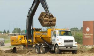
The map enables users to pinpoint the location of work zones and road restrictions and get the latest information, schedules and timelines for each project so they can better plan their travel around the City.
Utility Cuts & Repair Schedules

The map enables users to locate the various utility cuts throughout the city and see the repairs required along with repair schedule. Normally, roads, sidewalks and landscaping affected by a Utility Cut are filled with gravel until restoration can occur between May and October (weather permitting). Watch this video for instructions.
Public Art Collection

The Public Art Story Map allow you to view the location, artist details and picture about each separate piece of Public Art within the City's collection.
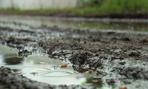
Potholes
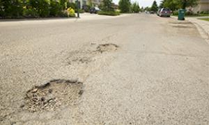
Please help us locate potholes on Saskatoon streets with this map. Pothole repairs are prioritized based on their size, depth, location within the roadway (driving lane, curb lane, etc.), and the traffic volume on that street. Potholes that cause concern in the driving lanes of high traffic streets will be repaired first.
Spray Parks
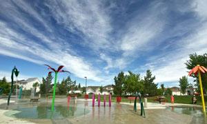
Cool off on your own time! All Spray Pad locations offer button-activated water play daily from 10:00 AM to 8:00 PM. Open June 1 to September 4, 2023.
Right-Of-Way
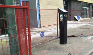
Individuals and companies intending to use the public Right of Way (ROW) can apply for a permit by marking the location and describing the project on an interactive, mobile friendly map. * Website account required to view the map.
Lane Maintenance
This map provides the status of gravel back lanes, including scheduled annual lanes maintenance and planned reconstruction for the current year. It will also show any changes to maintenance or reconstruction schedules.