Engage
Proposal
The Planning and Development Department has received an application from the National Affordable Housing Corporation (the applicant) proposing to rezone land in the Stonebridge neighbourhood to accommodate accommodate future residential development.
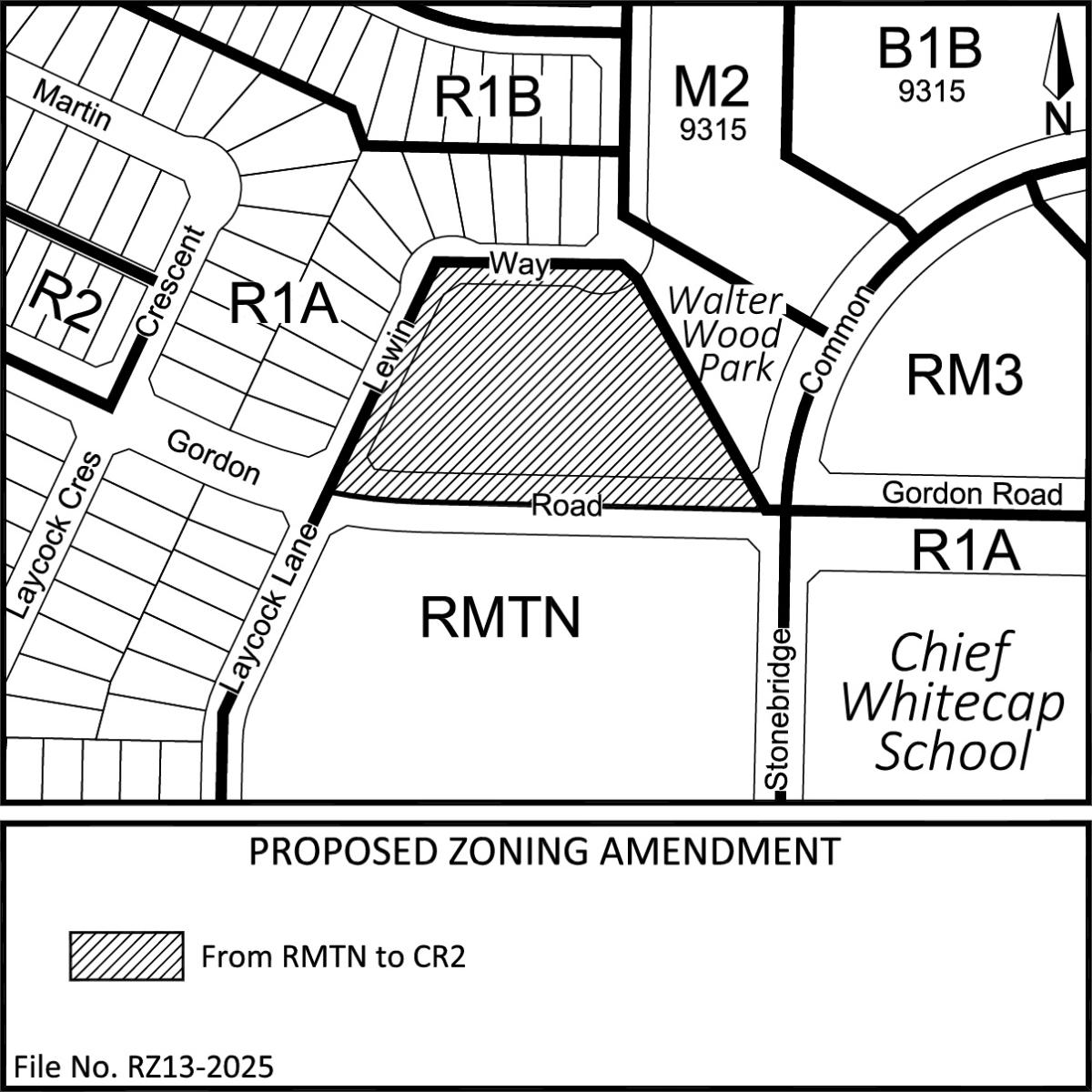
The subject land is located in the central part of the Stonebridge neighbourhood. The parcel is bordered by Gordon Road to the south, Lewin Way to the west and north, and Walter Wood Park to the east (see Location Map below).
The site is currently zoned RMTN - Townhouse Residential District. The applicant is proposing to rezone the land to CR2 – Corridor Residential 2 District, as shown on the map below. The proposed rezoning to CR2 would facilitate a range of ground-oriented residential building forms, limited neighbourhood commercial uses and related community uses. The CR2 district is intended to accommodate a transition between OUDs and TUDs and multi-unit and mixed-use development and is intended for development on corner sites, on sites adjacent to arterial or collector streets, or on sites adjacent to existing commercial, institutional, or mixed-use zoning districts.
The proposed rezoning is in alignment with the approved Stonebridge Neighbourhood Concept Plan land use map, which designates this area for low density multi-unit residential land use (see Related Pages).
Location Map
Supplementary Information - Preston Corridor Growth Area Land Use
In June 2024, City Council approved amendments to the Corridor Land Use and Corridor Growth Boundary areas throughout the city. The subject site is within the Preston Corridor Growth Area (see Related Pages). Through the amendments, the land use for the subject site was amendment to Corridor Residential. The proposed rezoning is in alignment with the existing Corridor Residential land use.