Purpose of New Zoning Districts
The new corridor zoning districts will be the primary tool for achieving the development defined by the corridor land use designations. They will only permit development that meets this intention.
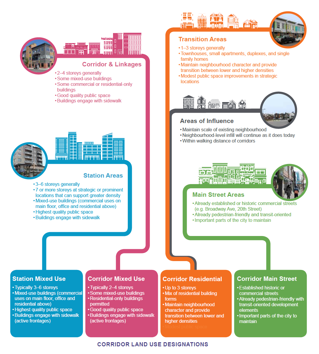
For now, four base zoning districts are being proposed – two under the Corridor Residential land use designation, one under the Corridor Mixed Use designation, and one under the Station Mixed Use designation.
The names and purpose statements of each draft zoning district are below. For more details, please see the linked visual summaries.
| CR1 | Corridor Residential 1 District | To provide for intensification opportunities and support infill development within the Corridor Growth Area in a range of ground-oriented, low-rise residential building forms and related community uses. The CR1 District is intended to accommodate a transition between one- and two-unit dwellings and multi-unit development. The CR1 District provides for density increases by allowing incremental intensification of neighbourhoods. |
| CR2 | Corridor Residential 2 District | To provide for intensification opportunities and support infill development within the Corridor Growth Area in a range of ground-oriented residential building forms, limited neighbourhood commercial uses and related community uses. The CR2 District is intended to accommodate a transition between one- and two-unit dwellings as well and multi-unit and mixed-use development. The CR2 District provides for density increases by allowing for incremental intensification of neighbourhoods. The CR2 District is intended for development on corner sites, on sites adjacent to arterial or collector streets, or on sites adjacent to an existing commercial, institutional or mixed-use zoning district. |
| CM1 | Corridor Mixed-Use 1 District | To facilitate approximately two- to four-storey residential and mixed-use development along major transportation corridors in the Corridor Growth Area. The CM1 District provides for a range of residential and mixed-use developments containing residential, commercial and institutional uses in mid-rise buildings that promote a compact, pedestrian-oriented form. The CM1 District encourages a variety of transportation options and buildings incorporating Transit-Oriented Development principles, including street-facing buildings with active frontages and ground-oriented uses. |
| CS1 | Corridor Station Mixed-Use 1 District | To facilitate approximately three- to six-storey mixed-use development along major transportation corridors near key transit station locations in the Corridor Growth Area. The CS1 District provides for a range of mixed-use developments containing residential, commercial and institutional uses in mid-rise buildings that promote a compact, pedestrian-oriented form. The CS1 District encourages a variety of transportation options and buildings incorporating Transit-Oriented Development principles, including street-facing buildings with active frontages and ground-oriented uses. |
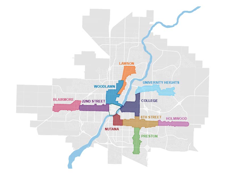
During the development of Corridor Plans, including engagement with the community, area-specific modifications to the base zoning districts will be developed. These will most likely take the form of overlay districts, which will provide for the unique characteristics of each Corridor Plan Area (refer to map below).
The proposed base corridor zoning districts are not tied to any particular Corridor Plan Area.