Initial Community Engagement held December 3, 2025
A community engagement session was held on Wednesday, December 3rd, 2025 to share information about the Nutana Plan area and gather initial feedback on concerns and opportunities for the area. Thank you to everyone who participated in the event.
You can view the information boards shared at the event here.
What are Corridor Plans?
Corridors are destinations, not just roads that get you from point A to B. They connect neighbourhoods and neighbours. They're places for people - whether you're walking, riding, driving or spending time with family and friends. To create this shift, the City of Saskatoon is re-thinking how corridors are planned for the long term, including how the land is used, how public space is designed and how buildings are built.
The Corridor Planning Program is the City of Saskatoon's approach to guiding growth and development along the planned Link (bus rapid transit) routes. The Growth Plan to Half a Million established Corridor Growth as a key initiative to help balance future outward growth of the City with infill development opportunities. Specifically, the Plan re-envisioned the future growth of Saskatoon with long-term targets of balancing 50% infill and 50% new area development, with 15% of the planned infill, or approximately 22,000 new residential units, targeted along the city’s busy corridors.
New!
The Nutana Background Report is now available. It provides an overview of the area, including its history, current plans, population, land use, transportation, housing, parks, trails and community facilities.
Volunteers from the Saskatoon Heritage Society have completed a Heritage Inventory for the Nutana Corridor Plan Area. It is an inventory of buildings and sites of heritage interest in the area, and includes research and commentary on the importance of these resources to the streetscape and community.
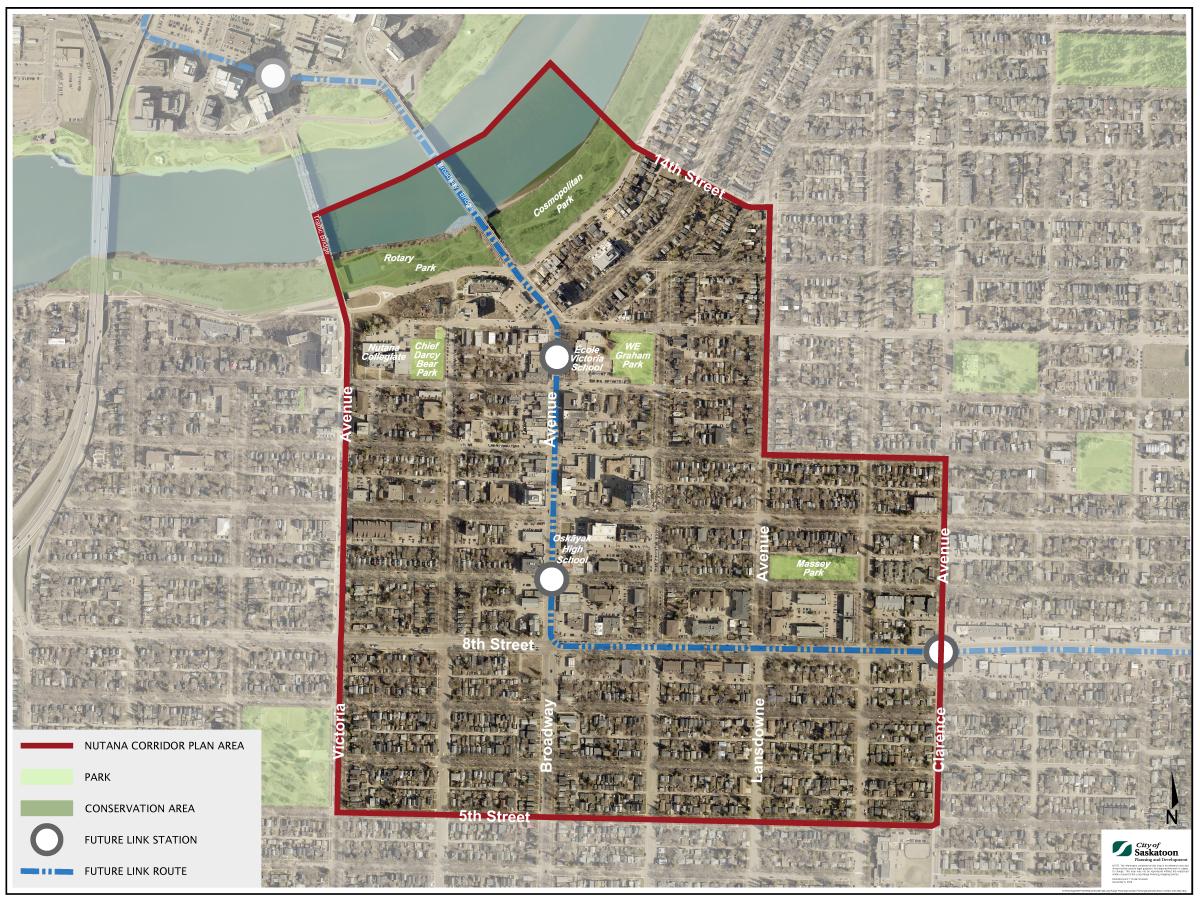
Nutana Corridor Plan Area
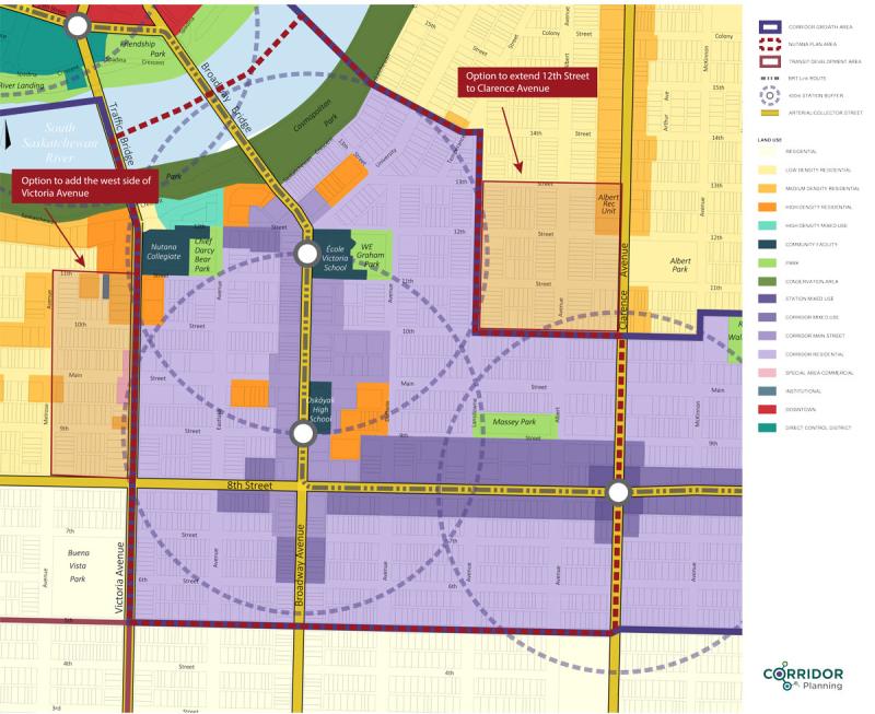
Nutana Plan Area Potential Boundary Change
We are considering extending the boundaries of the Nutana Corridor Plan Area and are asking for your feedback.
Some things we consider when making boundary changes to a Corridor plan area are:
- Distance to a Link Station: The boundary is usually set within about a 400-metre walking distance of a Link Station.
- Keeping blocks together: Rather than including just a few properties at the end of a block, it’s typical to include the whole block.
- Following clear edges: Boundaries can follow streets or back lanes, but they shouldn’t cut through individual properties.
Opportunities for improvement: Think about whether there are areas that could benefit from future incentives, upgrades to public spaces, or more housing options.
If these areas were included in the Nutana Corridor Plan, what would change?
- Any corridor incentives would apply
- Improvements to public spaces and amenities may be supported
- Eligible building height would be expanded up to 4-storeys on local streets
No change to eligible building height on 12th Street, Clarence Avenue, and Victoria Avenue
Potential Boundary Extensions - Nutana Plan Area