Engage
Proposal
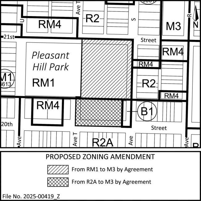
The Planning and Development Department has received an application from Kindrachuk Agrey Architecture, on behalf of Ahtahkakoop Cree Nation, proposing to amend the Official Community Plan (OCP) and rezone the property at 1930 20th Street West by Agreement.
1. Proposed Official Community Plan Amendment
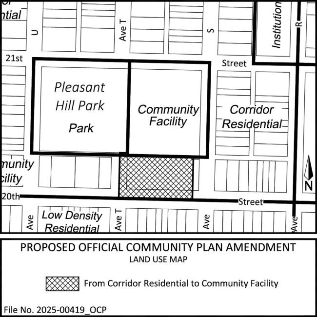
This site currently has two OCP Land Use designations, Community Facility and Corridor Residential. The applicant is proposing an OCP Land Use Map amendment to change the southern 39.6 meters (130 feet) of the site from Corridor Residential to Community Facility to align with the existing designation of the norther portion of the site. A location map identifying the proposed changes is available below.
Land designated as “Corridor Residential” has the potential for ground-oriented, low to medium density residential development. These areas are located near to the BRT routes and are intended to provide a transition of densities from Station Mixed Use, Corridor Mixed Use and/or Corridor Main Street lands into the surrounding neighbourhoods.
Land designated as “Community Facility” has the potential for institutional, educational, recreational, cultural, and community uses. Community Facilities should be retained as a focal point of the community.
2. Proposed Rezoning by Agreement
This site is currently split-zoned RM1 - Low Density Multiple-Unit Dwelling District and R2A - Low Density Residential Infill District. The applicant is proposing to rezone the entire site to M3 - General Institutional Service District, by Zoning Agreement. A location Map identifying the proposed Zoning Agreement boundaries is available below.
The Zoning Agreement would outline specific permitted uses that would be allowed on-site in addition to regulating development standards such as the building form, setbacks, height, site layout, and other considerations.