What's New
City Council Approval
City Council has approved the Corridor Land Use and Corridor Growth Boundary amendments at the Special Public Hearing on June 27-28, 2024. The report and amending bylaws can be viewed at the Public Hearing Special Meeting agenda.
These amendments received Government of Saskatchewan approval on August 21, 2024 and are currently in effect.
Please Note: Maps Provided for Convenience Only
The maps and materials provided on this page are for convenience only, and do not reflect more recent decisions made after the conclusion of this project. Please use the interactive Official Community Plan Land Use Map or contact Planning & Development staff for the most up-to-date information.
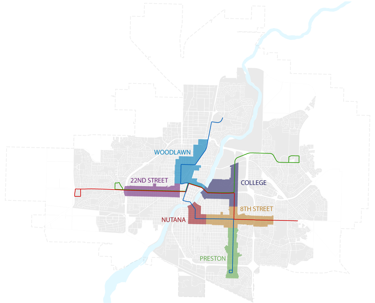
Corridor Land Use Amendments
View all approved Corridor Land Use maps (PDF)
View list of all sites included in the amendments. (This list is provided for convenience only; in case of discrepancy, refer to the maps.)
This work is part of the Housing Accelerator Fund Action Plan endorsed by City Council intended to increase available housing in Saskatoon. Since the public engagement sessions in Fall 2023, the City has been working on initiatives identified in the Housing Accelerator Fund Action Plan to have even more impact on housing in Saskatoon. As a result, much of what was presented in Fall 2023 is no longer what the City is working toward. Incorporating the required changes from the Housing Accelerator Fund Action Plan and feedback from the fall engagement sessions, the Corridor Planning team has completed revisions to the land use plans which can be found below.
| Corridor Plan Area | Land Use Map (approved as of August 2024) |
|---|---|
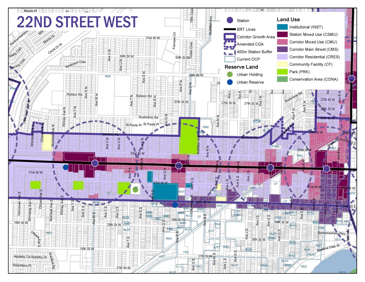
| 22nd Street |
View Map
|
| Woodlawn |
View Map
|
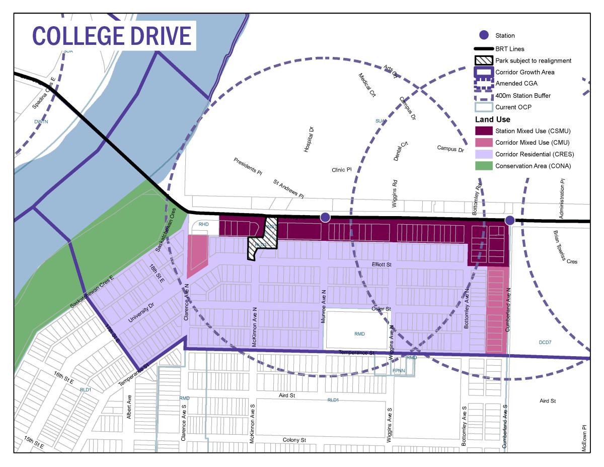
| College |
View Map
|
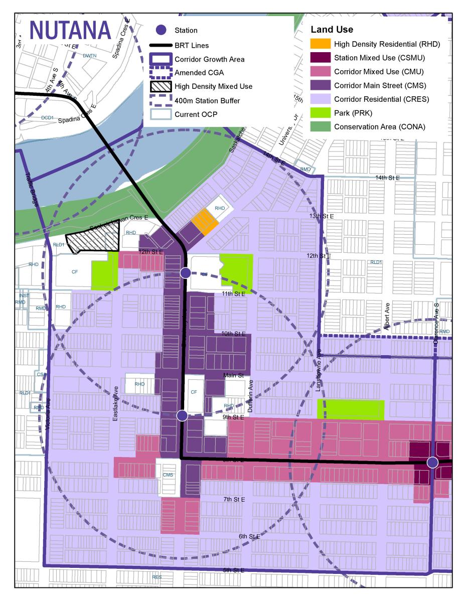
| Nutana |
View Map
|
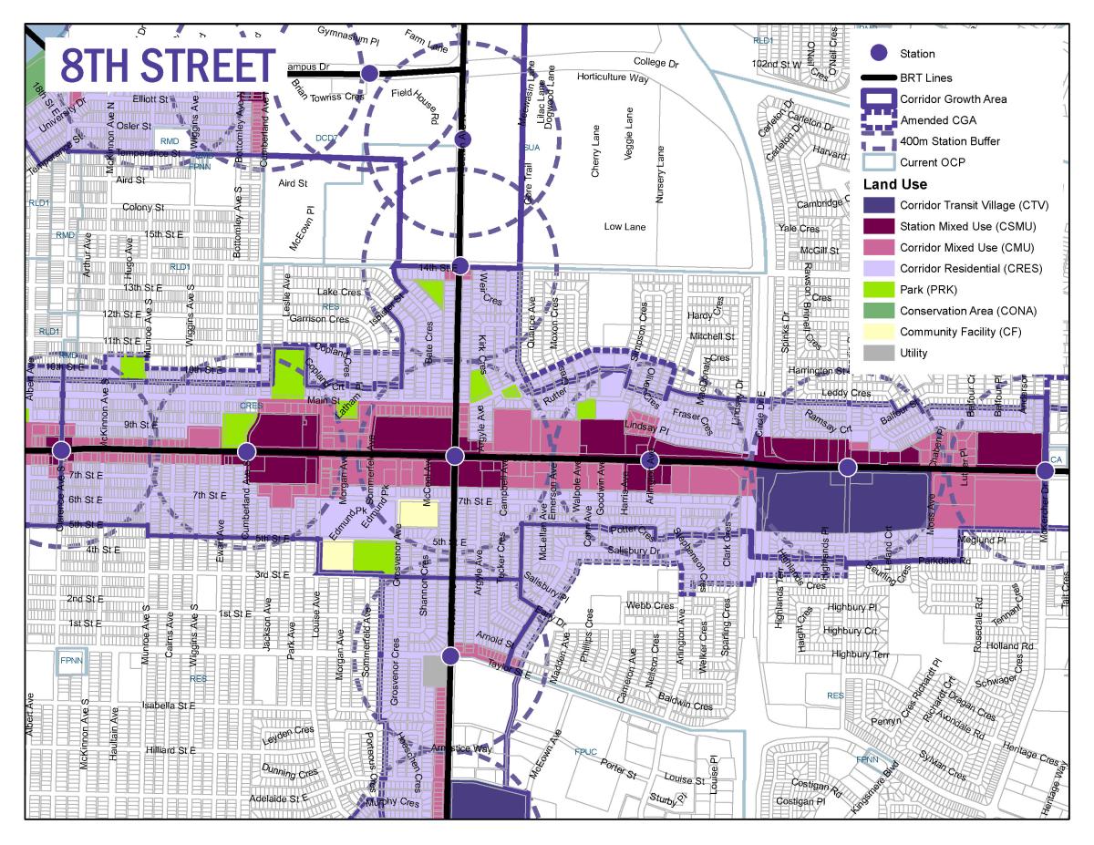
| 8th Street |
View Map
|
| Preston |
View Map
|
Feb. 29, 2024 Information Session on Updated Land Use Maps
Housing Accelerator Fund - Four Storey Residential Development
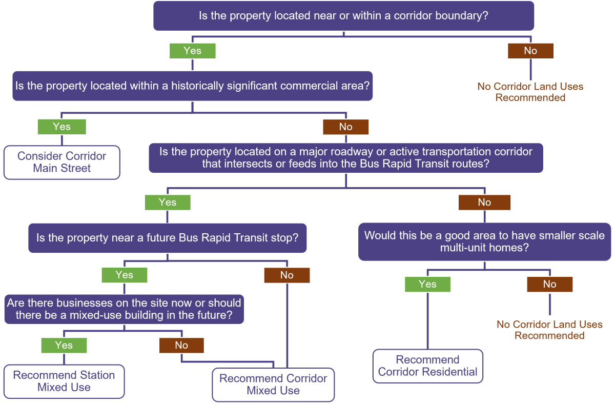
Please visit Saskatoon.ca/HAF for details on changes to permit, without the need for rezoning, four storey multiple-unit residential development within the Transit Development Area (TDA) approximately 800 metres from future Bus Rapid Transit routes, and up to six storeys for sites along the BRT routes to be designated Station Mixed Use and Corridor Mixed Use. The changes were approved by City Council on June 28, 2024.
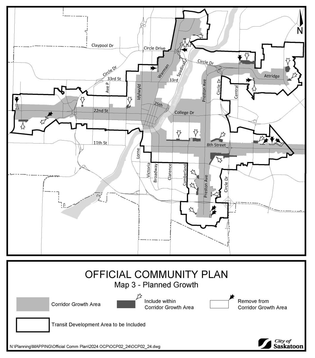
Corridor Growth Boundary Amendments
Amendments to the Corridor Growth Area boundary as found in the Official Community Plan (Map 3 - Planned Growth) were approved by City Council on June 28, 2024.
View all Corridor Growth boundary amendments (PDF)
The Corridor Growth boundary was identified early in the Corridor Planning Program as a study area encompassing approximately 250 to 860 meters on either side of the planned BRT system. The boundary amendments were determined through a review of the boundary to identify areas where it did not align with streets, back lanes, walkways or other spatial buffers. These boundary adjustments ensure properties within the Corridor Growth Area are still within a close proximity to the BRT but minimize the instances of dividing block-faces. Considering the potential of development standards being tied to the Corridor Growth Area, it is preferred that standards are consistent for neighbouring properties.
Maps with more details of Corridor Growth boundary adjustments in each Corridor Plan Area (click each for larger version):
Blairmore
No land use changes here; only boundary adjustments.
.jpg)
.jpg)
22nd Street
Refer to the 22nd Street Corridor Land Use Map for land use changes.
.jpg)
.jpg)
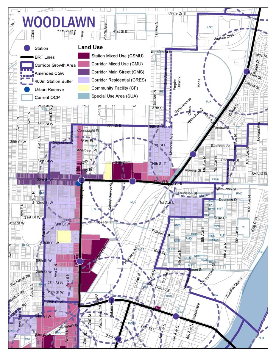
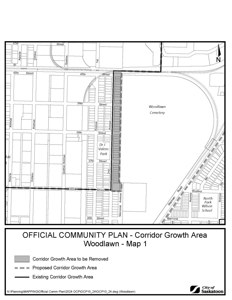
Woodlawn
Refer to the Woodlawn Corridor Land Use Map for land use changes.
Lawson
No land use changes here; only boundary adjustments.
.jpg)
Nutana
Refer to the Nutana Corridor Land Use Map for land use changes.
.jpg)
8th Street
Refer to the 8th Street Corridor Land Use Map for land use changes.
.jpg)
.jpg)
.jpg)
Holmwood
No land use changes here; only boundary adjustments.
.jpg)
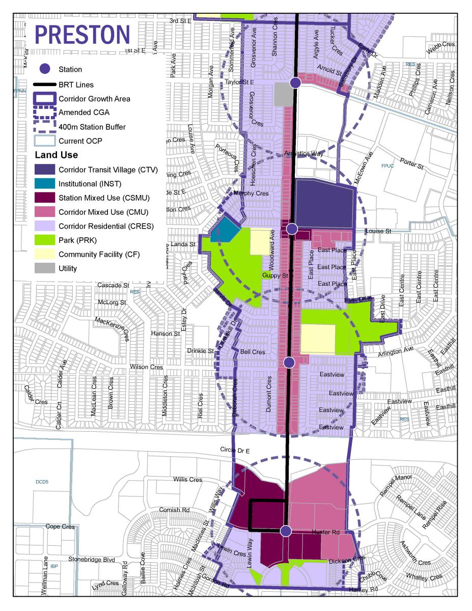
Preston
Refer to the Preston Corridor Land Use Map for land use changes.
.jpg)
.jpg)
University Heights
No land use changes here; only boundary adjustments.
.jpg)
.jpg)
Note: No boundary adjustments for the College Corridor Plan Area, only land use changes.
Station Mixed Use Opt-In Rezoning
The Corridor Planning team is leading an opt-in rezoning application for properties designated as Station Mixed Use. All eligible property owners have been sent a letter in the mail and were invited to attend a virtual information meeting in April about the rezoning process. Please visit the Station Mixed Use Rezoning page for details.